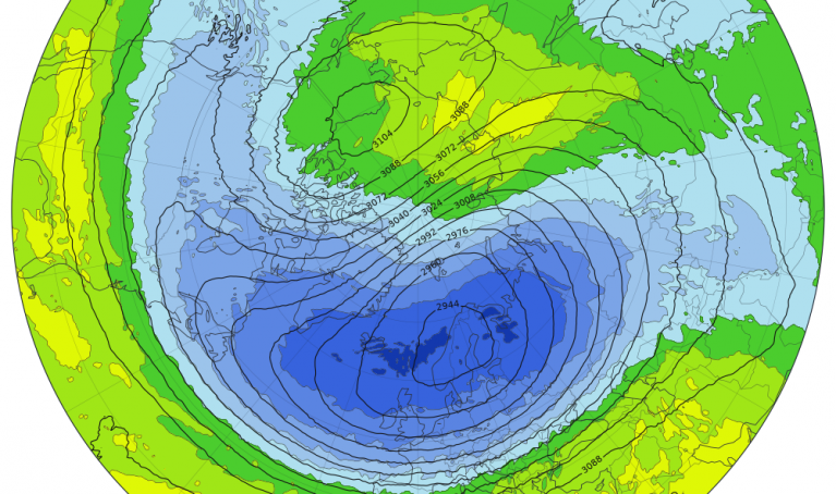



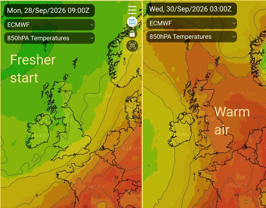
This week starts with a quiet day of weather on Monday, real warmth on Tuesday, before strong winds and frontal rain move in from the Atlantic. After an unusually warm Tuesday night, there will be rain for a time in the middle of the week as a deep low pressure sits out to the west. Then we settle into a more seasonal westerly flow with showers from the west and temperatures back to average for the start of October.
There was wet weather on Sunday as a cold front swept across the UK, and it was particularly wet for Northern Ireland and Scotland. High pressure on Monday brings a quieter start to the working week, a fine lull although the air is cooler with a nippy start for some.
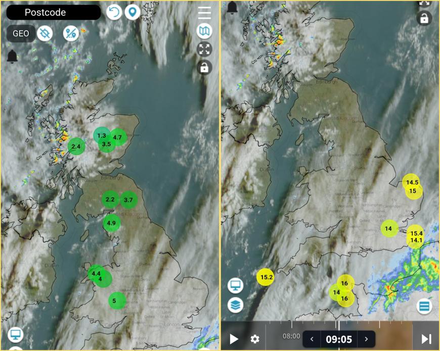
Netweather Radar Monday morning showing the nippy start where skies were clear, and the trailing warm front cloud and rain in the eastern English Channel
Sunday’s frontal band is trailing back across the Low Countries and northern France. This could bring outbreaks of rain to Kent and East Sussex by late afternoon on Monday as the blustery showers over the NW Highlands and Islands fade later today. For most of the UK, Monday is a fine day with temperatures in the high teens.
Monday night
The rain over Kent is associated with a warm front. This band of rain and cloud will gather itself for a time this evening and could bring some heavier, more persistent rain to the far southeast, brushing the coast of Essex and maybe Suffolk.
Through the night, warm and more humid air will surge northwards through Britain, as the rain becomes showery and more patchy. The risk of outbreaks of rain will be over southern Britain, accompanied by a lot of murky cloud, especially into eastern counties. It will be mild in the south but chilly again for northern Britain. The high pressure will drift away over Scandinavia, leaving a more east to southwesterly flow for the early hours of Tuesday.
Tuesday
At the edge of the high pressure, Tuesday will become more breezy. The warmer air will be over southern Britain, lifting temperatures here into the mid-20s Celsius. London could reach 27 or 28C so feeling very warm for late September as the early grey cloud moves away northwards and the sun comes out. Western Scotland, Northern Ireland and northwest England will feel warm enough at 18C.
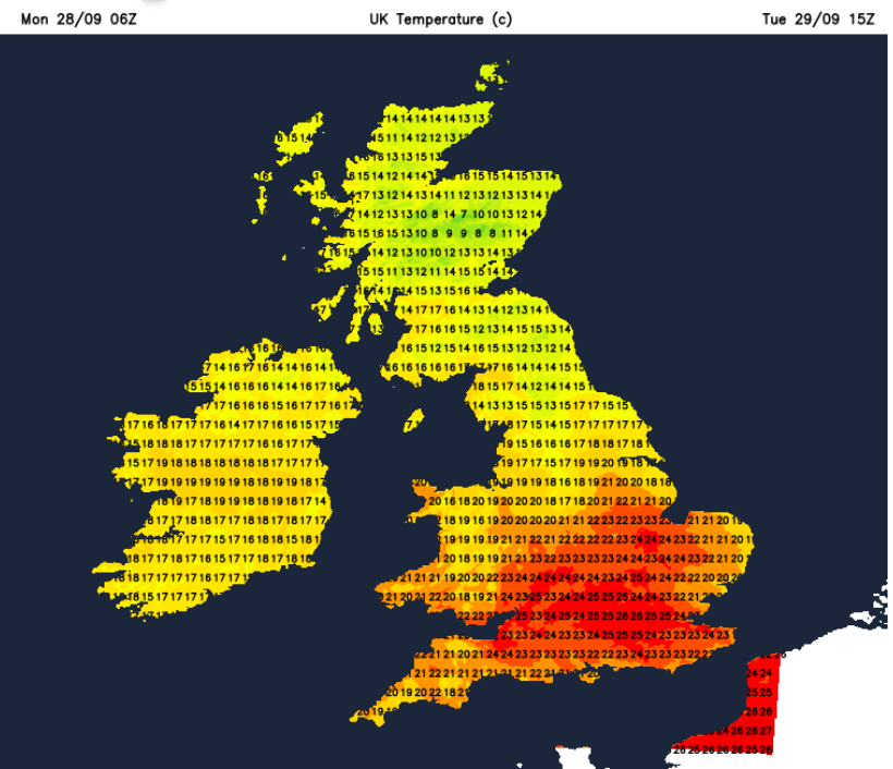
Most areas will have a fair day, although more cloud over central parts as the front edges northwards and this could bring the odd shower over the Midlands and Pennines. Away from the southeast, it will become breezy for England and Wales, windy for Northern Ireland and Scotland with a fresh to strong SE wind.
It will stay windy for Northern Ireland, west coast of Scotland, Northern Isles and the Irish Sea for Tuesday evening, thinking of the ferry services.
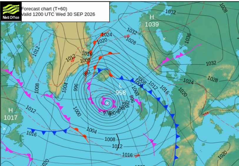
As the low centre continues to deepen, it is forecast to slide northwards towards Iceland. There will be frontal cloud and rain over Northern Ireland and Scotland, but the mass of very warm air will remain over Britain during Tuesday night until the cold front arrives.
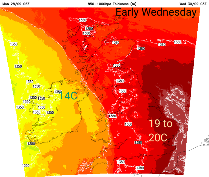
For Britain, temperatures will be in the mid to high teens, possibly 19C as a minimum, which is exceptional for the last day of September (30th). The highest minimum for the month of October is 19.4C on the 1st October 1985, recorded in Aber (Gwynedd). Not the right month for this week’s very warm night in terms of statistical data but still good context. Thinking about this time of year when we begin to think about frosts, such a warm night is bizarre. If the temperature stays above 20C then that would be recorded as a ‘Tropical Night’. At the end of September!
By early Wednesday there could be SE gales for the Western Isles and then for the far north of Scotland by dawn.
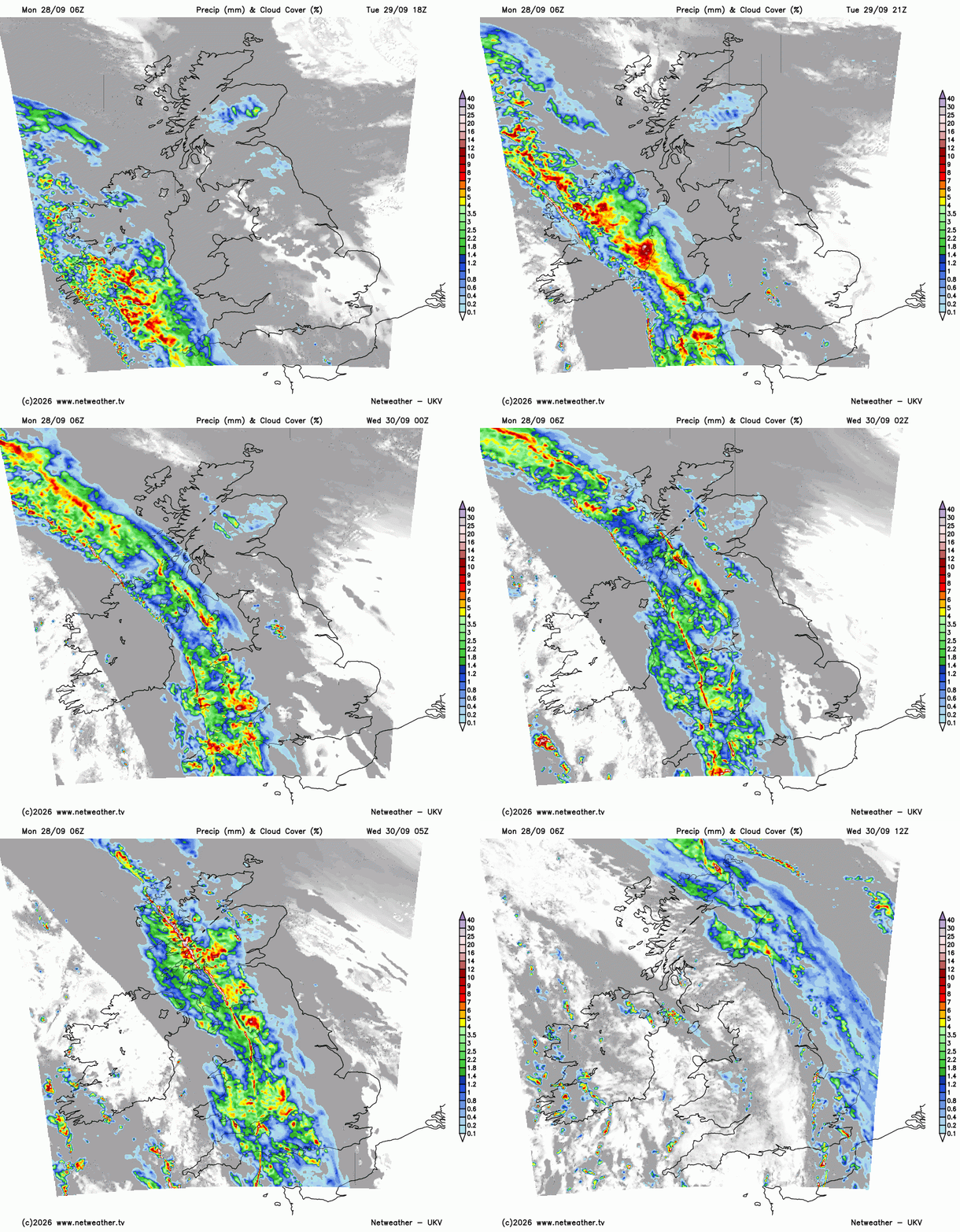
The cold front will bring a band of lively rain with embedded line convection and some heavy downpour. Wales and England are still crying out for rain, but this passes by steadily. It will clear the warm air away over the North Sea as the southerly winds veer and ease.
A rather miserable start on Wednesday along the band of heavy rain running north-south over Britain. Northern Ireland and parts of Wales will be sunny, but another band of rain will arrive from the southwest, so don’t think all is clear if the sunshine appears.
The main band should be over Norfolk, Northumberland and Aberdeenshire by late morning with bright skies behind. It will be worth keeping an eye on the Radar as this lively band moves eastwards and could bring poor visibility and spray on the roads.
There will be a lot of sunshine behind the front with a fresher feel to things. For eastern England, there will still be some warmth and a closeness in the air as temperatures reach 23C on Wednesday afternoon. Elsewhere, it will turn more seasonal but still with a lot of bright sunshine.
This week
A quiet start, followed by warmth from the south which will be particularly noticeable on Tuesday, and then Tuesday night for Britain. Wind and rain from the Atlantic during Tuesday night into Wednesday, and as that clears, back to fine, bright weather, with warm sunshine and a scattering of showers.
Loading recent activity...