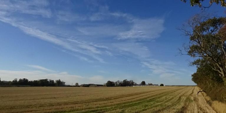



There’s been rumours, but is there a late September heatwave on the way?
There is no sign of one at the moment, but after a cool down for the rest of the week, with some showers or rain in places, it looks to turn warmer and drier next week, as high pressure builds. Perhaps Monday and Tuesday the warmest days, with temperatures forecast to reach the low to mid-twenties across parts of England and Wales, perhaps temperatures a little down for the rest of the week, but still in the south - with temperatures reaching the low 20s.
The second half of this week will see cooler and more changeable conditions for all following a very warm and humid start to the week in the south, when Monday saw 27C reached at a few spots in the south.
A strong jet stream will bring a few quite deep areas of low pressure past to north of Scotland on Thursday and Friday night too. So it will become increasingly windy, especially in the north and turning cooler too, following a cold front, with a band of rain, clearing the south Thursday morning. A cooler westerly flow will persist from Thursday through to Saturday, which will bring showers, mostly in the north and west, drier and sunnier towards the south and east, more organised rain in across the north and west Friday afternoon. A greater chance of showers in the south on Saturday. Nights will be on the cool side, days a little below average in the north to average in the south. Saturday will be a little warmer than Thursday and Friday in the south.
A strong westerly jet stream across the UK through to Saturday will bring changeable and cooler weather, but it will shift north from Sunday, allowing high pressure to build
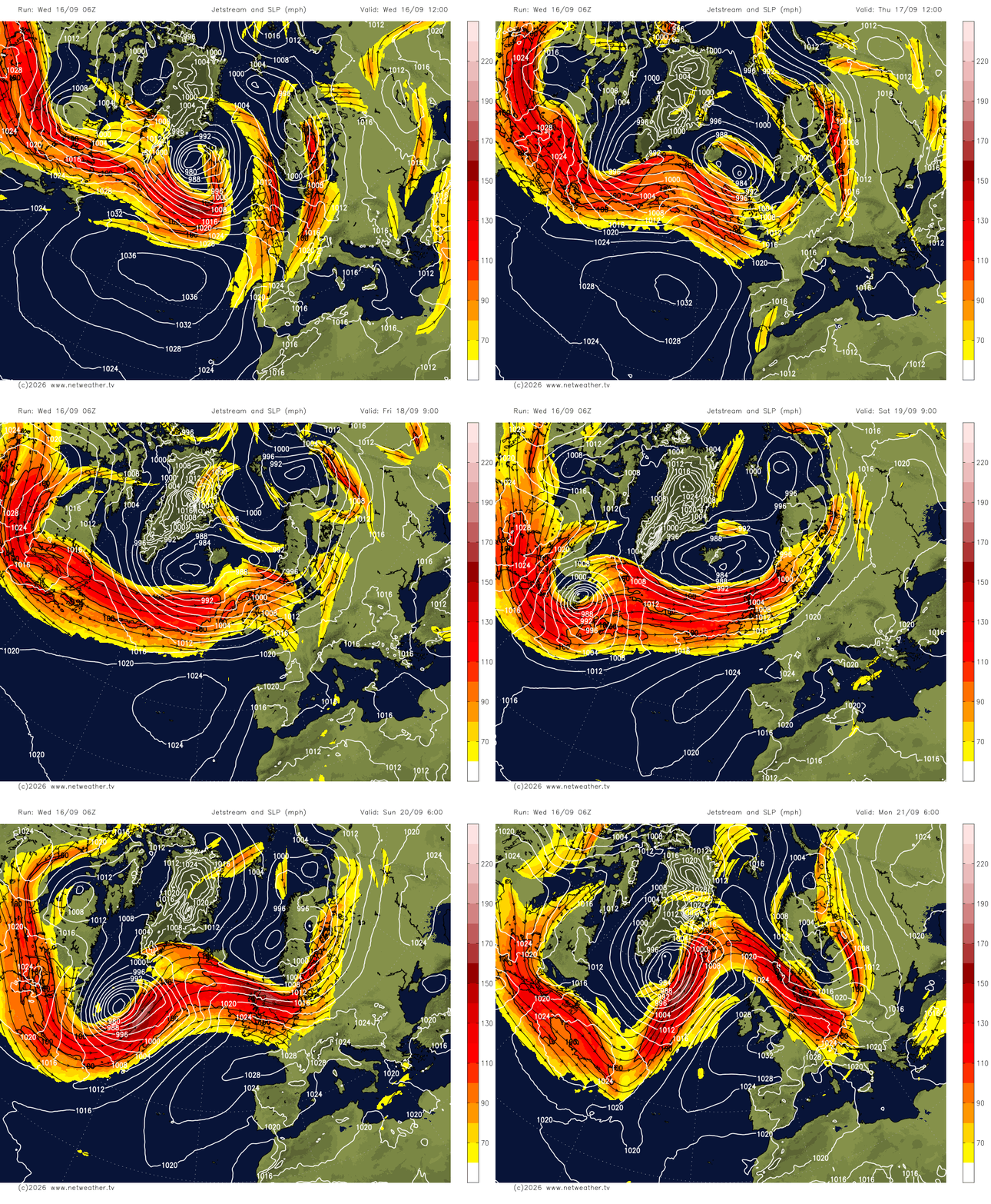
However, from Sunday, a ridge of high pressure looks to build north, as the jet stream shifts north, so showers should generally die out, with more in the way of dry and sunny weather, temperatures around average, reaching the mid-to-high teens, maybe low 20s in the south and east.
It will become mostly dry in the south too next week, as an upper level ridge builds and squeezes out any rainfall from Atlantic fronts that could bring some rain to the north on Tuesday, before rain becomes confined to the far northwest on Wednesday and the rest of the week.
High pressure builds north from Sunday into early next week
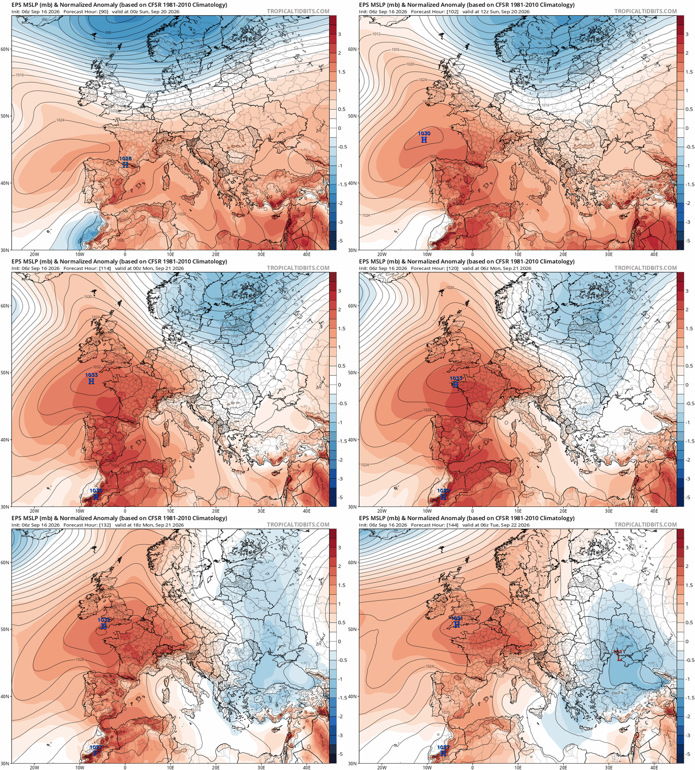
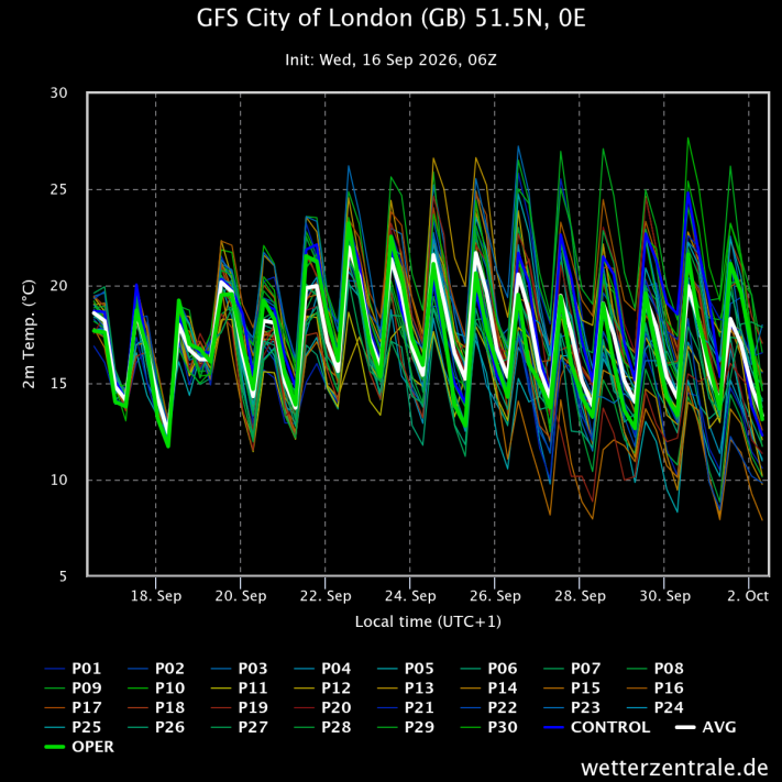
However, although it will be warm next week, perhaps humid for a time too in the south, with temperature trending above average by day, there is nothing to indicate that a heatwave is on the way during the second half of this month.
A trend upwards in temperatures next week across the south, reaching into the low 20s at least, perhaps mid-20s in a few spots
There are indications that more widely unsettled conditions may return off the Atlantic before the end of the month, but, for now, high pressure looks to build next week, bringing warmer and drier weather in the south.
Loading recent activity...