The Atlantic Hurricane season has been unusually quiet, no hurricane has formed in the Atlantic Ocean so far in the 2026 season, setting a new record for the latest date in a modern hurricane season without at least one hurricane.
During a typical hurricane season, the Atlantic basin has usually produced four hurricanes by September the 10th, the peak date of the hurricane season, and even more tropical storms. So far this year, only five tropical storms have formed.
El Niño has largely suppressed tropical activity across the Atlantic’s Main Development Region, as the phenomena increases wind shear - which is unfavourable for hurricane development, while dry air remains widespread across this region too, which is also unfavourable for development.
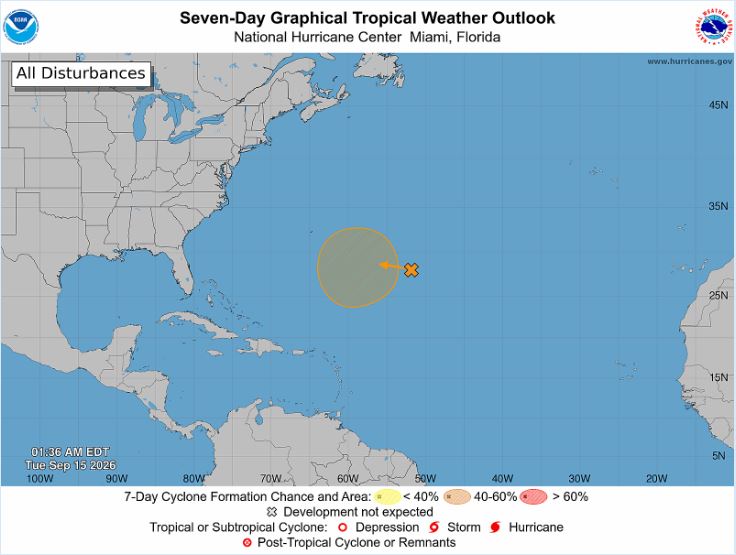
Over recent days the National Hurricane Center has had no tropical disturbances to monitor, but they are monitoring one in the central subtropical Atlantic for 40% chance of development in 7 days.
But while forecasters await the arrival of the season's first hurricane in the Atlantic basin, the latest on the calendar on record, the Mediterranean Sea has been monitored for a possible rare "Medicane" to form this week.
A medicane is short for Mediterranean hurricane, and it has been used for more than two decades to identify storms that develop over the Mediterranean and share some similarities with a hurricane. These similar characteristics are low pressure systems that are frontless and axisymmetric structure, with deep convection close to their centres, with a windless “eye” and sustained wind speeds close to hurricane strength
Medicanes don’t become as strong as many hurricanes do over the Atlantic, because medicanes form over a smaller body of water, meaning the storms have less time to intensify.
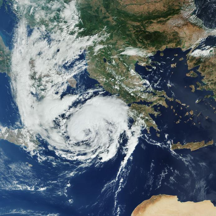
Medicane Ianos between 15 and 20 September 2020 was the most intense ever recorded for wind speeds, comparable to a Category 2 hurricane. Wind speeds reached roughly 98 mph in the storm, which developed over the Ionian Sea and affected Greece - resulting in four casualties and devastating damage in the western and central parts of Greece.
Medicane Ianos before landfall over Greece in Sept 2020
However, although relatively weaker for winds, Medicane Daniel in 2023 brought catastrophic deadly flooding to Libya, with 5,000–15,000 fatalities. Many of the fatalities were in the city of Derna after extreme rainfall over the nearby Akhḍar (Green) mountains of northern Libya flowed into the small catchment area flowing into two dams which burst - flooding the city. Storm Daniel formed in the Ionian Sea on September 4th, 2023, and drifted to the south before it transitioned into a medicane. Daniel then began to drift southeastward towards the northern Libyan coast on September 9th before making landfall near the city of Benghazi on September 10th. Satellite-derived measurements recorded wind speeds of up to 85 km/hour before Daniel made landfall. A record 16” (414 mm) of rainfall was measured in 24 hours at the city of Al-Bayda, Libya.
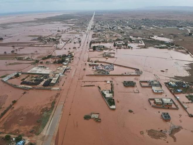
Image courtesy of Libya Observer
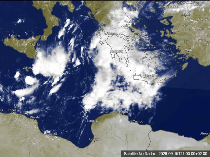
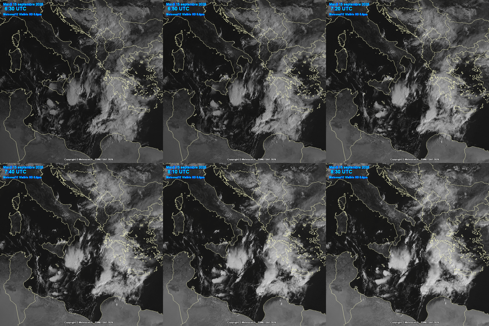
A low-pressure system between Italy, Greece, and Libya is being monitored for the potential for intensification, which could bring heavy rain with potential to bring flash-flooding along with strong winds to several countries in the region by the end of the week.
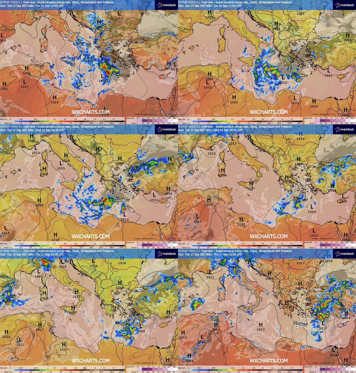
There is potential for this low to develop ‘tropical cyclone’ characteristics, though the probability is low to moderate, with current satellite imagery showing disorganised convection - which has weakened over recent hours, but with low level circulation still evident. A short-lived tropical/subtropical-like depression may still form by the middle of this week; so reorganization of lower-level circulation should be monitored in the coming hours, but with no deep warm-core or organisation looking likely to qualify it as a Medicane.
There is certainly fuel available for with warm water temperatures ranging between 27°C and 29°C. This morning, areas of thunderstorms are evident circulating around a shallow area of low pressure between northern Libya and southern Italy. The low will continue moving toward the east or east-southeast, approaching the Ionian Sea, where it could still intensify. Between today and Wednesday, the area of greatest risk will shift toward southern Greece and Crete, with the possibility of torrential rains, intense storms, strong gusts, and dangerous swells.
Loading recent activity...