Almost no rain is forecast by two medium-range weather models for large parts of the UK for the next two weeks, taking us nearly to the end of the month. Should this happen, some places may see no measurable rainfall for the whole of July. Some places in southern England haven’t seen any rain since the middle of June. Though things may change before the end of the month, two weeks is a long time, what rain may fall will unlikely make up for no rain falling for over 4 weeks.


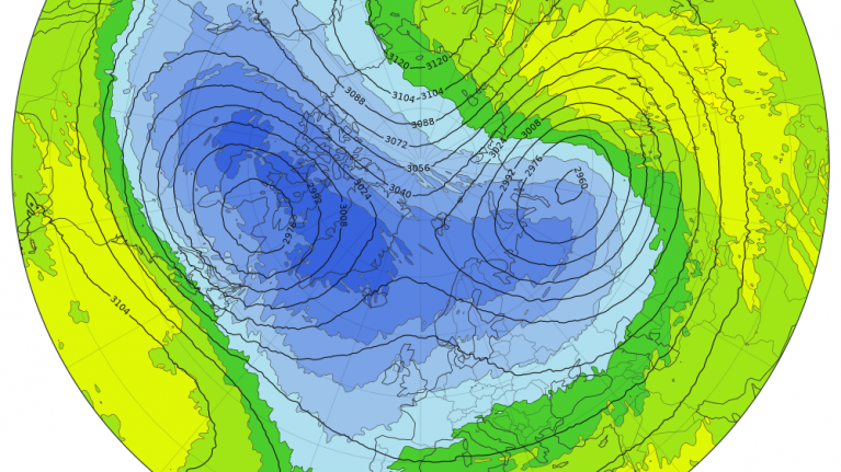
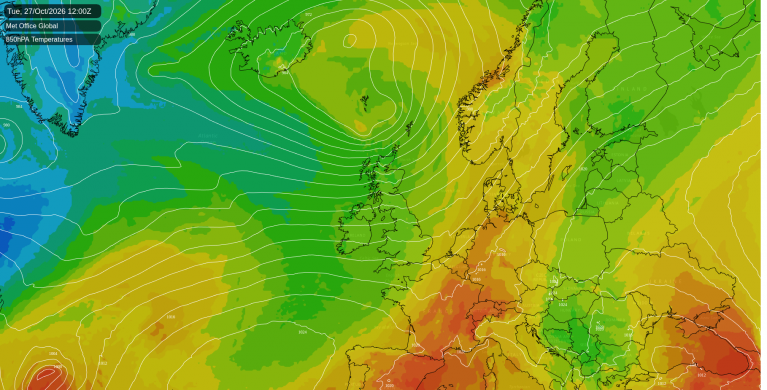
A blocking anticyclone currently located over the Norwegian Sea will drift southwest and become anchored to the west of Ireland over the next few days, close enough to keep the UK under a dry anticyclonic north or northwesterly flow. While northern and western areas may see isolated, light showers, the vast majority of England and Wales will remain completely dry for at least 7 days, but perhaps over 10 days.

Heatwave conditions will prevail across England and Wales for the rest of the week, with yellow heat health alerts in force from 9am this morning through to 9pm on Friday. Wednesday and Thursday may see the peak of temperatures, reaching 30-31C across southern England, warmth spreading north across Scotland and N. Ireland too, with mid-20s likely here, away from the northern and eastern coastal areas of Scotland cooled by onshore breezes.
The good news is for those who want relief from the heat, as the flow turns more northerly over the weekend, so temperatures will come down a bit. Highs reaching 24-27C across south Wales, central and southern England both Saturday and Sunday, elsewhere in the low 20s. Still above average though. Humidity will generally be low with the flow from the north too, so feeling comfortable, even if it is very warm, nights certainly easier to sleep.
A cooling off from the north this weekend

We are now reaching the mid-way point of summer and we’re already into the third heatwave, following one in May and another in June.
Although the current heatwave is not as hot or as humid as the last, the lack of rainfall so far this month means the ground is becoming very dry due to high evaporation and transpiration from plants in the consistently high temperatures since late June. This is leading to tinder dry vegetation across large parts of England, with recent wildfires breaking out - which are still ongoing e.g. two huge moor fires near Dovestone Reservoir in Oldham and on Tintwistle Moor near Glossop which are continuing to send huge plumes of smoke across Greater Manchester and other areas of NW England downwind towards the west. The low humidity of the air, typical of northeasterly or northerly winds over the coming days will exacerbate the dry conditions and could mean further wildfires may breakout, unfortunately many are started by people leaving disposable barbeques behind or discarding cigarettes, or in the case of the Dovestone Reservoir fire, youths letting off fireworks on the moors.
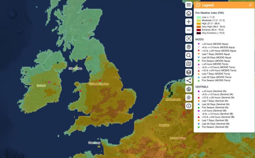
France and Spain also have been battling wildfires, due to extreme temperatures reaching the low 40s in the June and current heatwaves causing rapid drying out of the ground and vegetation. The Fontainebleau forest fire 60km southeast of Paris had nearly doubled in size this morning since yesterday morning in area burnt, over 1900 hectares, water planes usually used to tackle wildfires in the south of France were scrambled to fight the fires and were seen picking up water from the the River Seine. Also a wildfire broke out along the coast of Brittany in NW France, only 30 hectares, but still, unusual for this usually green part of France that receives high rainfall throughout the year, similar to Cornwall.
The three heatwaves so far this year have also impacted sea temperatures around western Europe too. Over the past week or so, surface sea temperatures around the UK have reached record highs, raising concern about the impact on marine life. The UK marine heatwave has been fuelled by record-breaking air temperatures in May and June, with 35°C or higher having now been recorded in May, June and July of the same year for the first time on record in the UK. These high temperatures over a long period layered on top of long-term ocean warming driven by climate change have helped the marine heatwave develop.
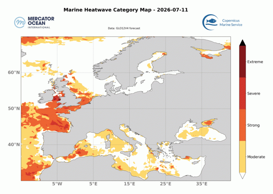 In late June, coinciding with the extreme heatwave in western Europe, the Mediterranean Sea experienced a record-breaking marine heatwave. Sea Surface Temperatures (SSTs) spiked to anomaly levels of up to 6°C above normal in the western basin. Sea surface temperatures of 30C have been recorded on the north side of Mallorca, 31C at Palermo on Sicily!
A marine heatwave also extends from the Bay of Biscay along the northern coast of Spain to the waters off the Azores and is expanding in area but remains stable in intensity.
So are there signs of a 4th heatwave of the year on the way? For the UK, it remains a possibility that after heat relaxes this weekend, as high pressure migrates to the west, that the high may drift back east again, which will allow heat to build again later next week, but there is uncertainty over how pressure patterns will evolve later next week. Some scenarios from model ensembles indicate high pressure will indeed drift back east over the UK and perhaps further east - which will mean heat may return, but there is also a small clustering for low pressure to move in from the Atlantic. High pressure dominating until late in the month seems to have higher confidence for now, so staying mostly settled and dry, perhaps turning hot again.
Loading recent activity...