As England and parts of Wales head into 'Heatwave3' this week, the school holidays are underway in Scotland and Northern Ireland. Here it has been windy and sometimes cool with patchy rain. Those in the far north can’t imagine temperatures passing 30C in London on Monday. And vice versa, those under the summer sunshine in the south, (perhaps beyond tired if they watched the England v. Mexico match), will be considering how to manage the next heatwave.
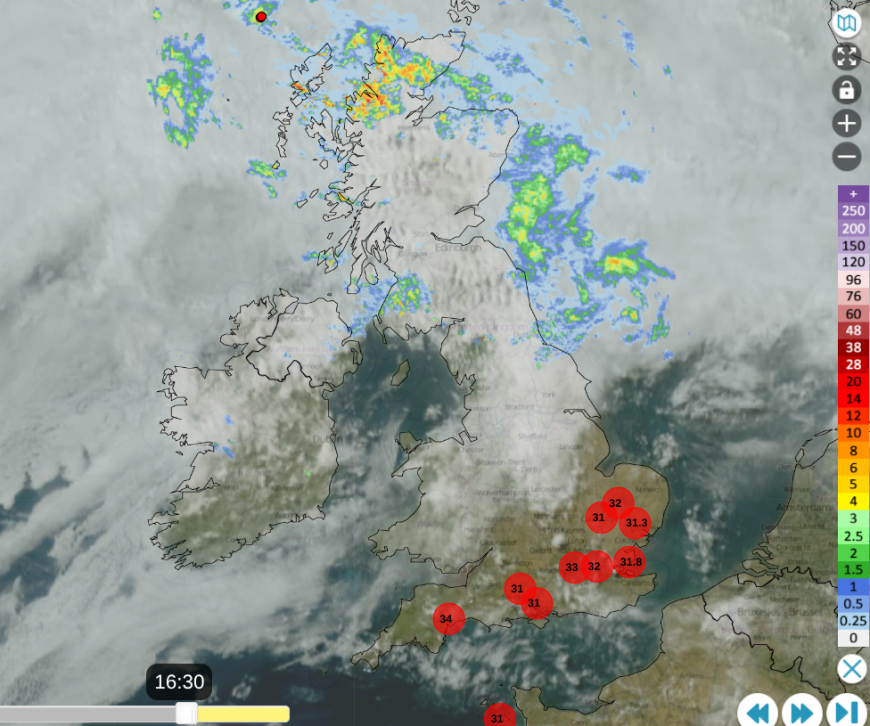
This rain is needed, although perhaps disappointing for the start of the summer holidays. The windy weather is annoying as it has been going on for days. At times, the cloud cover breaks and in the sunshine, northern Britain heats up and gets a hint of the muggy warmth from further south. However, there is a great contrast north-south. Rain, wind and cloud with temperatures in the teens, and perhaps the need for a jumper, versus sunshine and increasing heat.
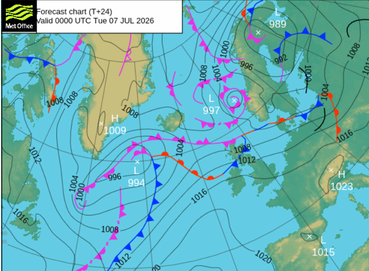
High pressure is lurking to the southwest, closer to the Azores on Monday. The jet stream is waving over Scotland, bringing a succession of low pressures and weather fronts with more cloud and bands of rain.
Tuesday
Although there will be some early low cloud over SW Britain, which could linger along the north coast of Devon and Cornwall, there will be another north/south divide. Southern Britain will be sunny and hot with light winds, although a moderate breeze for Anglia from the northeast. For the northern half of the UK, there will be more cloud with outbreaks of rain from the northwest. Northern and western mainland Scotland will start the day wet with patchy rain for exposed areas elsewhere but the rain does fade during the day.
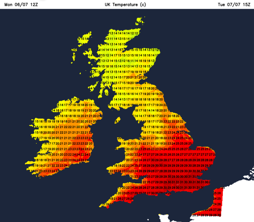
A very warm day for the southern half of England and eastern Wales. Temperatures will be in the mid to high 20sC, maybe 30 to 31C for London with warmer nights.
Midweek
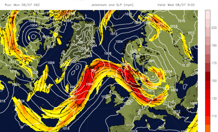
The high pressure is going to build over the UK by the middle of the week. The jetstream moves northwards and most of the UK will be in the dry, sunny and warm/hot air with lighter winds by Wednesday.
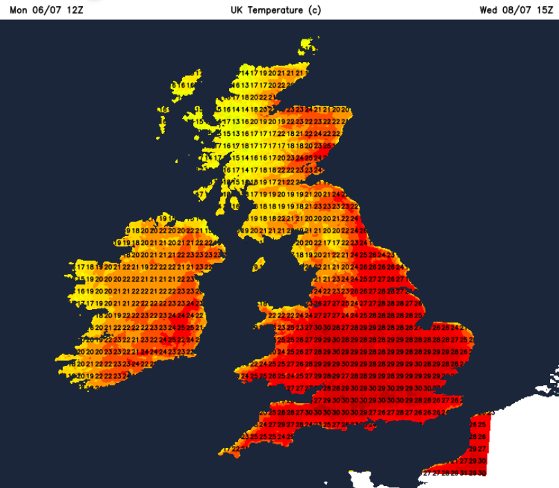
Midweek, more of the UK will heat up. Scotland and Northern Ireland into the 20s C and more areas reaching heatwave criteria in England and Wales with temperatures in the mid to high 20s and low 30sC. By Friday, central England into NE Wales looks very hot. The most likely top maximums will be 34, perhaps 35C. Although not expected, there is a small possibility of a degree or so higher. There is day-on-day heating, direct sunshine, and hardly any breeze. Also, this feed of very hot air from Spain and France.
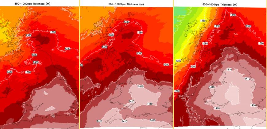
UKV model for Weds/Thurs/Fri
The June record was recently broken with 37.7C in Norfolk, with the previous record being 35.6C which had stood for 50 years. The July UK record is the all-time highest UK temperature, 40.3C in 2022 at Coningsby, Lincolnshire. At this point there is no suggestion of getting that hot this week.
Discussion about the July heatwave
Loading recent activity...