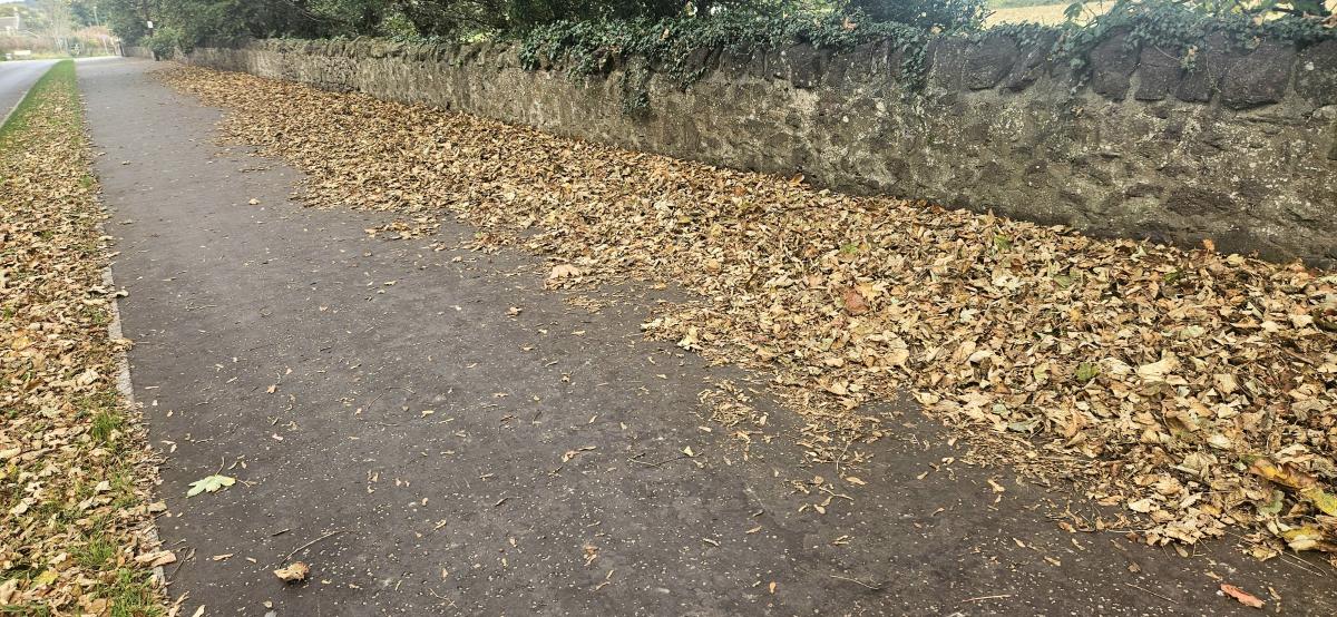
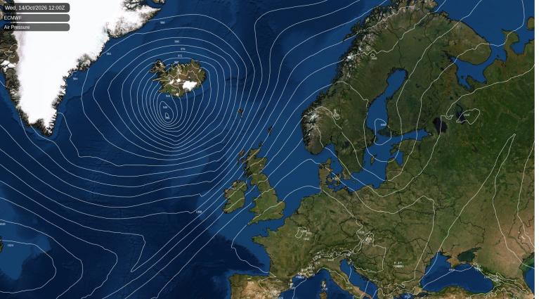
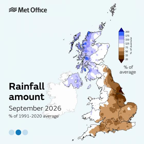
It has been a relatively dry October so far across England, following a deficit of rainfall in central, southern and eastern England in September too. England’s reservoirs are still falling as a result, as the typically more abundant autumn rains that normally start the refill haven't come yet.
A dry October so far follows a dry September across southern, central and eastern England
The Environment Agency’s latest weekly report, published 9 October, states that storage fell at most reservoirs, with England at 54%, which is 21% below the normal level for the time of year. Nineteen reservoirs or groups are now under half full, and eight are classed as exceptionally low. Those eight include Abberton and Hanningfield in Essex, Ardingly in Sussex, Clatworthy, Colliford and Wimbleball in the south-west, Severn Trent’s Dove Group, and United Utilities’ Pennines Group. For comparison, England’s storage was 64% at the end of October 2025, so this year is clearly worse.
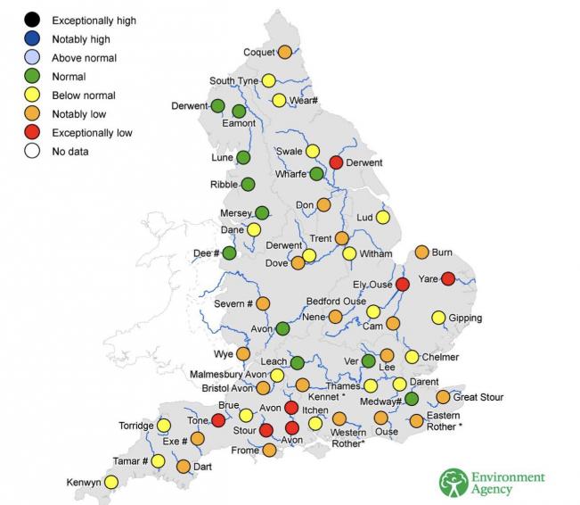
The status of Englands rivers early October
Yorkshire officially entered drought status last Friday - due to low water levels in reservoirs and rivers. This follows the declaration of prolonged dry weather for the area at the end of July due to a lack of spring and summer rainfall.
September water situation report from Yorkshire Water shows low reservoir levels and rivers below critical level, not much rain has fallen so far this month to alleviate the situation, hence the drought status
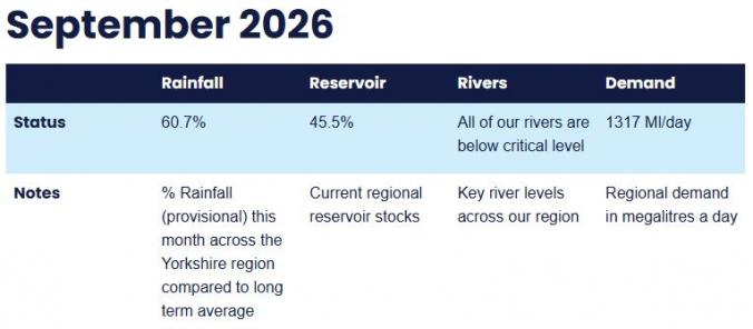
The region joins all of central, southern and eastern England in drought status while the North East and North West remain in prolonged dry weather.
Dry conditions also persist in eastern catchments of Scotland with the Lower Tweed seeing a return to Significant water scarcity, with Moderate water scarcity for the Tyne (Lothian) and Tweed
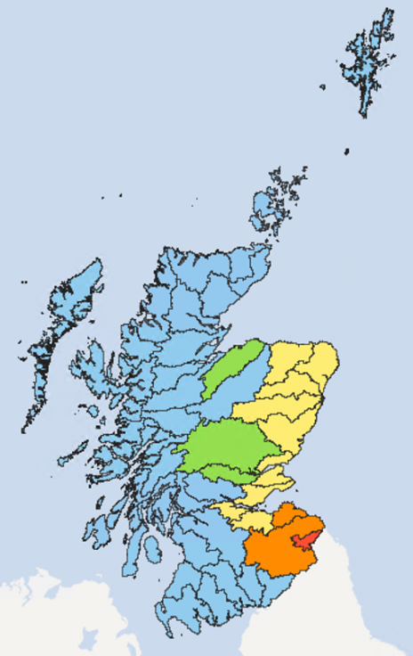
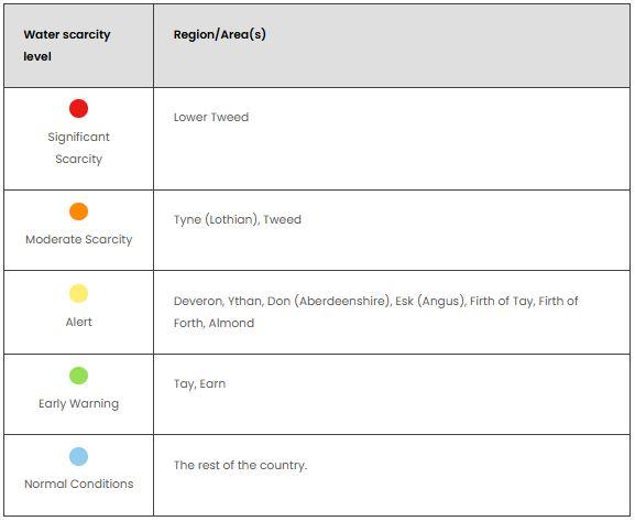 Images from SEPA
The recent rainfall is not yet enough to replenish all the water used over the spring and summer which also saw low rainfall. The Yorkshire area has had the 5th driest April to September on record, which means levels in certain parts of the area are very low and have thus reached the trigger for declaring a drought, like other parts of England.
Even though there has been rain, some heavy, very little of it reaches the reservoirs at first. After a long dry summer, the soil soaks up the early autumn rain before much of it runs off into rivers. That’s why river flows rose at just over half of monitored sites, but every site was still normal or lower for the time of year.
Demand is also still high. Water use has steadied thanks to cooler weather and hosepipe bans, but it remains above expected levels in some areas.
Groundwater is falling too. Groundwater levels are in their normal seasonal decline, and two sites are exceptionally low. This matters because in many areas groundwater supplies the rivers that feed reservoirs, so low groundwater means slower refilling.
The year started well with water levels following a very wet winter across most areas, which makes the prospect of a drier autumn and winter a worrying concern for next summer. Reservoirs were at 94% at the end of February, giving a large buffer when the dry spell began. But the long, dry and hot summer used up that buffer.
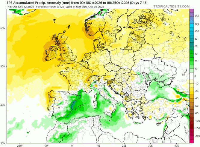
Weeks of steady, widespread rain are needed to fill up rivers, reservoirs and aquifers. The short-term forecast isn’t very promising though. Although there will be some brief spells of rain this week, they will likely make little impact on water levels. While weather model output is increasing in confidence for blocking high pressure to build over Northwest Europe from this weekend. A stubborn, slow-moving area of high pressure looks to build across northern UK next weekend and linger close to the north through much of the following week. It could even be near record-breaking for strength of the surface pressure for October.
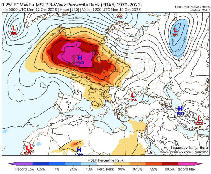
So we are likely to see a protracted spell of dry and settled weather across many areas from the weekend, through next week and perhaps towards the end of the month. It may not stay completely dry everywhere, with thicker cloud and some showers possible across southern England around the southern periphery of the low on Sunday and early next week, blown in on a keen easterly wind. But the rain is unlikely to amount to much, before dry conditions take over by mid-week.
Dry conditions for much of NW Europe from the weekend looking at the day 7-14 ensemble trend
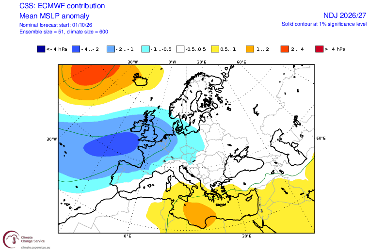
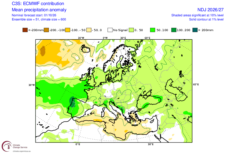
But some tentatively good news, given it’s a long range forecast, is that the Met Office and ECMWF seasonal forecast October updates point towards low pressure dominating the weather in the November-January period with wet rather than dry conditions favoured. This is the typical weather pattern that has occurred in the past during a strong / Super El Nino event, as is likely this autumn and winter. So some hope of going some way to address the drought.
November - January forecast stormier and wetter weather from seasonal forecasts
Loading recent activity...