




If it wasn’t the heat giving you trouble sleeping, the noise from the thunderstorms might have woken you up. Friday will be another hot day for parts of England, potentially record breaking again for June. Change is on the way from the west this weekend.
The line of rain and lightning moved from northwest Scotland away over the Northern Isles with reports of large hail and strong, gusty winds. Clusters of thunderstorms moved over the Southern Uplands towards Edinburgh and the Forth in the small hours with a stunning and noisy thunder and lightning show, extending into Northumberland.
Convective Forecast for Friday 26th
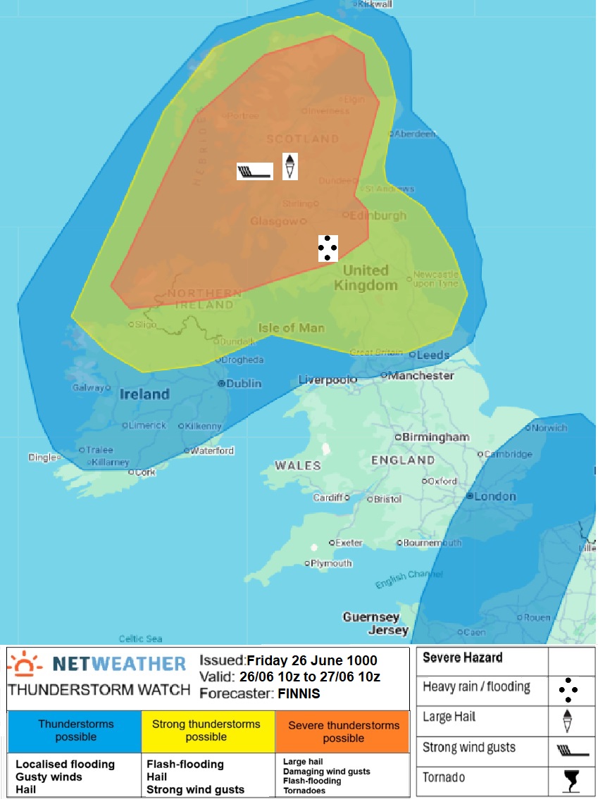
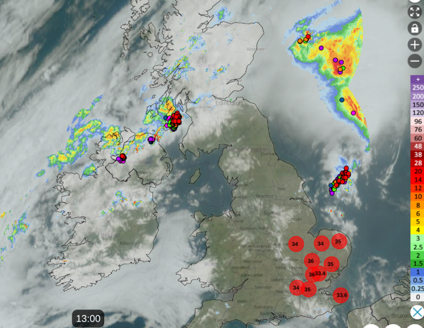
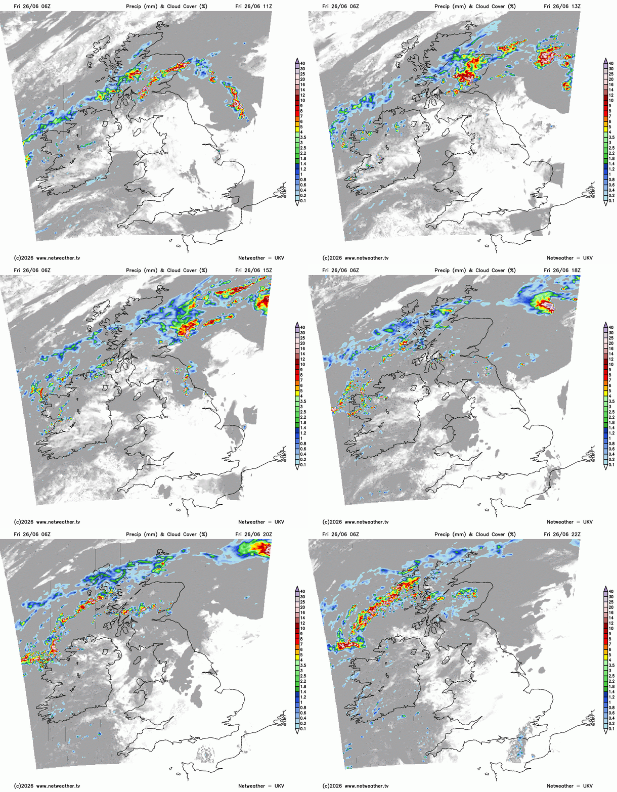
What will be worth watching this afternoon is developments over the Pennines, for northern and northeast England into the Scottish Borders as new storms develop in the heat. Some clusters will drift away over the North Sea but others look to head northwards over central Scotland into Friday evening. So again, the risk of heavy rain, poor visibility on the roads and frequent lightning.
“Many areas missing the worst, but thunderstorms could bring disruption in places this afternoon and early evening.” Met Office
Friday could see the highest temperatures of this week, with the June record threatened again.
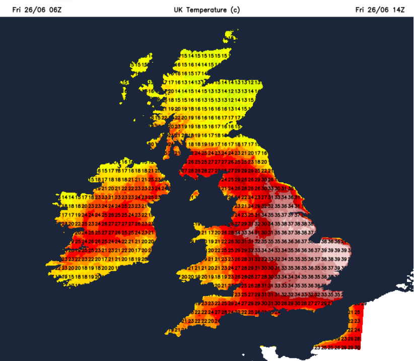
Considering that we haven’t passed 37C this week, the UKV temperatures have been overreading it is hard to trust the model highs but parts of eastern England are around 35C before 1pm. The red Extreme Heat warning is now focused on the highly populated area of London and the Home Counties as the working week comes to an end for many with hot journeys home.
“The exceptional spell of hot and humid weather will continue across this region, with impacts to the general population highly likely.”
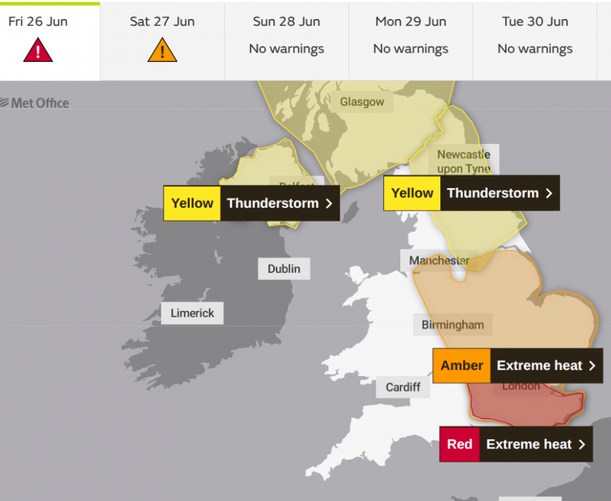
Wales is no longer in the Amber extreme heat warned area, after recording their hottest June day on Thursday. 35.9C at Bute Park, Cardiff, beating the 33.7C record from June 2020. Much of Wales and SW England had recorded four or five days at or over the heatwave threshold temperatures. It really has been an astonishing week for England and Wales.
“Hot and humid weather is expected to continue, with exceptionally warm temperatures both day and night.”
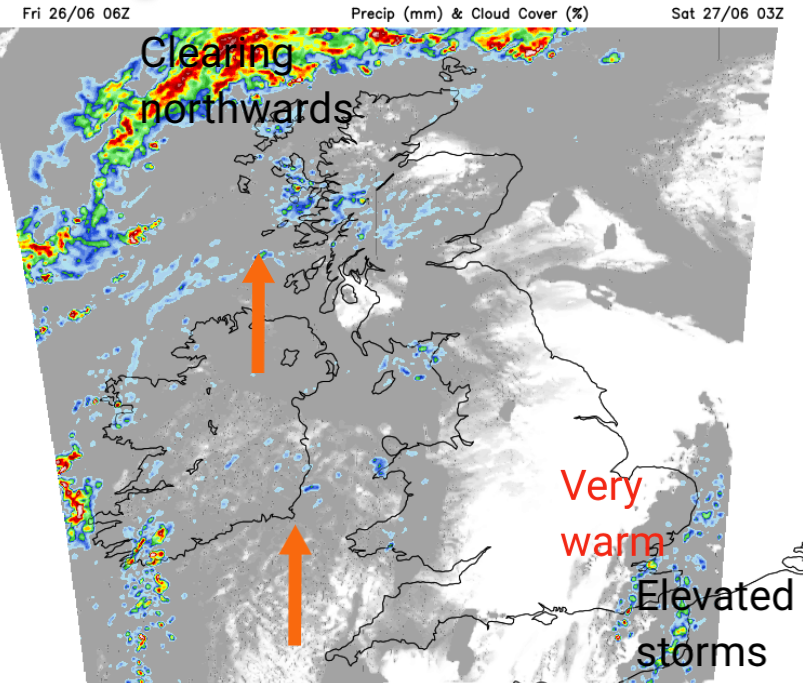
It will be another stifling night for London, as well as other parts of SE England, with hardly any breeze as the heat continues. Elsewhere, it will still be warm but just signs of some relief if this is all getting too much. A brisk southerly wind will pick up for Ireland and western Britain by dawn on Saturday.
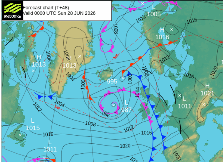
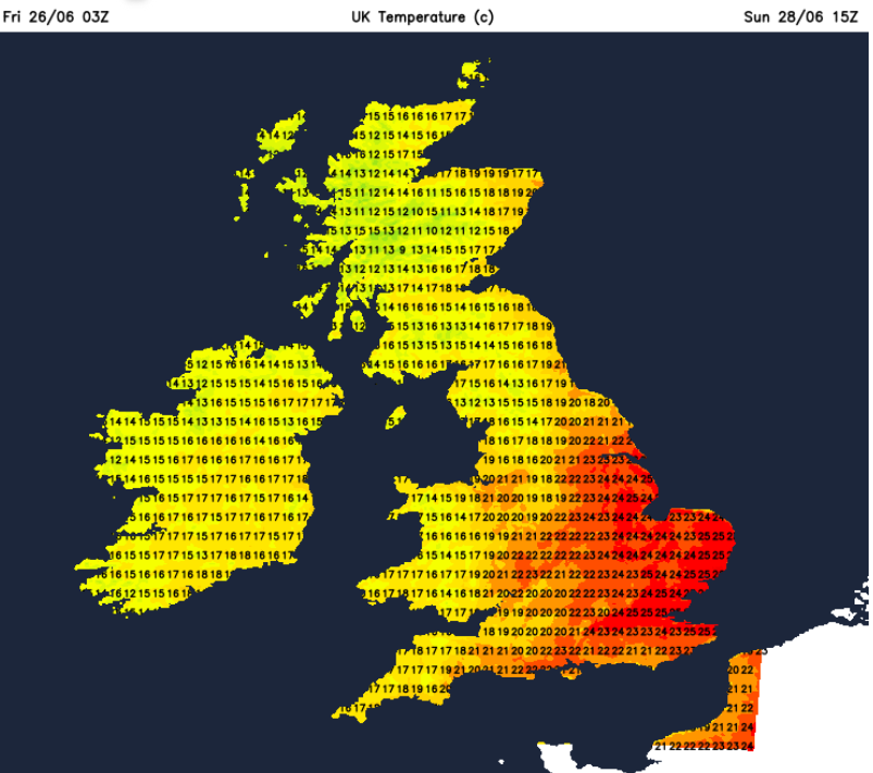
Fronts from the Atlantic will be queuing up at the weekend, ready to clear out the hot and humid air and allow fresher conditions from the west to reach over the UK. It will be slow progress for England, particularly East Anglia and the southeast, where there will be another hot day, but not as extreme as it has been in the week. The highs might be 30 to 32 C, which is down from the forecast 34 or 37C on Friday. There is a possibility that the June temperature record could be broken again today.
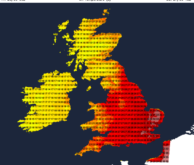
There will be clouds and outbreaks of rain with the warm but blustery southerly wind for Northern Ireland and western Scotland. Northern Ireland could see sudden gusty winds and intense downpours by the afternoon. Ahead of this there will be a lot of fine, sunny and warm weather. The southerly flow will take very warm air right up to northern Scotland, up to 25C. Still hot for SE Britain but with a few clusters of heavy showers, reaching over more of mainland Scotland, and some models are showing showers coming across the English Channel. Southeastern Britain could see a few heavy, perhaps thundery showers drift northeastwards on Saturday afternoon. Worth keeping an eye on the radar. France remains very hot with red and amber heat warnings including for Paris, with warnings for thunderstorms in the north, which might reach Kent on Saturday evening.
Remember the frontal bands trying to edge in from the Atlantic, well they will reach more of western Britain during Saturday night with outbreaks of rain. Clearing skies, a westerly breeze and fresher air will follow. Ahead of all this, there will be more strong, June sunshine. The UV is as high as it gets, so don't get burnt. Avoid the sun 11 til 3pm, wear a hat and in date/high value sunscreen applied 30 minutes before you go out. The UV values stay high due to the strength of the sun’s rays at this time of year. The air temperature does not matter.
Eastern England will see top temperatures in the mid to high 20sC, elsewhere a real change from the heat of the past week. There will be a few showers on the breeze on Sunday, more so for Northern Ireland and Scotland but overall it will be a fine, sunny day and much more comfortable for those who have found the heat all too much.
Loading recent activity...








