Mainland Europe is in for a hot week with heatwave conditions likely. Temperatures in France are in the high 20s, just tipping into the low 30s Celsius. Spain is the same for the start of the week and will get even hotter. For the UK, temperatures are slowly rising but a stubborn low pressure over the North Atlantic will disrupt the feed of heat from the south.
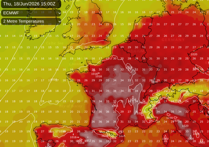
SE England will move from 24C up to 29C by Friday. Manchester 22C up to 25C. Closer to the low pressure and more of an influence from the north Atlantic than from Africa, temperatures for Belfast and Glasgow remain in the high teens, say 18 or 19C. This is a bit above average.
Under the European high pressure, there are large areas with clear skies and sunshine, adding to the heat. For the UK, the main low pressure and waving fronts will continue to feed areas of cloud and bands of rain from the west. Our weather remains a bit mixed with drier and warmer weather in the southeast.
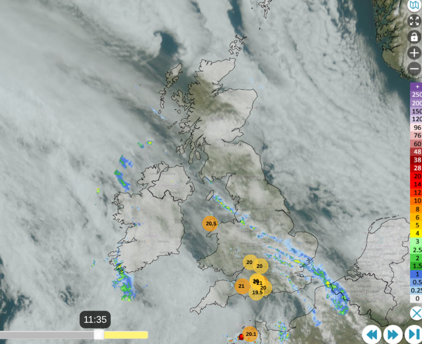
Netweather radar at 11:35 on monday 15th with top 10 temperatures, lightning strikes near Channel Islands
Monday started with a light, cool easterly breeze off the North Sea but the wind will veer to a southwesterly later on as the warmer air from the south arrives. There has been a thin band of rain feeding from Kent to north Wales and Merseyside this morning. Over England, that will edge northeastwards but fade away. There will be showery outbreaks around the Solway Firth by mid-afternoon linked to this band. Thicker cloud and rain will brush past Northern Ireland arriving over Strathclyde and SW Scotland this evening. Northeast Britain and the Northern Isles will be brighter with sunshine but still in the cooler air. The main rainband will spill across the Central Belt this evening with showery outbreaks over Northern Ireland and Wales. England will remain dry with temperatures by day into the mid 20sC and a mild night to come.
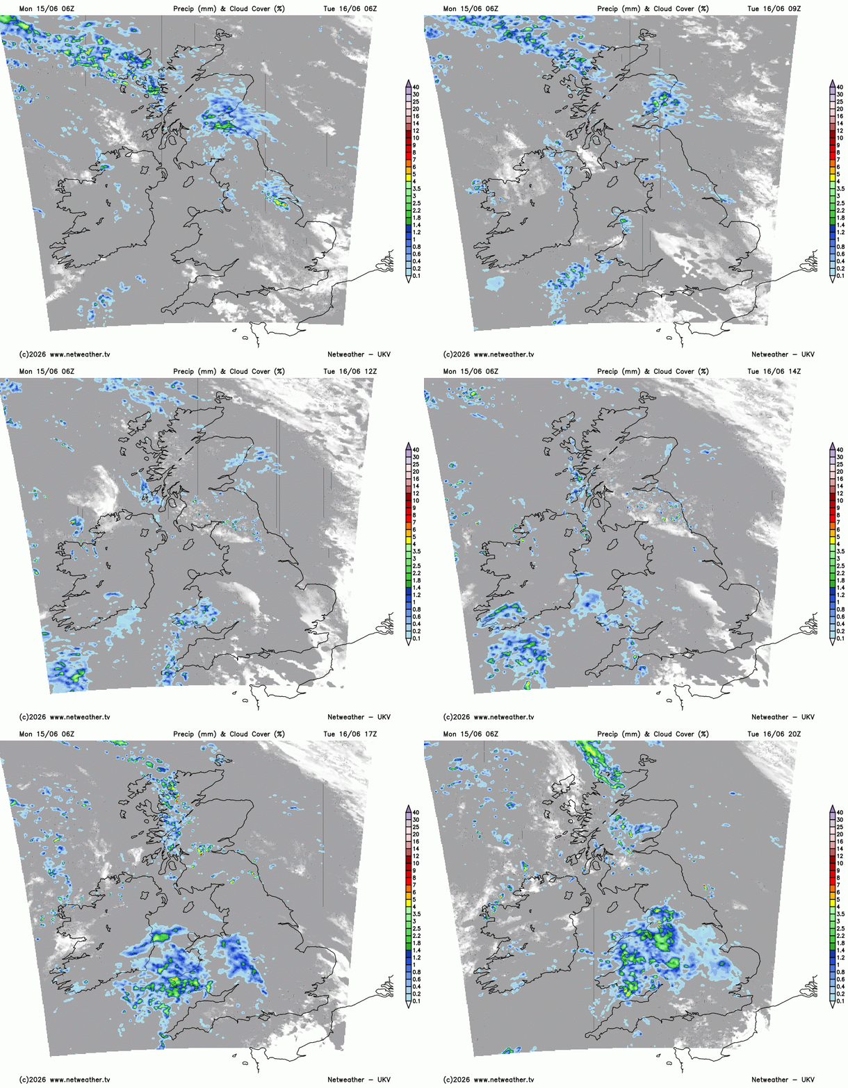
The mixed picture continues, but with a background theme of warming air. The Atlantic low pressure will throw frontal bands over the UK, bringing more cloud and some rain. Again, the southeast will miss this and there will be a drier slot in between the rain over Scotland and a heavier pulse heading for Wales on Tuesday. Temperatures in London could reach 27C and it will feel more humid in the southeast.
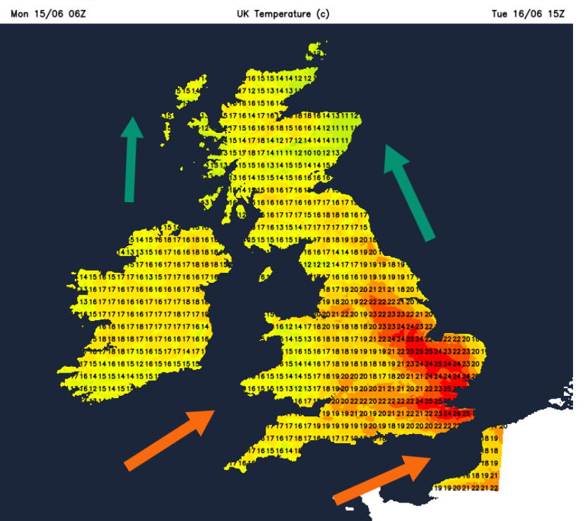
It will also be warmer by night, which some people will begin to find uncomfortable. Back in late May, the Met Office didn’t issue one of their Extreme Heat warnings, which is part of their Severe Weather suite and only includes an Amber and Red version. Although we are not into heatwave territory here yet, temperatures in southeast Britain would need to be over 27 or 28C for three consecutive days for that, we can check with the Heat Health Alerts (only available for England). There are three areas covered by yellow alerts which is the first signal that “adverse temperatures are likely to impact on the health and well-being of the population.”
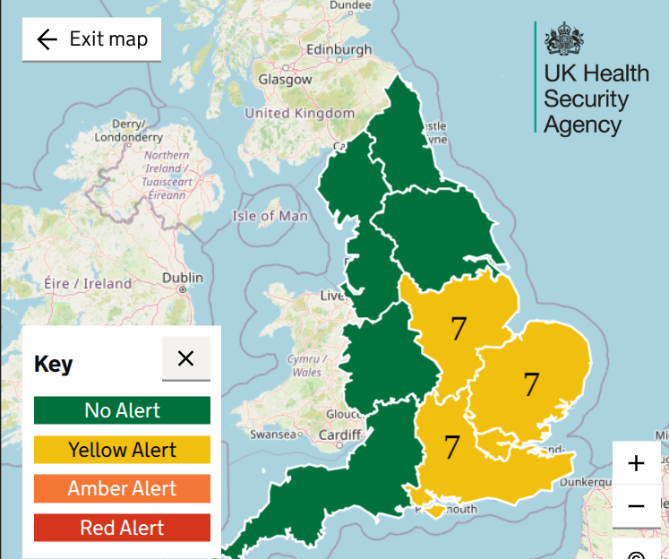
These are running from later on Wednesday 17th through until Monday 22nd, so all of next weekend. The matrix number for these alerts is 7, which links to a specific square showing a medium likelihood of this heat event, but with Low impacts forecast at this time, impacts on health and social care services from this forecast. Low is still some, rather than the minimal Very Low.
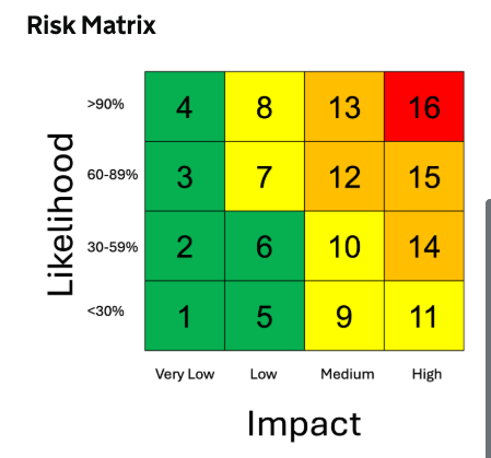
The usual Met Office weather warnings are also changing to these numbered Matrix squares; more information coming soon.
Midweek onwards
The waving front from Tuesday will continue to feed rain from the southwest during Tuesday night into Wednesday. The UKV shows rain over the West Country, around the Bristol Channel early on Wednesday, feeding east towards East Anglia as more rain arrives for Wales. The very warm air will be over southeastern Britain, but the cloud and rain will complicate the warming picture. Areas where the sun does appear will see temperatures leap up again. Northwestern Scotland will feel fresher with air off the north Atlantic and there will be a scattering of showers over Scotland and Cumbria midweek. Bright or sunny spells in between.
Further ahead it looks like the warmth/heat will build slowly although the models do vary for the northwest of the UK, if the warmth will reach or be able to stay as that Atlantic low topples closer.
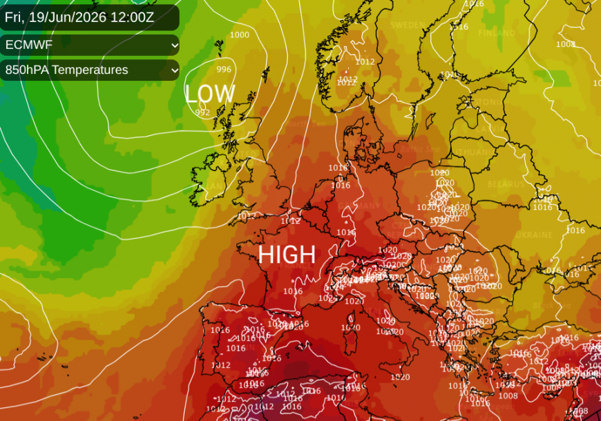
If you are heading to Europe soon, all the national meteorological services' warnings are shown on the Meteo Alarm website. It's an easy one-stop shop to find out about severe weather and who issues the official weather warnings for a country if you are off on holiday.
For the World Cup Football, England are playing Croatia on Wednesday at 9pm in Dallas Stadium, which luckily is air-conditioned with a roof. Outside in Arlington, Texas temperatures are forecast to reach 34C, 94F mid afternoon.
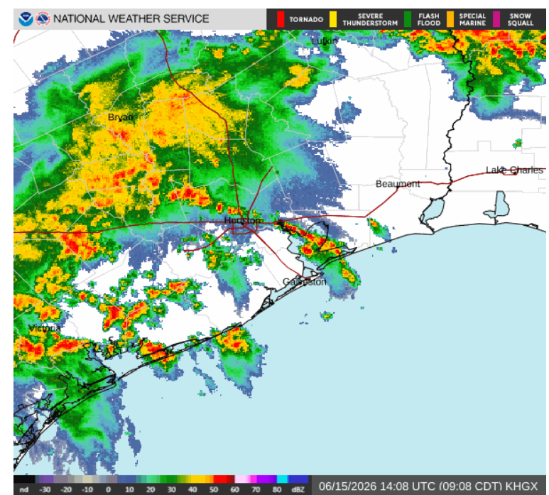
Texas radar showing thundery showers around Houston early on Monday
Portugal are playing DR Congo at 6pm also in Texas, but at the Houston stadium. The Houston area starts this week with a Flood Watch. Heavy showers and thunderstorms are forecast from Sunday night through until early Wednesday. Kickoff is at 12 noon on Wednesday, so hopefully there won’t be any issues with flooding around the stadium or with transport links.
Loading recent activity...