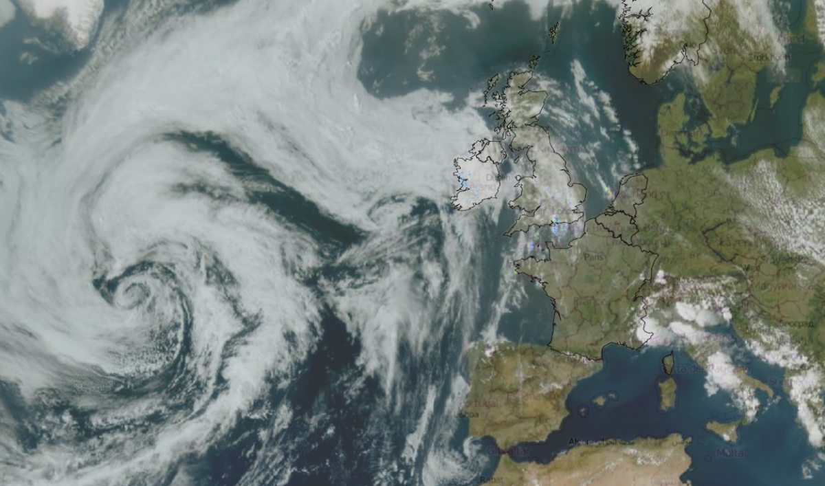
The heat will cling on for southeast England until Sunday, although as intense as it was to start this week. Over the Bank Holiday weekend into Tuesday, high pressure brought heat and sunshine with a new May record high temperature for the UK, 35.1C Through the middle of the week, there have been areas of cloud and rain but also cracking thunderstorms bringing torrential rain and hail, followed by a stunning lightning show on Wednesday night. The heat is fading and the nights are cooling down. Our eyes turn to the Atlantic and the great swirl of cloud on the satellite image, a low pressure. This has been introducing more humidity, resulting in convective activity and storms
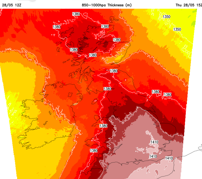
Thursday heat with 31C for London
The steady high pressure is going to drift away before this coming weekend, so big changes are afoot. The centre of the high will drift away over central Europe towards the Balkans. We lose the warm southerly flow, the stagnant area of heat that has been over the UK for days and there will be more cloud, so less direct heating from the sun and the temperatures will decrease.
You might be very pleased to hear this if the heat by day and night has been too much.
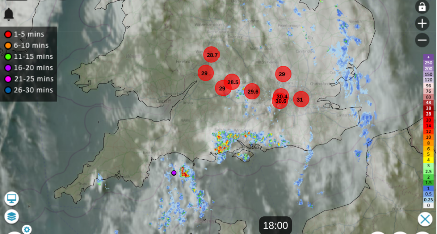
Netweather Radar Thursday evening 6pm with a scattering of showers in the south, inland temperatures still high
Southeastern Britain is in for another warm night after a hot and humid evening with a scattering of lively showers. The heat will still be over Essex, inland Suffolk, Kent, Sussex and London on Friday with temperatures into the mid to high 20sC. It will be warm for the Midlands and eastern England with a bit more cloud about, as a band of patchy rain moves across southern Britain during the day. The winds will be light and the band of rain could turn to heavier showers by mid-afternoon over SE England.
The first tendrils from that Atlantic low will be reaching northern areas. For northwest and western Scotland, there will be cloud and rain with a brisk W/SW wind. It will feel cooler and the rain will only fade by Friday evening.
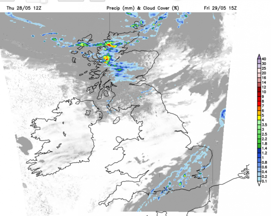
In between the rain in the far northwest and the residual heat in the far southeast, there will be a lot of fair, often sunny weather. It will feel pleasantly warm but not too hot. Temperatures will be around 18 to 23C but breezy for northern Britain.
The last of the showers should clear from Kent on Friday evening, leaving clear skies and light winds across the UK. Overnight, the temperatures will be coming down again, 9 to 12C, although London could still be at 16C.
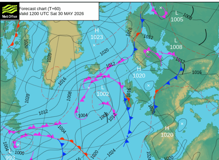
Saturday
There will be plenty of sunshine over England and Wales on Saturday morning. Temperatures will respond, up to the low to mid 20sC so again pleasantly warm. Southeastern Britain will be warmer, 24 to 27C away from the Norfolk coast.
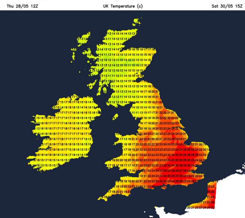
Eastern Scotland should also be fine and warm around 19C. The occluding frontal bands from the Atlantic low will be approaching western Scotland and Northern Ireland, so there could be more cloud and outbreaks of rain here for much of the day, with a southerly breeze. It depends on how the frontal band wavers about; it might sway back westwards and allow brighter skies to Belfast, so some uncertainty here.
Once the main frontal band progresses over the Irish Sea and into more of Scotland, there will be some heavy, even thundery showers following for Northern Ireland by Saturday teatime. Ahead of this, the fine, sunny and warm weather continues over England and inland Wales.
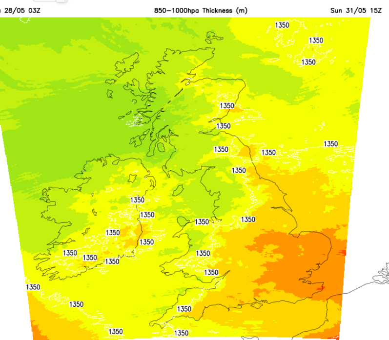
Sunday will be back to what we expect in the UK, a day of bright or sunny spells with blustery showers whizzing by. It will feel fresher everywhere, especially in the shade or as a heavier downpour passes by. However, there will be areas that miss most of the showers and see more sunshine. It will be strong sunshine and feel warm, it's just the airmass will be different, even for SE England. The westerly flow off the Atlantic will bring a good scattering of showers with temperatures around 16 to 23C. Quite a change from the 30sC and heatwave.
Loading recent activity...