Tuesday 26th May, provisionally saw a new May temperature record for the UK. Kew Gardens in London reached 35.1C beating the Bank Holiday Monday value of 34.8C which had smashed the previous record from 1944 of 32.8C. London Heathrow saw 35.0C yesterday with widespread heat for England and Wales. Astonishing heat for the month of May, which is statistically part of spring rather than summer. It has felt fresher in northeastern Britain as a breeze off the North Sea, and accompanying cloud, makes a difference.
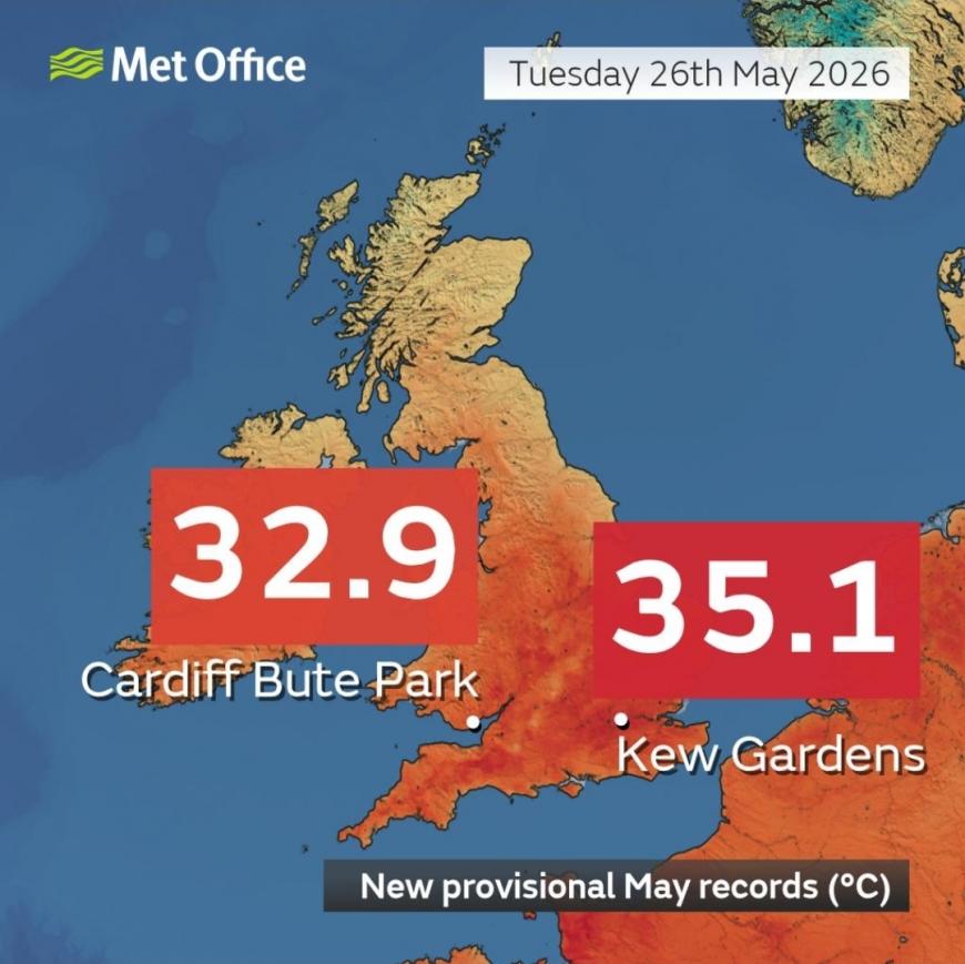
In South Wales, Cardiff reached 32.9C on Tuesday beating the Bank Holiday Monday value in NE Wales of 32.2C, which had also smashed the previous Wales May record of 30.6C from 1944.
The May night-time record has also fallen again, for the third night in a row. Camborne in Cornwall fell to only 21.4C, which was its minimum temperature, with a Tropical Night. This heatwave has certainly been something.
Northern Britain and Northern Ireland have seen high temperatures this week but not the intense heat of 30sC. As the High pressure bringing the steady spell shifted about, a cooler E/NE flow off the North Sea made quite a difference late on Tuesday. There is a bank of grey cloud over NE and eastern Britain which feels cooler with a different airmass. In the Highlands, temperatures dropped to 1.1C overnight. Imagine that southern Britain.
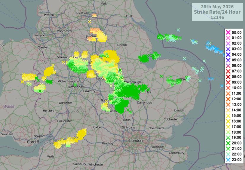
Lightning strikes (sferics) from Tuesday
Tuesday wasn’t just a day of heat and sunshine for England and Wales. There were incredible thunderstorms. Yesterday’s Convective Forecast highlighted a region of risk with the potential for isolated storms and boy, did they pop!
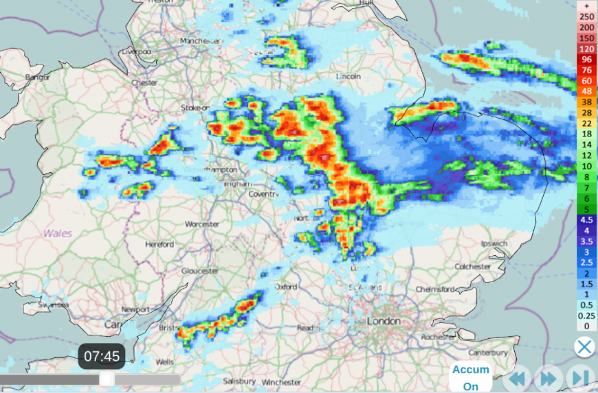
Rainfall accumulated totals for 24 hours from Tues 26th until 0745 on 27th. Shows isolated heavy downpours from thunderstorms
Once they triggered, all the potential energy was released with a gentle drift E/NE through the day. There were hailstorms, torrential rain and lightning as a mile or so down the road, it stayed fine as ominous towering clouds went bubbling up. Sutton Bonnington in the Midlands recorded 22.0mm (so nearly an inch of rain) but these kinds of storms will inevitably miss the gauges.
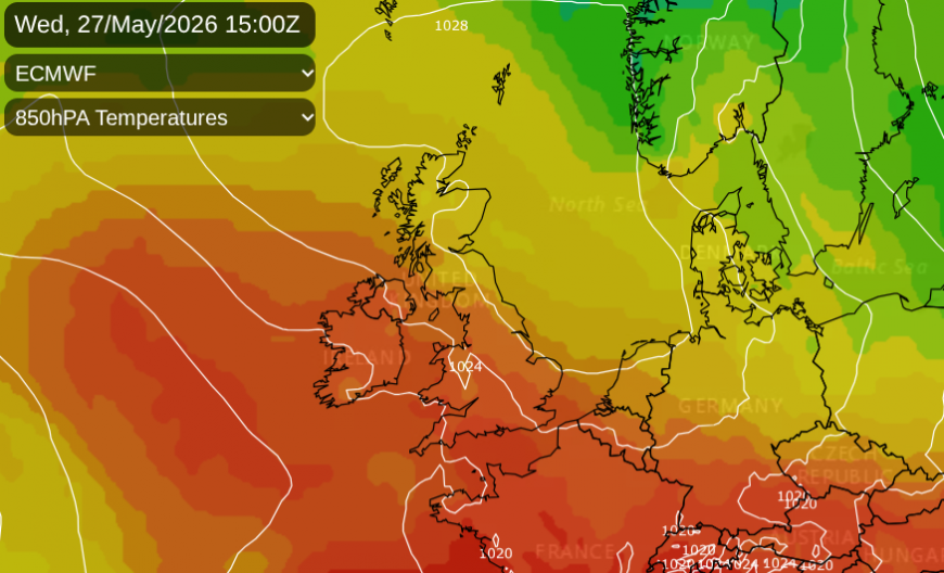
Wednesday
Today isn’t expected to break another record but for SW Britain, it will be another hot day with heat and humidity. Southeast Wales and the West Country will see temperatures in the high 20sC, tipping into the low 30sC. Cardiff and Bristol are likely to reach 31 or 32C, and 33C is likely somewhere in central southern England towards the Bristol Channel. It’s already warm before 9am
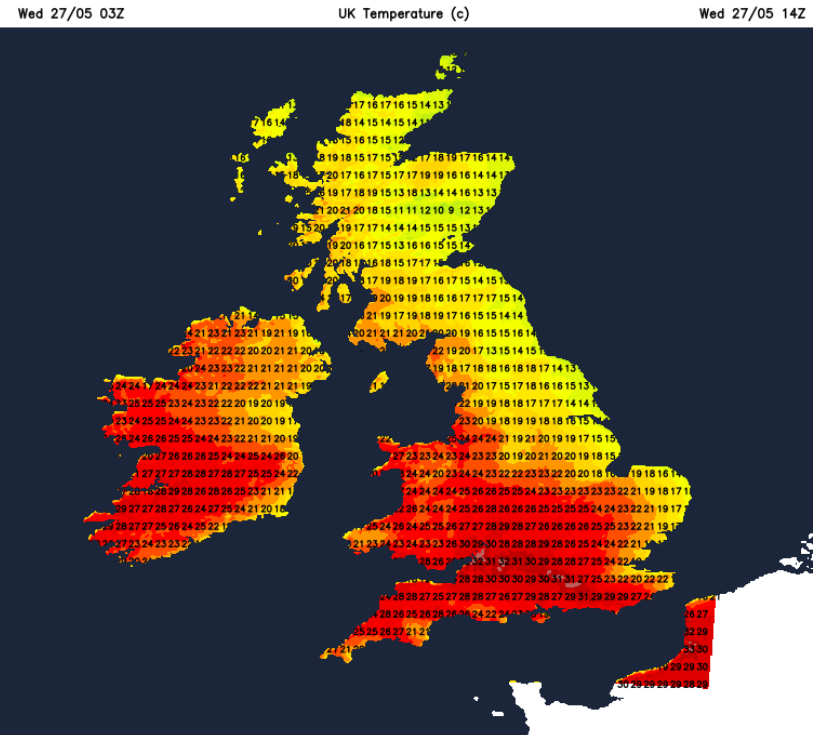
The easterly flow off the North Sea will make a difference. London will be closer to 27C today, still very warm but not 35C. For East Anglia, closer to 19C along the coast with well 24C inland. Northern Ireland will be in the low 20sC today with bright dry weather. Scotland will be only 14C on the cloudy east coast but 21C for the west coast with more sunshine. The blanket of cloud will thin and break but expect a stubborn section stretching inland from Angus and Fife.
Similar for the cloud over northern England, which will linger for longer over NE England as other areas brighten and warm up. 13 to 16 along the east coast with grey skies but further west in the sunshine, Manchester could reach 25C and Birmingham 27C.
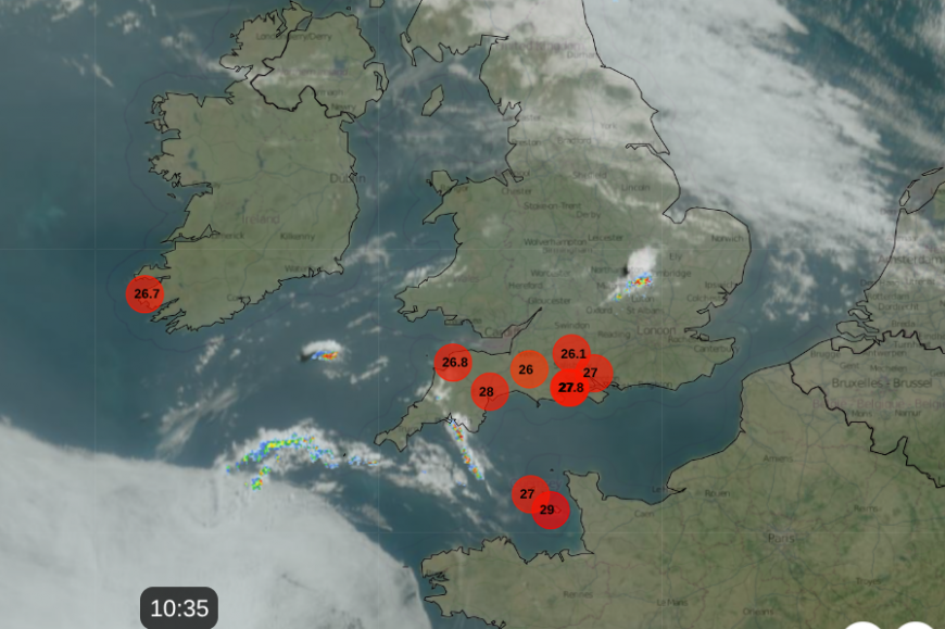
Radar showing top ten temperatures at 1035 (around 26-28C for SW England, 29C on Channel Islands), small cell near Milton Keynes and showery band near Cornwall, tomorrow's cloud for Ireland away to SW
You can see showery outbreaks away to the southwest on the radar, this band will edge northeastwards today, towards Bristol, over Wales and the Cotswolds. There could be heavy rain, small hail and lightning from this today, with further developments into central southern England by this evening. The band of cloud with showers will extend through the Midlands into Merseyside overnight.
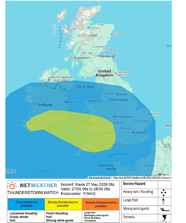
For many, it will be more comfortable night, even feeling cool away from the far S/SW. However, another pulse of heat will surge up through the UK on Thursday as the flow veers to a southerly. This will reach right up through Britain, also for Northern Ireland, but with more cloud from Ireland. Back to warmth for eastern England and London could see 31C on Thursday.
Storm photo of the day has to go to Joe (Joey.GII from the Netweather community forum) or perhaps the cat, Jasper with the stunning Mammatus cloud in Derbyshire yesterday.

If it's all too much, there will be a gradual change from the Atlantic starting on Friday but this unusual heat won’t clear from SE England until early Sunday.
Loading recent activity...