Although the peak of the intense heat has now passed with a new UK May record top temperature of 35.1C, there will be more very warm, even hot weather and sunshine, until proper shift at the end of the week to more usual late May conditions.
There is a fresher easterly wind off the North Sea, with banks of cloud floating about and some cracking hailstorms and thunderstorms trying to interrupt the heat and sunshine.
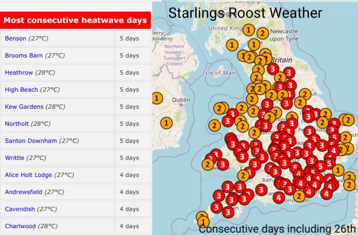
The criteria for a UK heatwave “when a location records a period of at least three consecutive days with daily maximum temperatures meeting or exceeding the heatwave temperature threshold.”
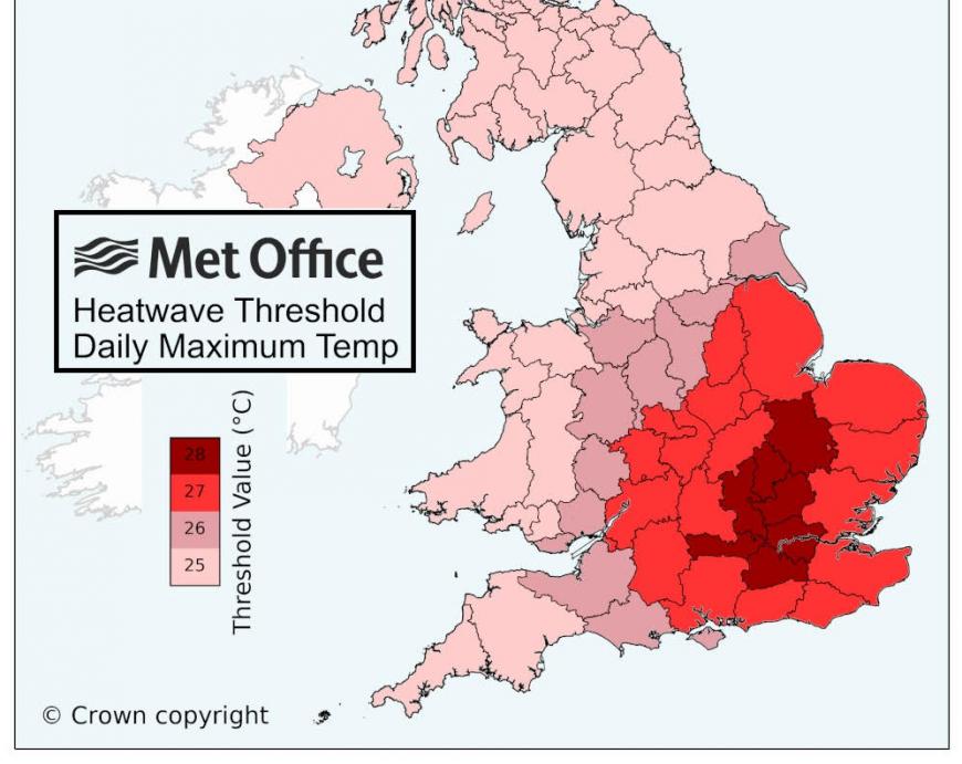
This threshold varies from 25C for a good part of northern and western UK, up to 28C for zone from The Wash down to London and the Home Counties.
This criterion has been met widely across Wales and much of England (away from the far north and east). The map above from Starlings Roost Weather shows locations that have exceeded the threshold temperatures for three days, and in some cases up to five days, including Tuesday 26th May. SW Britain is in for another hot day on Wednesday.
Although beating the UK and Welsh temperature records for the month of May stand out, it has widely been unusually hot for the time of year. Some places have even seen temperatures pass their June record maximums. Considering on Sunday the UK May record stood at 32.8C from 1944, many places in southern England were over 33C on Tuesday with four at or over 34.5C
Met Eireann reported a provisional new record high temperature for May as Shannon Airport in Co.Clare reached 30.6C on Tuesday 26th. New May record for Jersey at Maison St Louis 34.2C, and the 11th hottest day of any month since 1894. The threshold temperature for Jersey is 28C with an official heatwave declared here. In France, there have been hot nights and many place records broken by day as temperatures moved to the mid 30sC. This same heatwave has broken records in many western European countries including Spain, Portugal and Germany.
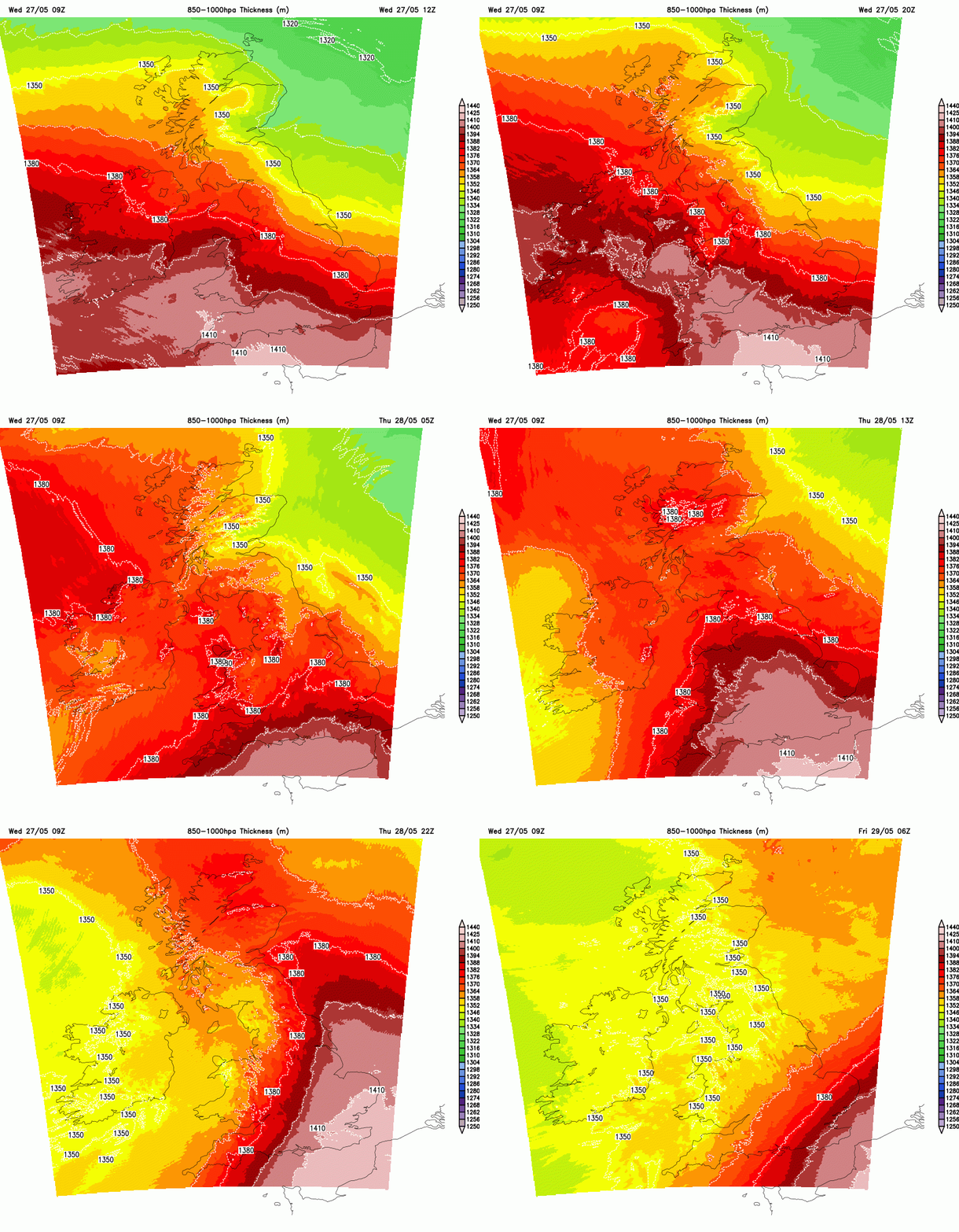
There will be another pulse of heat up through the UK on Thursday, making quite a difference to eastern England after the fresher feel on Wednesday with a flow (and cloud) off the North Sea. As the winds swing to the S/SE much of the southern half of Britain will have a very warm day with temperatures in the mid to high 20sC. Exposed coasts won’t be as hot. North of London could again move into the low 30sC.
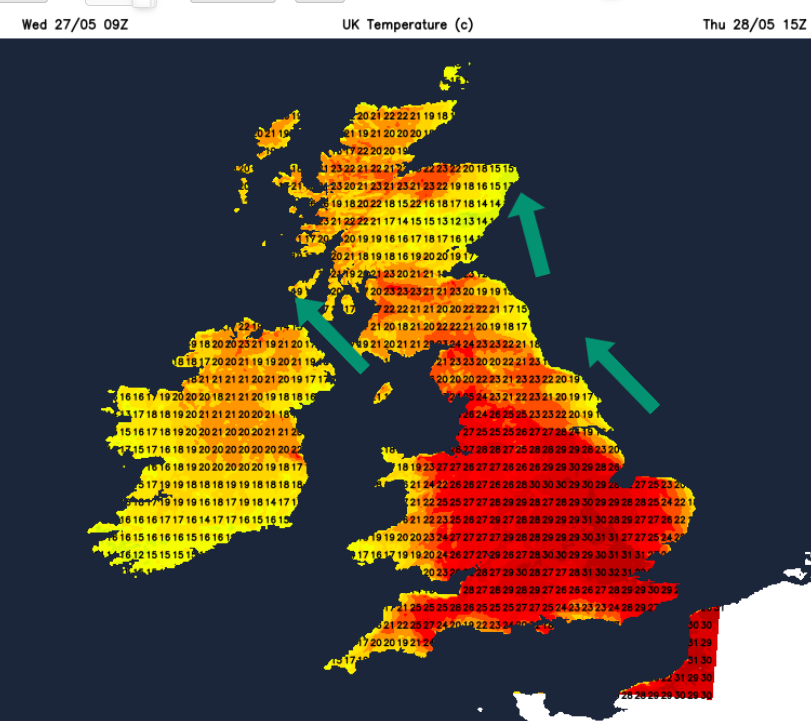
There will be an onshore breeze for E/NE England and eastern Scotland but as it will be from the SE it won’t manage to reach as far inland as today. Not as hot for SW England and southern/western Wales. Northern Ireland will see some thicker cloud tempering the feel of the day.
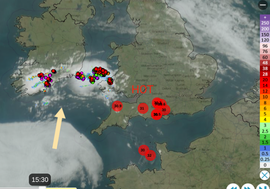
This bank of cloud has been lurking away to the southwest on Wednesday but will move up through Ireland, also encroaching on Wales and parts of England during Thursday. Scotland and the Lake District will feel much warmer on Thursday. Again there could be a few heavy showers, even thunderstorms but overall its another warm and fine day.
During Thursday night the winds veer around to the southwest. No longer the heat from the continent but the start of a change to Atlantic air and a return to more average late May temperatures. It will still be a warm night for eastern/SE England but elsewhere more comfortable. Showery rain will arrive over western and northern Scotland with a few bits for Northern Ireland
Friday
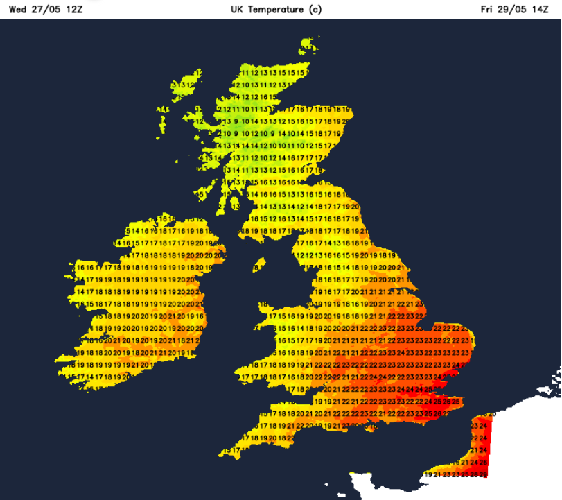
Friday looks windy in the north with a mix of cloud then bright even sunny spells and a scattering of showers. Eastern Scotland will reach the high teens in the brisk westerly flow but the air will be different. Southeast England will continue with the very warm air as temperatures reach the mid 20sC potentially again the high 20s, even 30C. Elsewhere it will be sunny and warm but just not the same heat.
There is rain in the forecast for Saturday in the west and north but it will take until Sunday for the heat to finally leave the south east.
Loading recent activity...