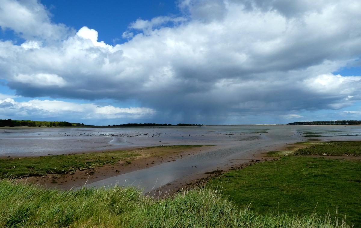
Wednesday will bring plenty of showers across the UK with bright or sunny spells in between. It still feels cold for this time in May. It’s rather disappointing to be stuck in this northerly flow from the Arctic.
On Tuesday, Cardington, Bedfordshire started the day with a chilly -2.8C but Hurn, Dorset reached 18.8C. Today the maximum in the southeast will be around 15C.
Further north, there were bands and clusters of heavy showers working their way across the UK, with thunder and lightning, even hail for southern Scotland and Newcastle. Plenty more showers to come.

Today, there will be heavy showers with an eastern risk of thunderstorms and hail.
The Netweather Convective forecast for Wednesday highlights a broad area of Britain where thunderstorms are possible with the risk of sudden gusty winds and localised flooding. It’s showers, so some areas will see more downpours and others fewer.
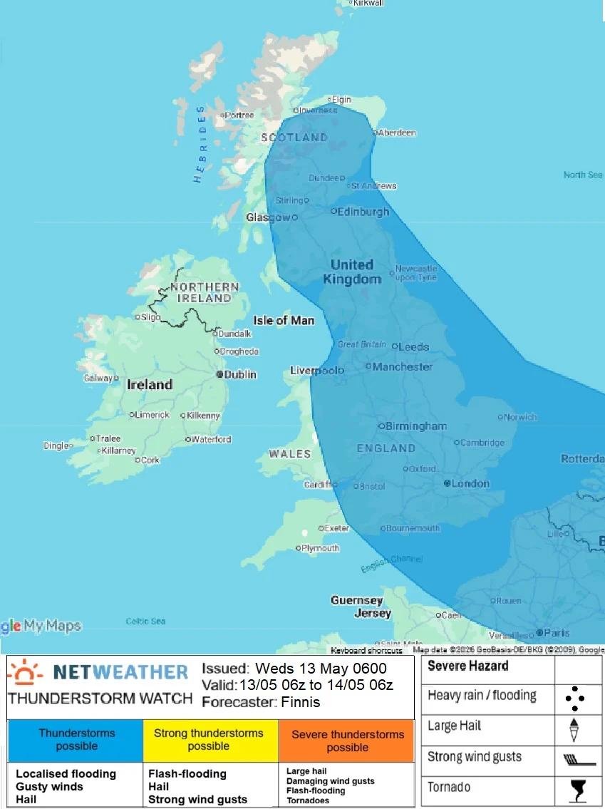
“Upper low originating over Greenland…will continue to drop southeast over the North Sea on Wednesday…Surface heating in sunny spells will generate extra instability, which allows some thunderstorms to develop too, particularly in the afternoon/early evening, accompanied by hail and gusty winds, over quite a broad area of the UK, though less likely across the far west, further from the upper low”
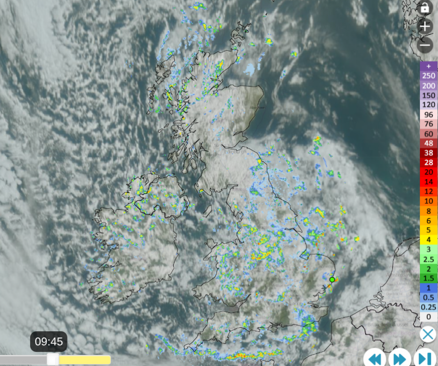
The Netweather radar (and satellite) image above from this morning shows a rash of showers but areas of clear sunshine for a few favoured spots. It won’t last, expect a shower to pass by. There is also one (green) dot showing a sferic from the past 10 minutes (0935) close to Aldeburgh in Suffolk as a heavy shower passed by.
There is a surface low over the North Sea and a moderate to fresh NW wind bringing showers over Northern Ireland, Wales, Merseyside and the West Country. These will move through quickly on the breeze but SW England won’t see as many showers with longer bright or sunny spells. It will be windy with strong northwest winds for Cornwall and the Channel Islands. Temperatures in southern England will be around 12 to 14C, so several degrees below average for mid-May. Temperatures in Northern Ireland will be around 10 to 12C so feeling cool all day.
The winds will be much lighter over Scotland (away from the west coast with a northerly here) and for northeast England so the hefty showers will be slow-moving, bringing heavier downpours to one area. Temperatures in northern Britain will be around 10 to 12C, colder as the showers pass by and there will be snow over the mountain tops.
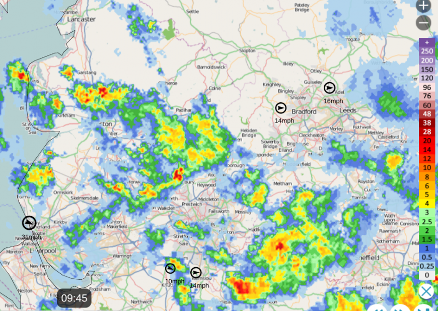
Netweather radar over NW England on Wednesday morning with wind values, showing scattered showers and gaps.
It will be worth keeping an eye on the radar, to see how the clusters of heavy showers are moving, north to southeast. You can use the animate button to see the recent motion and the Radar will also show where there are gaps with drier weather. Turn on the Lightning, and many of the Sferics will show up as dots or crosses depending on your version.
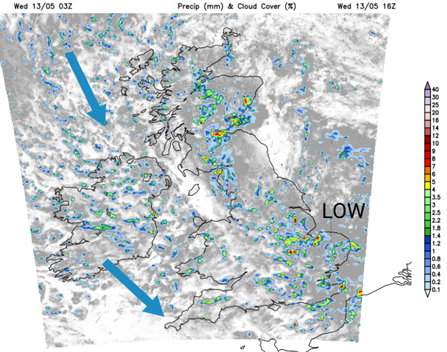
Tonight
The northerly flow will continue to bring showers down through the UK overnight. Temperatures will be in single figures overnight with lighter winds.
Thursday
The steering flow will be from the north on Thursday, even veering slightly NNE through the day. This will bring showers down through Britain but also expose slightly different areas to Wednesday. After a showery start, Northern Ireland should see plenty of fine weather as the showers diminish. Temperatures in northern Scotland with a brisk wind will be around 9C. Elsewhere, temperatures across the UK will be only 10 to 12C.
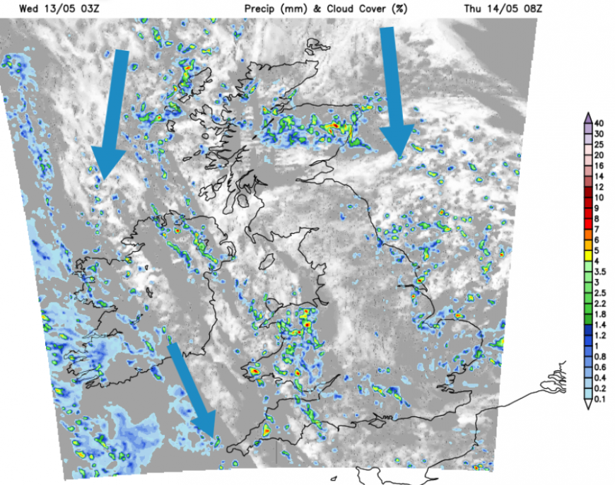
The low centre will remain over Scandinavia and keep us in this cool northerly flow into Thursday night. There will be the risk of a patchy frost for northern and central Britain, but a brisk, chilly wind for the far NE of Scotland, closer to that low. There will be more cloud from the North Sea over eastern Britain and clusters of showers running down the coast of eastern England. Wintry showers continue overnight for the mountains of northern Scotland but western parts of the UK will be clear and more settled during Thursday night.
Friday will still be in this cold northerly flow. The trend is towards lighter winds, clearer skies, fewer showers and more sunshine. However, along North Sea coasts of England, there will be more cloud, a nippy wind and outbreaks of rain or showers linked to the low centre. This unsettled weather will drift from eastern England over East Anglia, London and the Home Counties and showery remnants should fade from Kent and Essex on Friday evening. Temperatures will be around 9 to 14C.
When is it going to warm up? Next week.
Loading recent activity...