It’s on the chilly side this week, with temperatures widely below average for the time of year by day and night. The gusty northerly wind today and tomorrow, especially under any showers, making it feel chilly even, though pleasant enough in the sun out of the wind.
Temps below average this week, but recovering to above average next week.
Temperatures look to return to average by early next week, as we lose the arctic-sourced northerly flow we have currently and the wind turns southwesterly or southerly. From the middle of next week, models currently point to temperatures going above average into the low even mid-20s.
For now, a cold front swept south on Tuesday, clearing the far southeast of England early evening and following on behind is another surge of cool arctic air - bringing temperatures below normal for the time of year along with sunny spells and scattered heavy showers today and tomorrow, some of which will be heavy with hail and thunder - particularly towards the east close to an upper low over the North Sea.
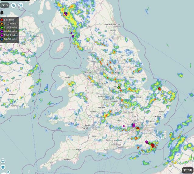
The upper low originated over Greenland earlier in the week and has since dropped southeast towards the North Sea. Cold mid-level temperatures associated with the upper low, as low as -32C at 500 hPa level, will create steep lapse rates (steep drop in temperature with height) over the UK over the next few days, particularly towards the east. Surface heating in sunny spells supporting rapidly rising parcels of warm air up into the cold air aloft, forming cumulonimbus clouds with hail and thunder.
Showers will become fewer on Friday, as a ridge of high pressure builds in, bringing drier conditions with the north to northwesterly wind easing, but it will remain on the cool side into Saturday. Temperatures should recover in the east on Sunday, back into the mid-teens, as winds turn southwesterly.
There will be a band of rain arriving in the west later on Saturday - which will move east across most areas by Sunday afternoon, but it should be mostly dry on either side of this rain band over the weekend before showers move in across the far west on Sunday.
It looks to remain unsettled early next week, with low pressure close to the west and a brisk south to southwesterly wind bringing spells of rain or showers across the country, though wettest weather towards the northwest. It’s looking warmer than the start of this week, with temperatures back to near average, reaching the mid-to-high teens.
Good ECMWF ensemble agreement for temperatures to reach the low twenties from middle of next week
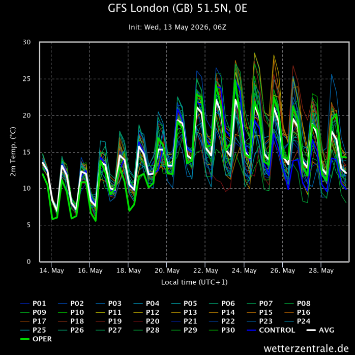
From the middle of next weekend, there’s fairly good agreement from medium-range model ensembles for high pressure to build from the south and become centred over the North Sea by the end of the week. This will mean temperatures by day may rise into the low twenties celsius across eastern England initially, then perhaps more widely across England and Wales by Friday, when ECMWF forecasts temperatures reaching 25C in the SE of England.
Low pressure close to the west to start the week, then high pressure builds from the south towards end of the week
The warm weather may continue through the Bank Holiday Weekend into the following week, but that’s a long way off. 00z GFS run showed 31C across SE England on the 28th, too far out to take seriously. Low 30s has been recorded in the south in late May, but it’s not a common occurrence.
Loading recent activity...