It’s a very warm end to the working week with temperatures moving into the twenties across Britain. Anglesey reached 24.3C on Thursday as western areas saw the peak of the warmth yesterday. In the sunshine, England should see higher than that today. For western parts, increasing cloud and showery rain has surged northwards and will inhibit temperatures on Friday before a shift to a flow from the Atlantic. For Britain today, there is warm air from continental Europe and a lot of sunshine.

On the combined satellite and radar picture, you can see the western blanket of cloud with outbreaks of rain over Gwynedd, Somerset, the Irish Sea and up to the NW Highlands. This week’s high pressure is just slipping away over Denmark just in time for an unsettled Bank Holiday weekend here, with rain.
There are clear skies and sunshine across the North Sea and a good part of Britain to start Friday. As that sunshine gets to work, temperatures will leap up.

The cloud and outbreaks of rain will edge NNE during today. The main weak band will move over Wales to northwest England and Morecambe Bay into southern Scotland. To the east of that, in the very warm sunny region, there could be a few heavy showers, even thunderstorms developing. The East Midlands into Buckinghamshire, Bedfordshire could see convective development this afternoon with the focus shifting towards Lincolnshire by teatime.
The winds today will be light, a change from yesterday and so any showers will be slow-moving with sudden gusty winds, poor visibility and surface water and spray on the roads.
For most, away from the cloud in the west, it will be a glorious day. Such a shame that there will be a change through Saturday. Temperatures should rise up to 25C today, with 26 even 27C possible.

Northern Ireland should see 17 to 19C as bright or sunny spells appear after a slow start. In Wales, any sunny spots could reach 18C but under the cloud and rain it will stay at 14 or 15C. In Scotland, the Islands and west coast will be around 12 to 14C with cloud and rain but for central and eastern areas it will be a warm day with only light winds. Patchy cloud and rain will be on the way but in the sunshine, temperatures in Grampian should reach 23C and for the Central Belt, around 18C.

Eastern and central England will see temperatures widely passing 20C today with a light southerly wind. Newcastle 22C, Leeds 24C, Manchester 22C even Skegness could reach 22C. Birmingham 23C, Cambridge 24C, London will be 24 to 26C today and for the south coast of England, 20C, although only 15C in the southwest with more cloud.
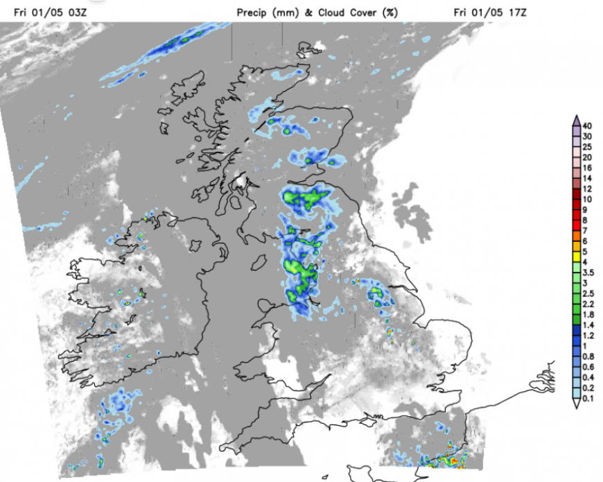
France has thunderstorm warnings for later today and heavy showers, maybe thunderstorms, could move out into the English Channel this evening, perhaps clipping Kent. There might be some lightning strikes to see from the coast but it is getting dark much later now.
"We know people will be wanting to enjoy the good weather, but we ask they do so responsibly...People should avoid lighting outdoor fires and be mindful that one spark can spread causing a large amount of damage. Remember, there’s no such thing as a harmless fire.” Scottish Fire & Rescue
The risk of wildfire spread remains high, even extreme in some parts of the UK and there are pleas before the long weekend for people to take care in the current conditions.
Loading recent activity...