Bank Holiday weekend forecasts are rarely simple. For the early May Bank Holiday weekend, there will be more cloud about and rain seems likely. It won’t be as warm as Friday 1st May, when temperatures will reach the low to mid twenties. Start your long weekend early if you have a chance. Gardeners and growers will welcome this rain, but it is a shame that it has to arrive as many people have some time off.
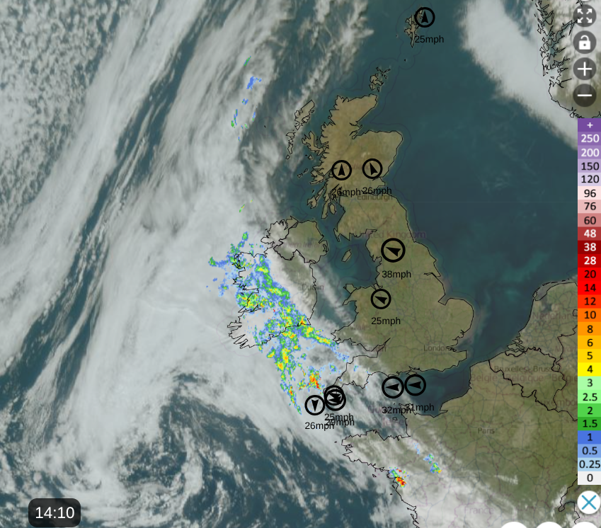
Where to start - high pressure and the change from the west. Under the high pressure there has been a lot of fine, sunny and dry weather. The wind has been noticeable over the past week, often making it feel cooler but balanced by the strong April sunshine. Away to the southwest there is a low pressure which is visible on the satellite image from lunchtime on Thursday and between the high and the low we have brisk winds. There is also a warmer air flow from the south and southeast as the continuing sunshine warms the earth under the clear skies. There is more cloud linked to the low pressure with showery, even thundery rain for Cornwall into Ireland. There is also cloud on a cold front away to the northwest, more to come from these.
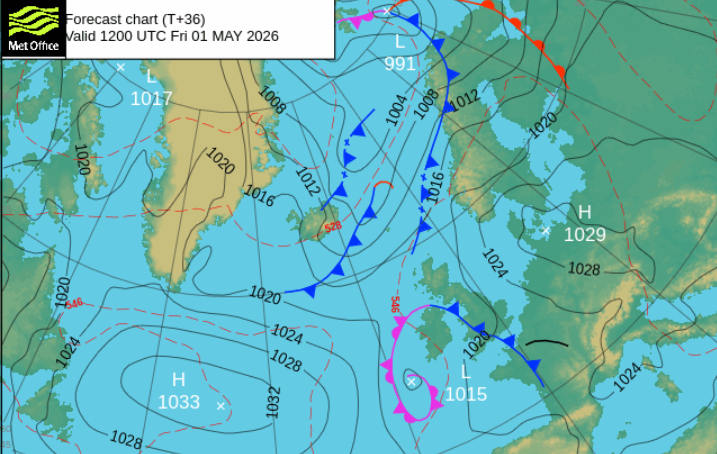
The front in the far northwest will fade and drift towards western Norway. A new cold front will appear from the north and attempt to move over Scotland. By early next week, colder air with origins in the Arctic will have reached the UK, so that will be quite a change by Monday in the north and for all of the UK by Monday night.
Daytime temperatures on Bank Holiday Monday could be around 11 to 16C, although higher in any sheltered sunnier spots in the south. The air will just feel different.
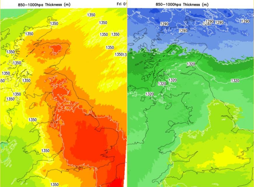
On Friday parts of the UK should see temperatures of 20 to 25 even 26C with glorious sunshine. However, all this cloud in the southwest and northwest will still be edging eastwards, across Ireland. There will be clusters of showery rain, for Northern Ireland and western Britain and the cloud will creep further inland during the day. This will keep the temperatures down as air from the Atlantic begins to reach Ireland. The winds will be lighter on Friday so that will help with how the day feels and the warmth over Britain.
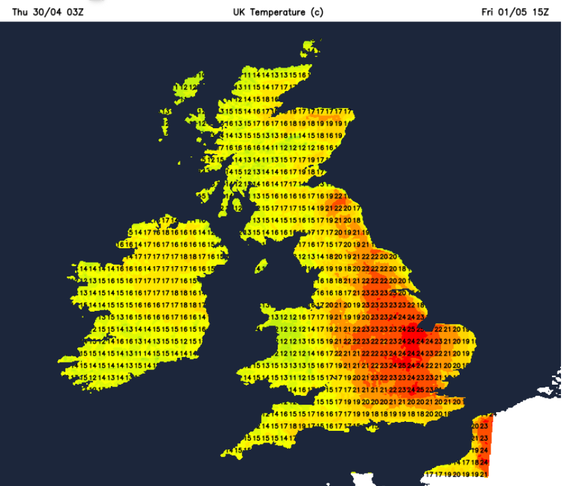
So we have bright sunshine, warmth and dry weather over much of eastern, even central Britain and a more mixed picture further west with rain in places. This is important for Saturday’s weather because as this cloud and rain continues, it almost falls apart and could leave a large clear gap for more sunshine and warmth over England on Saturday. There will be rain approaching from various points but there could be more fine weather to start the weekend.
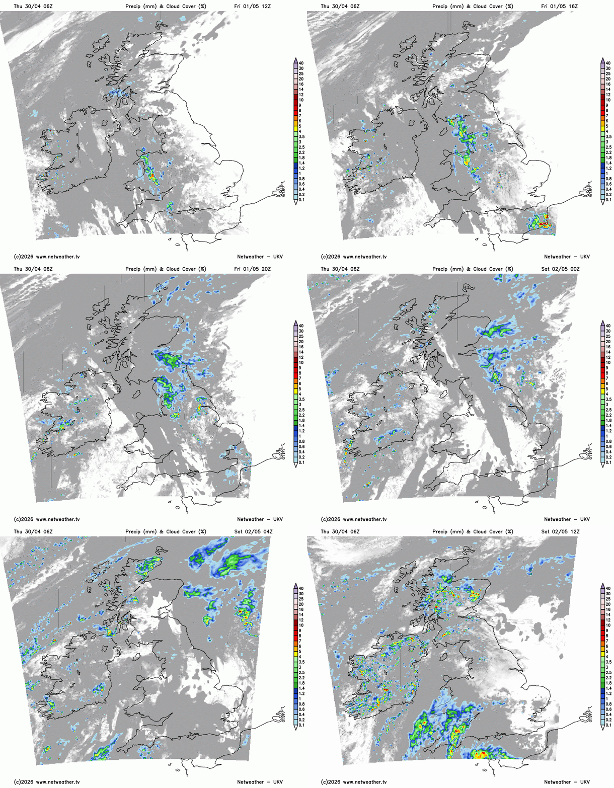
There is a strong signal later on Friday for an area of showers running north south over a central swathe of Britain, perhaps NW England, maybe into the Midlands and Pennines, even SE Scotland. The models vary a lot but just bear this in mind if you are hoping that the fine weather from Friday morning will last, there is this cloud from the west bringing a risk of showery rain. Added to that is the chance of a pulse of heavier rain heading north from France, across the Channel into SE England on Friday evening and night. Kent and Essex look mostly to see some showers but they could move over Suffolk too, or head off over the North Sea.
Saturday
By Saturday morning the rain from Friday should have cleared away but with a southwesterly flow, there will be more cloud and a scattering of showers from the Atlantic. Mostly the winds will be very light although NE England could have a blustery westerly wind but with breaks in the cloud and sunshine.
Northern Ireland and Scotland will see showers but as always mixed with bright or sunny spells. Temperatures will vary from 12 to 17C depending on the rain or sunshine. Northern Ireland could have heavy downpours by lunchtime. The UKV model shows rain from the southwest, pushing over Wales and the West Country with some heavier pulses embedded by lunchtime. This spreads into the Midlands, Yorkshire and Manchester as clusters of heavy showers move across the Channel into southern England.
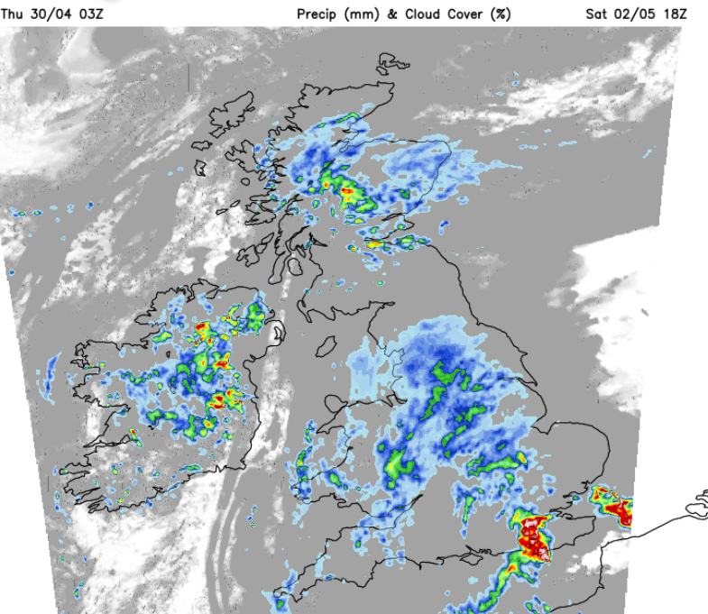
The GFS model shows slower progress for the rain from the southwest, the ECM takes the focus of the rain up through central southern England and towards the Humber on Saturday night. There is the risk of rain from the south including heavy downpours but the track and timings have uncertainty. All of this will affect the temperatures of course. If the sun stays out for longer with the warm air mass still around from Friday, then the temperatures in England could reach 19 to 22C, even up to 23C for London by early afternoon. The cloud will increase in the afternoon.
This rain over England could turn heavy and persistent later on Saturday with a slight risk of thunder and it could feel rather humid. A real change from the recent dry spell. With only light winds any heavy showers will be slow moving on Saturday evening over England.
Sunday
There will be a cooler start for Scotland with a northeasterly wind perhaps even a touch of frost for the Northern Isles. A low centre will form over Britain associated with the rain from Saturday which will continue for Sunday morning mostly over northern England with showers over Wales. The GFS model keeps a distinct frontal band of rain edging northwards slowly over the UK on Sunday followed by a zone of showers particularly for the Midlands and inland Wales. Any showers over Northern Ireland and Scotland look more scattered about again there will be downpours with a good deal of cloud, maybe drier and brighter for northern Scotland by day. So more uncertainty about the positioning of the rainband on Sunday. There will be a cool breeze off the North Sea from the northeast and temperatures of 11 to 13C. Elsewhere temperatures will be 14 to 19C
Bank Holiday Monday
The gradual change on Monday will be this shift to the cooler northerly flow. Many places will start off fair and dry on Monday still with a good deal of cloud and light winds. Early on Monday, a front will bring a band of showery rain into the far north of Scotland. This band will work southwards followed by the colder air and a northwesterly wind. Ahead of this there will be a lot of cloud with a few bright spells and a scattering of showers. So another forecast where it is hard to pin down any detail. Temperatures should be 11 to 16C but perhaps higher in any sunshine. The Bank Holiday weekend will end with zones of showers across the UK but other areas, bright and dry but it will be noticeably colder in the north by the end of Monday.
Loading recent activity...