The weather can still be notoriously fickle in early April, as it is a transitional period where the atmosphere is trying to balance the still lingering cold air from winter over higher latitudes with the growing warmth over mid-latitudes of the northern hemisphere, as the days become longer and the sun gets higher in the sky each day. This creates a "battleground" scenario between competing air masses, resulting in rapid shifts from warm, sunny days to sudden, cold, stormy and even wintry weather.
Spring is a transitional period from winter to summer, but it’s often not a smooth transition, as the UK often sits between colder air to the north, milder air from the south and moist Atlantic air pushing in from the west. The boundaries between these air masses can shift rapidly, leading to sharp contrasts in temperature from one day to the next. This can mean one day can be warm and sunny, but the next maybe cold and showery, with wintry precipitation still possible over higher ground in the north and less often to lower levels. It snowed where I live in Surrey on the morning of April Fool’s Day 4 years ago.
The jet stream can still be strong in early April, with the contrast in competing air masses, with deep depressions still possible affecting the UK, as we’ll see over the Easter Weekend with Storm Dave.
It looks likely we will go through a roller coaster of weather through early April, fitting with what I have described as the often fickle nature of UK weather this time of year. We will see swings from warm to cool to end the week, to wet and windy over the Easter Weekend then a brief burst of warmth in the south early next week before back to cool and unsettled thereafter, perhaps with a risk of wet and windy conditions returning too later next week.
Tuesday, the last day of March, saw 20C reached at Pershore in Worcestershire, it’s turning cooler to end the week, more especially in the north where temperatures will struggle to make the teens and with a risk of overnight frost.
But it’s all change over the weekend, as an explosively deepening low, named Storm Dave by the Met Office this morning, passes over the north of Ireland then northern Scotland on Saturday, bringing gales across the north. Easter Sunday’s looking chilly and blustery with sunshine and showers, which could be wintry over high ground in the north, perhaps hail in showers elsewhere. Cold night to follow, with risk of frost, so gardeners beware.
Storm Dave cross the north on Saturday, followed by a cool, showery & blustery day on Sunday
Easter Monday looks calmer, drier and sunnier after a widespread cold and frosty start, with high pressure building in bringing settled conditions for most, though it will turn increasingly windy towards the west, as a southerly wind strengthens here.
Easter Monday looks dry and settled, as high pressure builds in, though turning windier in the west
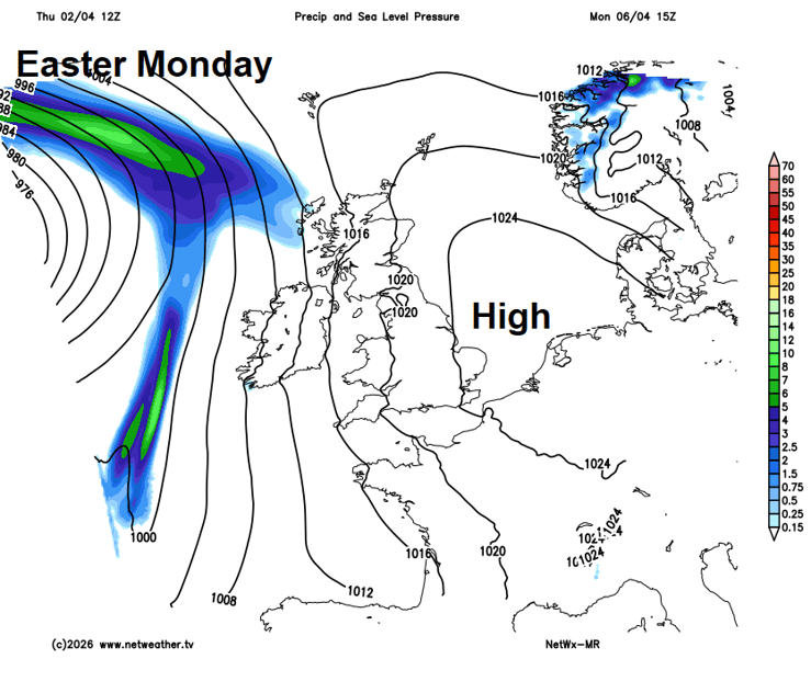
Tuesday looks like it will turn briefly warm across the south, as low pressure stalling to the west and southwest draws a warm southerly flow sourced from the Mediterranean. It looks like it will be cloudier with showery rain across the north and west, but across central, southern and eastern England we may see some warm sunshine with temperatures currently forecast to reach 20C or a degree or two higher. Perhaps thundery showers pushing north across England later in the day, as the plume of warm air breaks down from the west.
Potentially warm across parts of England on Tuesday, thanks to warm southerly wind
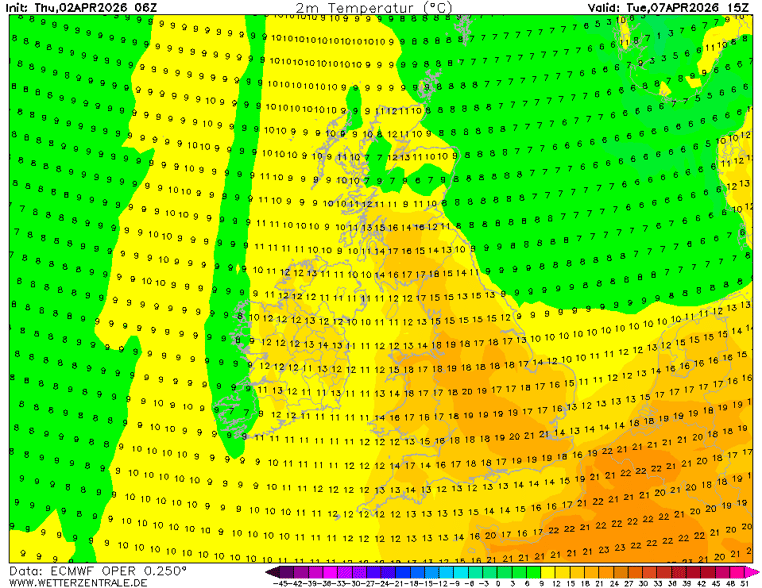
The brief plume of warm air looks to be swept away east by Wednesday, as an Atlantic upper longwave trough pushes in from the west from the North Atlantic along with a strengthening jet stream - which could bring another deep low by the end of the week, but certainly it will become unsettled, windier and cooler, with westerly or southwesterly winds bringing showers or longer spells of rain across all parts.
Turning more unsettled from the west from the middle of next week
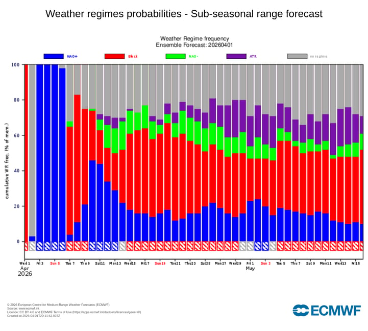
These unsettled westerlies perhaps continuing next weekend and into the following week, but there are signs that blocking high pressure building over Scandinavia may extend its influence towards the UK by the middle of the month, with support for this from ECMWF ensembles, as shown in the regimes below - with blocking (red) forecast as the most likely regime from mid-April.
56 minutes ago, snowspotter said: Wow - that’s what I call a bold statement ! It's the same statements I read every single year in this forum. This timeframe holds the most interest basing on some background signals. 9 times out of 10, it turns...
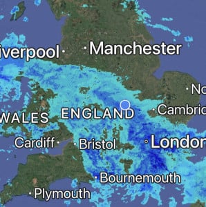
Absolutely hammering it down here, it’s so loud on the roof I can’t get to sleep 😴 Will be some big puddles in the morning, so many drains are blocked with leaves in the village 🥹
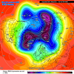
Good improvements for scandi high gefs mean
23 minutes ago, damianslaw said: Saturday morning could produce a new low for the season. Cold ridge and light winds recipe for notable chill. Could be a while before we see temperatures that low again?!

2 hours ago, Dennis said: there is heading in a new Polarvortex warming Today's ECM chart has strengthened the zonal wind mean.
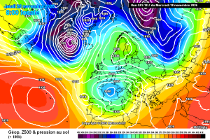
This is a pretty decent chart for late nov in a strong Nino, the Atlantic does get in briefly afterwards, but the pattern seems to amplify again. Just a casual 940 Hebrides low. Hello darkness and all that. Then, quite randomly, it’s back to...