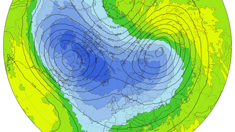
There has been talk about late sudden stratospheric warming events ruining spring in recent years. This is mainly said from the perspective of people who often favour cold and snowy weather in winter, but prefer spring as well as summer to be predominantly warm, dry and sunny. It references the tendency for some sudden stratospheric warming events to trigger high latitude blocking to the north of Britain, with low pressure systems tracking much further south than is typical, and a greater chance of cold air masses coming in from the north and/or east.
One example of where this did happen was in 2018, when the end of February and March saw two exceptionally cold easterly blasts, which brought falling and lying snow even to places that rarely see it, such as the peninsula of south-west England. I was in Exeter at the time and had 17cm level snow on 1 March 2018, and 10cm level snow on 18 March 2018. In between those easterly blasts, the weather was often cloudy and wet, because of the southerly tracking lows plus some milder air getting into their circulation. This predominantly dull wet weather continued for much of April. However, the pattern abruptly shifted into May, which was a very warm and sunny month for most of the country. The warmest and sunniest weather of May 2018 also coincided with the Bank Holidays.
But not all sudden stratospheric warmings have such dramatic impacts. We had a late sudden stratospheric warming event in 2025, and the spring went on to be, averaged over the UK, the warmest and sunniest on record, just edging out the exceptionally sunny "lockdown spring" of 2020. There was a spell of northerlies in the second week of March 2025, which for a time looked like it could bring in a more extended cold spell with high latitude blocking. But it didn't happen, and high pressure returned to Britain after the northerlies.
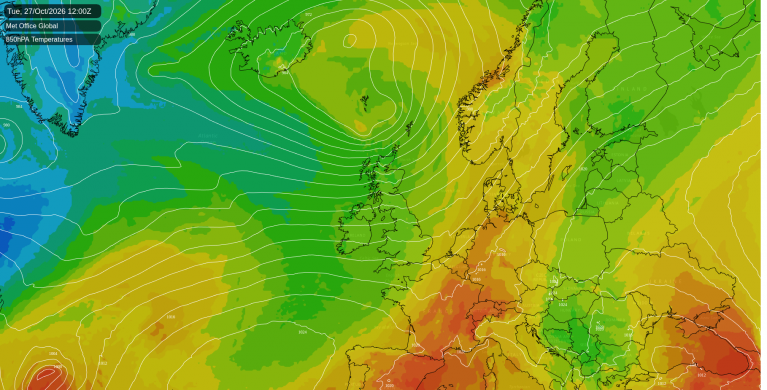
Next week looks to me like it could well end up being similar to the northerly in the second week of March 2025. It is looking highly likely that there will be a northerly blast next week, centred on Wednesday and Thursday, when there will initially be a north-westerly, and then a northerly. However, it is also looking likely that high pressure will build in behind it for next weekend, and so predominantly dry sunny weather and recovering temperatures is looking the most likely outcome afterwards.
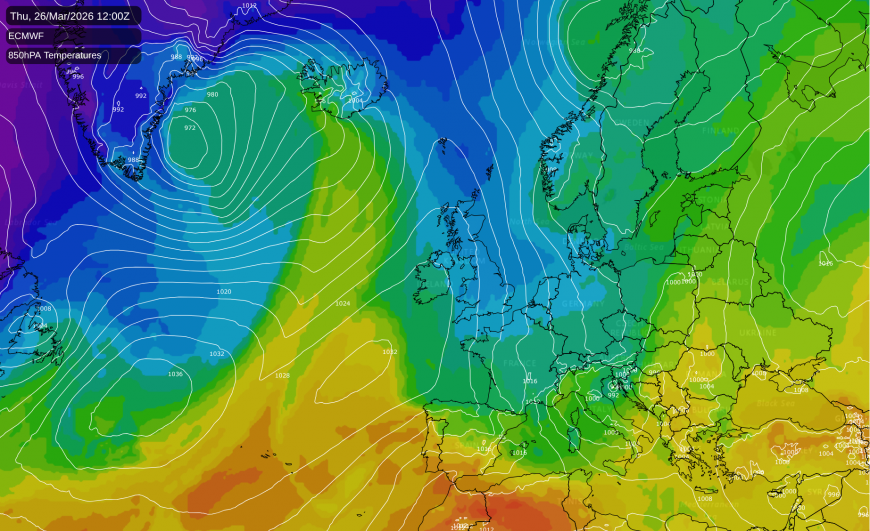
The northerly looks likely to bring snow showers to low levels for a time in Scotland, and possibly also the north of England, and places such as Aberdeen could well wake up to a covering of snow next Thursday morning. For other regions, there could be some sleet or snow at low levels in the heavier showers, but it looks like being a predominantly hill snow event, with rain predominantly falling near sea level. Hail could well be widespread. There is the possibility of some damaging frosts afterwards, given the recent warm weather which has seen advanced plant growth.
However, none of this is particularly unusual at this time of year, and temperatures look likely to temporarily fall just a couple of degrees below the long-term average for most of us. For most of the UK, the 1991-2020 long-term average minimum temperature for March is between 2 and 4C, indicating that even in the most recent 30-year averaging period, frost can be quite widespread if temperatures fall just a little below average. This is especially the case in clear and calm conditions which tend to see high diurnal temperature ranges, meaning warm days but also cold and potentially frosty nights.
Away from lowland parts of southern England, it used to be very unusual in most parts of the UK to go through a spring quarter without seeing any sleet or snow falling, as recently as the 1990s and 2000s. For example, the warm spring of 1990 had widespread snow showers in early April, and the warm spring of 1997 had widespread snow showers on 6 May. It has become more common in recent years, and I suggest that this is mainly because some of the more marginal setups that used to bring wet snow in spring are now tending to deliver rain at low levels, with hill snow. The northerly in the second week of March 2025 was a good example, and I recall other examples in mid-March and early April 2019, and early March and mid-April 2024 for instance.
It is still possible to get widespread snow at low levels in April, even in the south of England, as many of us saw starkly around 5-6 and 11-12 April 2021. There was widespread snow in the second week of March 2023, as well as the exceptional snowy spells of March 2018. However, in recent years it has been becoming less common.
Loading recent activity...