Since mid-January 2026, the forecast models have often been showing a possible cold snowy spell via easterly winds, associated with the Scandinavian blocking high. In each case, the end result has been a south-easterly airflow over Britain, sending the cold air from Russia to the north of Britain, while giving most of lowland Britain a lot of rain, near average to cold daytime temperatures and mild nights. There has, however, been a lot of snow in the Scottish Highlands recently, with south-easterly winds pushing the snow into large drifts on northwest-facing slopes.
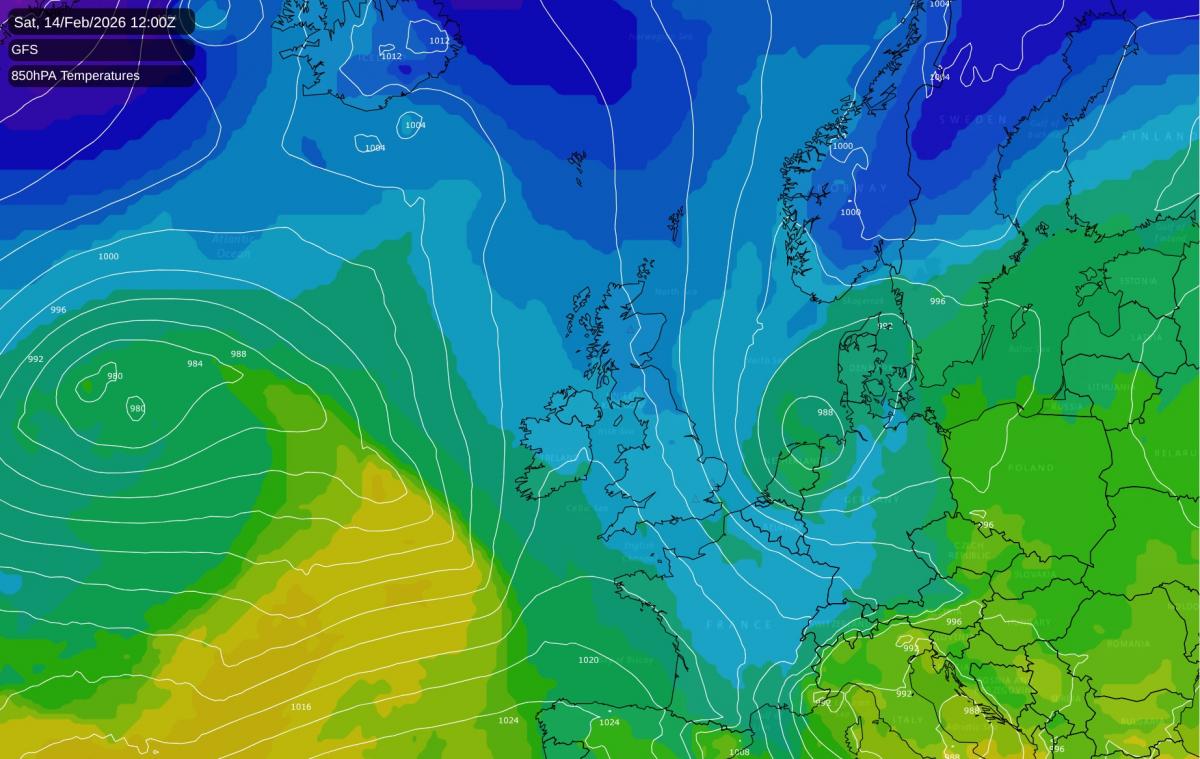
At present, the forecast models are now going for a northerly in about a week's time, followed by cold and potentially snowy weather as low pressure systems and fronts push against the cold air mass, bringing snowfalls on the northern and eastern flanks. The current model outputs at 7-10 days ahead (14-17 February) have similarities with the first half of February 2009. Although the February 2009 cold spell started with an easterly on the 2nd which brought the London area its most substantial snowfall since February 1991, from the 5th to 13th the emphasis was on northerly winds and low pressure systems and fronts pushing into the Arctic air mass.
Again, this setup is not guaranteed to pan out as is currently modelled. In particular, the temperatures that are being modelled currently look marginal for snow from the English Midlands northwards, and probably conducive to cold rain further south. if the models shift towards a more northerly tracking jet stream and tone down the initial northerly, then this would tip the outcome towards mostly rain at low levels, with snow on high ground.
With us moving into late February, there is also a likelihood that if temperatures are marginal for snow at low levels, if the sun subsequently gets out then the snow will tend to thaw quickly in the sun. The second half of February 2010 was a stark example of this over much of the country, when most areas had frequent snow but it tended not to lie for long. Snow in the second half of February doesn't necessarily melt quickly in sunshine if temperatures stay very low - the "Beast from the East" on 27/28 February 2018 being a stark example - but we're not looking at an air mass anywhere near that cold affecting the British Isles.
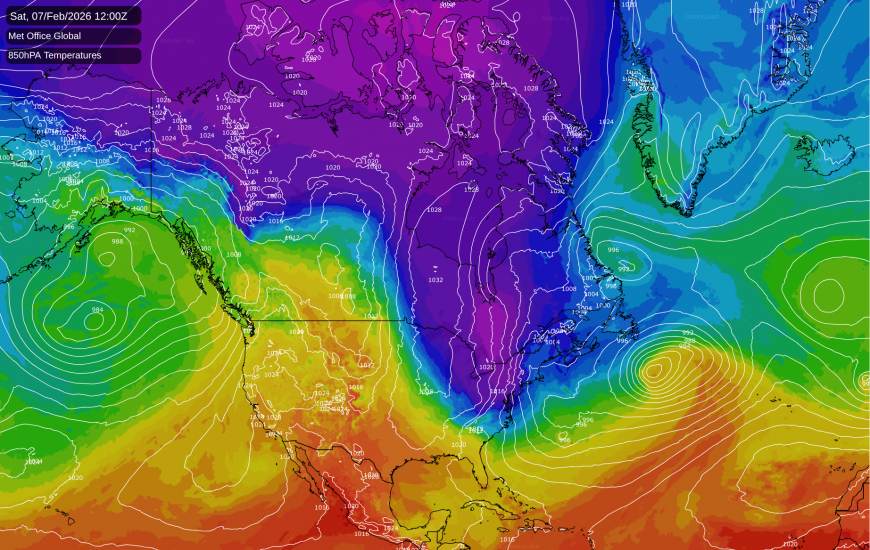
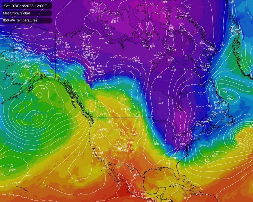
Currently there is still a very cold air mass over the north-east of North America, but the rest of the country has seen mild conditions over the west spread eastwards into central parts.
During the coming week, it looks likely that this milder air will push into the north-east as well, leaving all of North America with near average or mild temperatures, with most of the country, especially central parts, tending to be considerably warmer than average. It will still be cold enough for snow at times in the north-east, but nothing like as cold as it has often been during the past month or so.
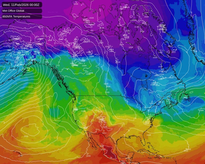
This, in turn, will reduce the input of cold air into the North Atlantic Ocean. In recent times the input of intense cold air masses into the North Atlantic has been helping to power up the jet stream, which may have contributed to the failure of deep cold air over Russia to make it all the way across to the British Isles. With less cold air coming into the North Atlantic, this increases the likelihood of the jet stream weakening, which ties in well with the current model outputs suggesting potential for a cold and wintry spell over Britain.
An ongoing sudden stratospheric warming event may also tip the balance of probabilities towards cold and potentially snowy weather in Britain through the second half of February and into March. Thus, there is some strong evidence to suggest that the current forecast model outputs may be more likely to verify than was the case with the easterlies that were modelled earlier. The caveat is that, as noted earlier, the setup that is forecast for 7-10 days' time does look marginal for snow at low levels, and probably not quite cold enough in the south.
Loading recent activity...