A dry spring has left eastern England and Europe parched. In a pattern reminiscent of 2022, this has primed the region for heatwaves, deepening the UK's marked northwest-southeast weather divide.
Summer 2025 is developing in a way reminiscent of summer 2022. It is proving difficult to get much in the way of substantial rainfall into the eastern side of England, even when the weather turns unsettled with low pressure close by. Most of eastern England, and also much of western Europe generally, has had a long run of drier than average months starting in February or March, which is resulting in parched ground and “priming” these regions for a higher than average chance of substantial heatwaves. But we have been seeing an enhanced northwest-southeast split, again much as we did in 2022, with most of northern and especially western Britain being cloudier, wetter and less prone to notable heatwaves. June 2025 was another dry month in eastern England but, in contrast, a very wet month in Cumbria and north Lancashire, and a dull one in western Scotland.
June 2025 was a remarkably warm month in the east of England. The Central England Temperature of 17.0C was about level with 2023 and 1976, which were the hottest Junes in central England since 1846, but this masks a marked west-east split, with western parts of England coming out cooler than 2023 and 1976, and eastern parts coming out hotter.
Relative to the 1991-2020 long-term average, many sites in eastern England were 4 to 5C warmer than average by day, and around 3C warmer than average by night. Even though the positive temperature anomaly was higher by day than by night, the night time minima were also notably high - generally in summer, maximum temperatures deviate from normal more than minimum temperatures, and many other months that had maximum temperatures 4-5C above the long-term average had minimum temperatures just 1-2C above. Some high minima, especially near the end of June when a number of sites in the Midlands and north of England failed to drop below 20C on the night of the 27th/28th, contributed to many people without air conditioning being unable to cool buildings down substantially at night.
I see it as unlikely that we will see another 40C in Britain this year, as a lot of things would have to fall into place synoptically for that to happen, but the chances of it are higher this year than during the summers of 2023 and 2024, and the chances of us getting into the mid-30s Celsius at some point this summer are quite high.
During the next few days, cooler air will spread in from the north-west, covering not just Britain but also France and the northern half of Spain and Portugal. However, it will remain hot in the south of Spain and Portugal, where temperatures will widely be in the mid to high 30s Celsius for much of the coming week. Much of France will be on the cool side through next Monday and Tuesday with highs of around 20C in the north and east of France, though up to around 25C in the south-west.
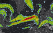
Sunday could well produce some significant rainfall in parts of eastern England, with some persistent rain for a time and then sunshine and showers, where some of the showers may be heavy and thundery. However, showers by nature are hit and miss, so not everywhere will catch a shower. There will be some more showers around today, these mainly in the west, and on Monday, these mainly in eastern Scotland.
But by the middle of next week, the north-westerlies will have run out of steam and we will return to the northwest-southeast split that has been a recurring theme of the summer so far. High pressure will build into western Europe, often extending into the south and east of Britain, but with low pressure often close to the north and west of both Scotland and Northern Ireland.
It is not currently forecast to get exceptionally hot, with maximum temperatures mostly rising into the mid to high 20s Celsius through next Thursday and Friday over a larger part of England. But hotter weather is forecast to establish again over more southern parts of western Europe, with temperatures widely into the mid-30s Celsius in France. This will leave Britain quite prone to the occasional burst of notable heat, especially in the east of England, during the second half of July, should we pick up a southerly flow pulling this hot air in from France at some stage.
The forecast models have, however, currently backed down from predictions of monster heatwaves with temperatures widely into the low 40s Celsius in France and touching 40C in parts of England around 12-15 July. Temperatures in these regions, while still hot by most standards, are now generally forecast to be around 5-10C lower than those figures. It now looks probable that any really exceptional heat will not set in until later in the month.
Loading recent activity...