A brief spell of unsettled, potentially stormy weather is set to interrupt our largely dry spring before sunshine and warmth return. We'll also explore recent Arctic and Antarctic developments.
The start of the weekend brought a familiar picture for this spring so far, with clear blue skies and sunshine for a large majority of the UK, with exceptions being mainly confined to north-west Scotland and the far west of Northern Ireland.
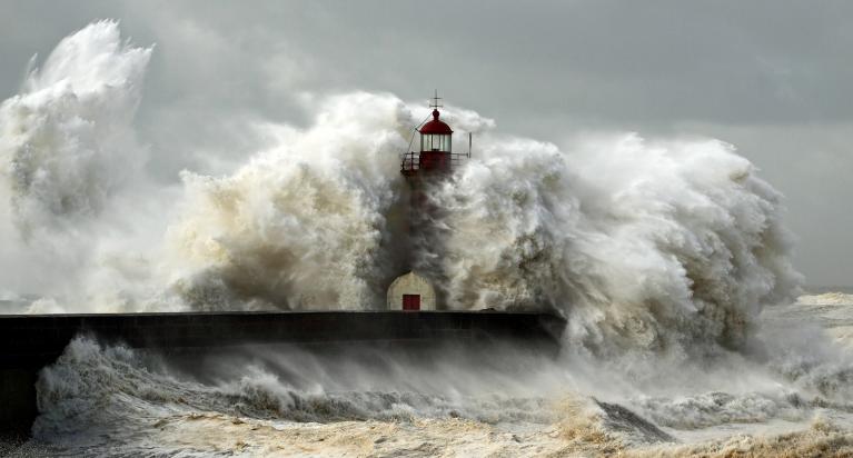
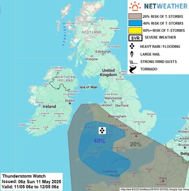
This is set to change temporarily for some of us through the next couple of days though, with low pressure briefly settling close to south-western Britain and bringing cloudier conditions with some scattered showers and thunderstorms. However, these look set to be largely confined to Wales and south-western and central southern England, though there is a possibility of them extending further north and east for a time on Monday.
A thunderstorm watch has been issued for Sunday and overnight into Monday
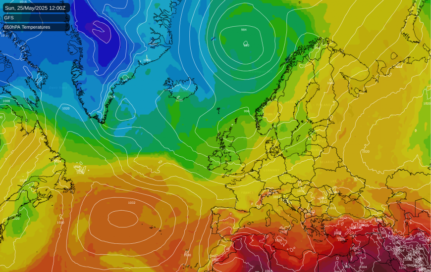
After that, there is high confidence that the low will sink back southwards, allowing high pressure to rebuild from the north and continuing the predominantly dry and sunny theme of the spring so far. With high pressure situated further east than we saw last week, although there may still be some cloud coming in off the North Sea at times via a slight northerly or north-easterly airflow, the chances are that much of eastern England will be sunnier than they were last week, when North Sea cloud often proved persistent in some regions. This weekend will also mark a shift to warmer weather, which is expected to continue next week as well. Away from coastal fringes, maximum temperatures into the low 20s Celsius are forecast to be widespread during the coming week. As is not uncommon at this time of year when the prevailing westerlies tend to be at their weakest, some of the highest temperatures will often be found in western Scotland.
While many of us have been enjoying the fine weather of recent weeks, there are growing concerns about water shortages, especially in northern and eastern regions that missed out on most of the rain that affected some areas in late March and around the Easter weekend. The European ECMWF 42-day model outlook has quite a strong signal for low pressure dominating the weather during the last week of May and into early June. This is also indicated by the American GFS model, where the majority of runs have our high pressure moving away eastwards, allowing low pressure to come in and to become centred especially to the west and south-west of Britain.
But there are no guarantees of this, as the medium and long range models have gone for low pressure becoming dominant at various points during this spring so far. On each occasion, when the low pressure has materialised, it has proved to be just a short-lived blip in a period otherwise dominated by high pressure. This weekend is a good example - the low pressure coming in from the south through today and tomorrow could have brought about a breakdown to a wetter and more unsettled spell of weather, but instead, it is set to last for just two or three days, followed by a return to high pressure.
The polar regions have not been a big talking point during the last couple of months, and a possible reason for this is that conditions have been less exceptional there recently than they were during late winter and early spring. February 2025 in particular was exceptionally warm over most of the Arctic, but recently temperatures have been just a little above the long-term normal.
As the National Snow and Ice Data Centre has reported, the Arctic sea ice extent was running at record lows through a large part of February and March, but through April, when we would normally see the melt season get underway around the edges of the Arctic Ocean, sea ice extent has taken longer than usual to start declining, and for much of the month it remained largely constant. As a result, during the past fortnight, the Arctic sea ice extent has ended up close to the average for recent years, though still a fair way below the 1981-2010 long-term average. High pressure dominated over the Arctic Ocean for much of the month with relatively limited inputs of warmer air from the south into the high Arctic.
However, temperatures in the Arctic have increased into early May, with the Danish Meteorological Institute’s graphs of temperatures above 80N showing a shift to well above-average temperatures there in early May, following a spell of nearer average temperatures in April. Temperatures are set to remain mostly above normal for much of the Arctic during the coming weeks, with winds often coming in from northern Eurasia, pointing to potential for the sea ice to the north of Eurasia to be transported poleward, potentially leading to an early start to the melt season in that region.
It is a similar story around Antarctica, where Antarctic sea ice was at or near record lows for much of February and the first half of March. The sea ice has recovered at a faster than normal rate during late March and April, taking the current Antarctic sea ice extent close to recent averages. However, it must be noted that this is again still considerably below the 1981-2010 average, and not by enough to suggest a reversal of the drop-off in Antarctic sea ice that we saw starting in 2015.
Loading recent activity...