A mixed week with showers and sunny spells, a mid week low bringing much-needed rain and blustery conditions.
It’s all about low pressures in the next few days. We’ve started the week with one to the northwest, and more will swing over Wales and England by the middle of the week. Wednesday might be wet and windy for southern Britain. These lows bring bands of cloud and rain, or blustery showers with sunny spells in between. Friday looks more settled.
It is the start of meteorological autumn, the beginning of September, October and November as the autumn months for statistical climate data. It is also the day when the new list of storm names is published. We are in the Western Group comprising the UK Met Office, Met Éireann and the Dutch KNMI. We’ll have to wait and see when Storm Amy appears, and how many others from the list this time.
There will be some much-needed rain this week but it will be over different parts of the UK, often showery and not enough to offset the months of dry weather. Temperatures will be around average, and it will feel warm in any sunshine. It’s just not the heat that we experienced earlier in August, and it certainly feels cooler as it gets dark.
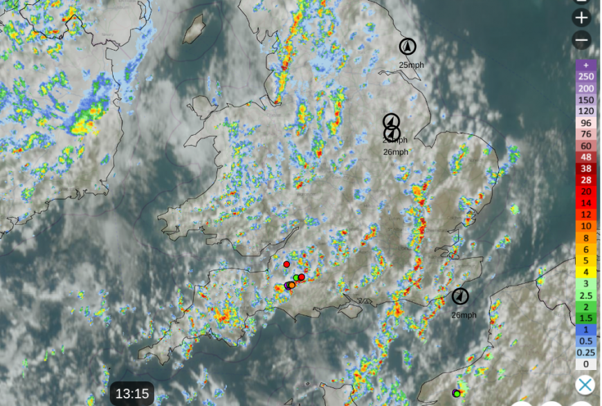
The low pressure in the northwest has been throwing bands of rain across the UK during Monday morning. Away in the southeast, there has been warm sunshine with less cloud for East Anglia but clusters of showers have made their way towards London with lines from the Channel Islands and over the southern counties of England. The risk of thunder continues here this afternoon. The lightning strikes are visible on the Netweather Radar. The day remains mixed with a scattering of showers, some places hardly seeing any but other areas receiving some moderate downpours, even heavy ones in the south. In between will be the bright or sunny spells with temperatures of 17 to 22C. Northern Ireland and Scotland will be blustery with fresh southerly winds along the west coast of Scotland.
Northern Scotland will be windy tonight as the winds ease elsewhere in the UK. There will be clearing skies with a lot of dry weather for England until a band of heavier showers. Temperatures will be around 11 or 12C
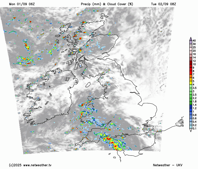
A good part of England will start off fine and sunny, but there are two regions of showers moving in from the west. The first from western Scotland, moving inland with a scattering for Northern Ireland in the day. There will be bright spells in between and temperatures around 17 to 20C. Clusters of heavy showers will already be over SW Britain on Tuesday morning with fresh SW winds. They will work their way eastwards over Wales, the Midlands with the risk of thundery bursts for southern England. There could be some heavy downpours in these as they reach London and the Home Counties in the afternoon. There will be more cloud linked to an occluded front for southern Britain and a brisk wind along Channel coasts with strong winds through the Straits of Dover by mid-afternoon.
The weather will clear during Tuesday night, with lighter winds to end the day. A few showers will run from Cumbria into southern Scotland but eyes will turn to the Atlantic for the next lively low pressure.
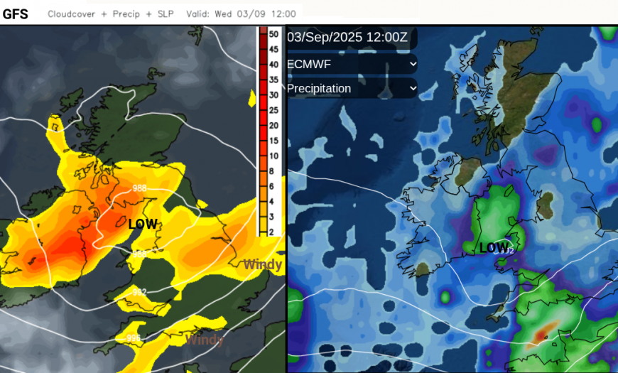
There has been some variation on how far north this moves, and so, where will see the rain and blustery winds.
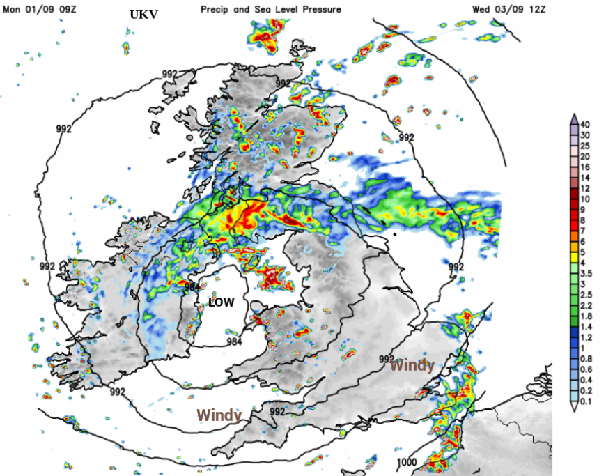
As the new low centre moves in, there will be frontal rain but with some hefty bursts embedded in it. As this moves northwards through Britain, there will be sunnier skies with heavy, even thundery showers behind it. It looks windy for England and Wales but again, this will depend on how the low centre develops.
Loading recent activity...