


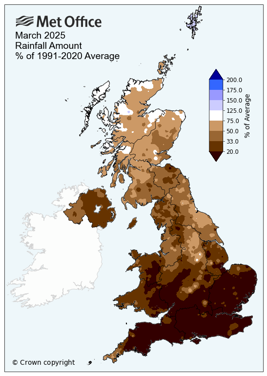
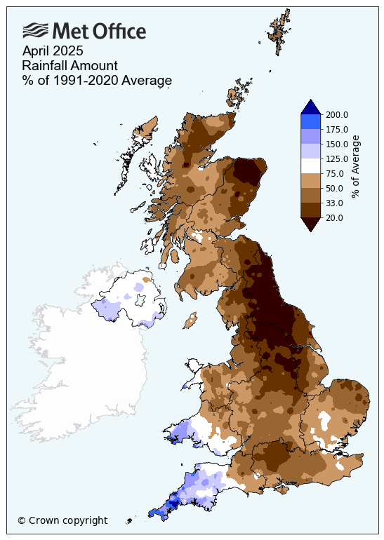
Chances of rain have been very few and far between this spring for large parts of the UK and Ireland. March was dry for most, with only Scotland recording more than half of the average rainfall and only Shetland recording above average rainfall. In April, SW England, SW Wales and N. Ireland were the only areas of the UK to see above average rainfall - with Cornwall the wettest county with 169% of the average. Many areas last month saw well below average rainfall, with parts of NE England only seeing 5mm.
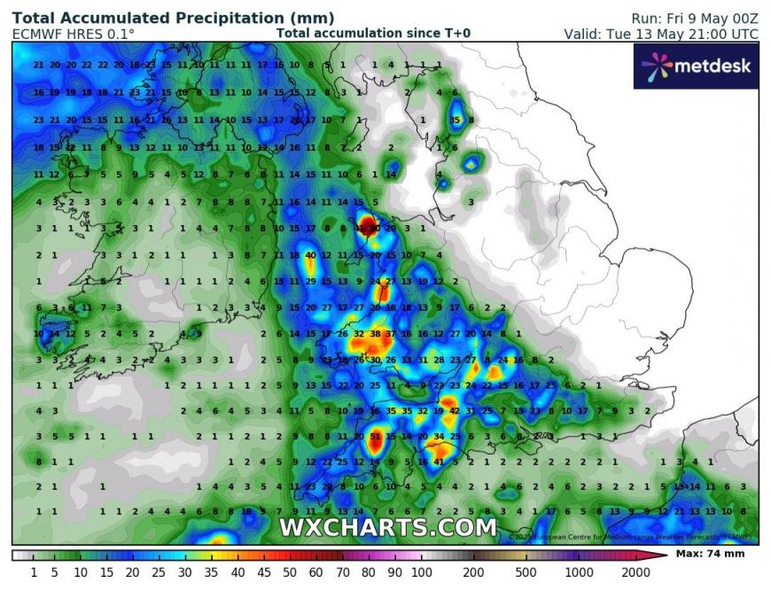
May has started off on a dry note for most too, however, there are chances of some rain later this weekend and into early next week, but this chance looks to be confined to southern areas of England, more particularly the southwest, along with Wales, Rep. of Ireland and N. Ireland. Like last month, parts of SW England and south Wales could see the greatest chance of rainfall between Sunday and Wednesday, before it turns drier again.
Rainfall accumulations now until Wednesday, mostly from showers or thunderstorms.
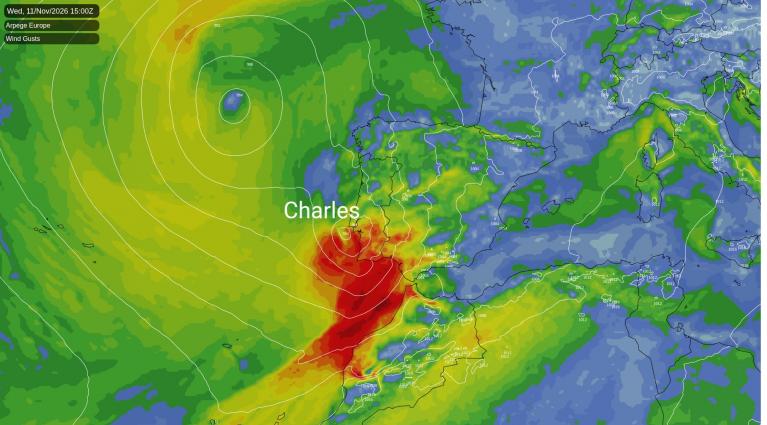
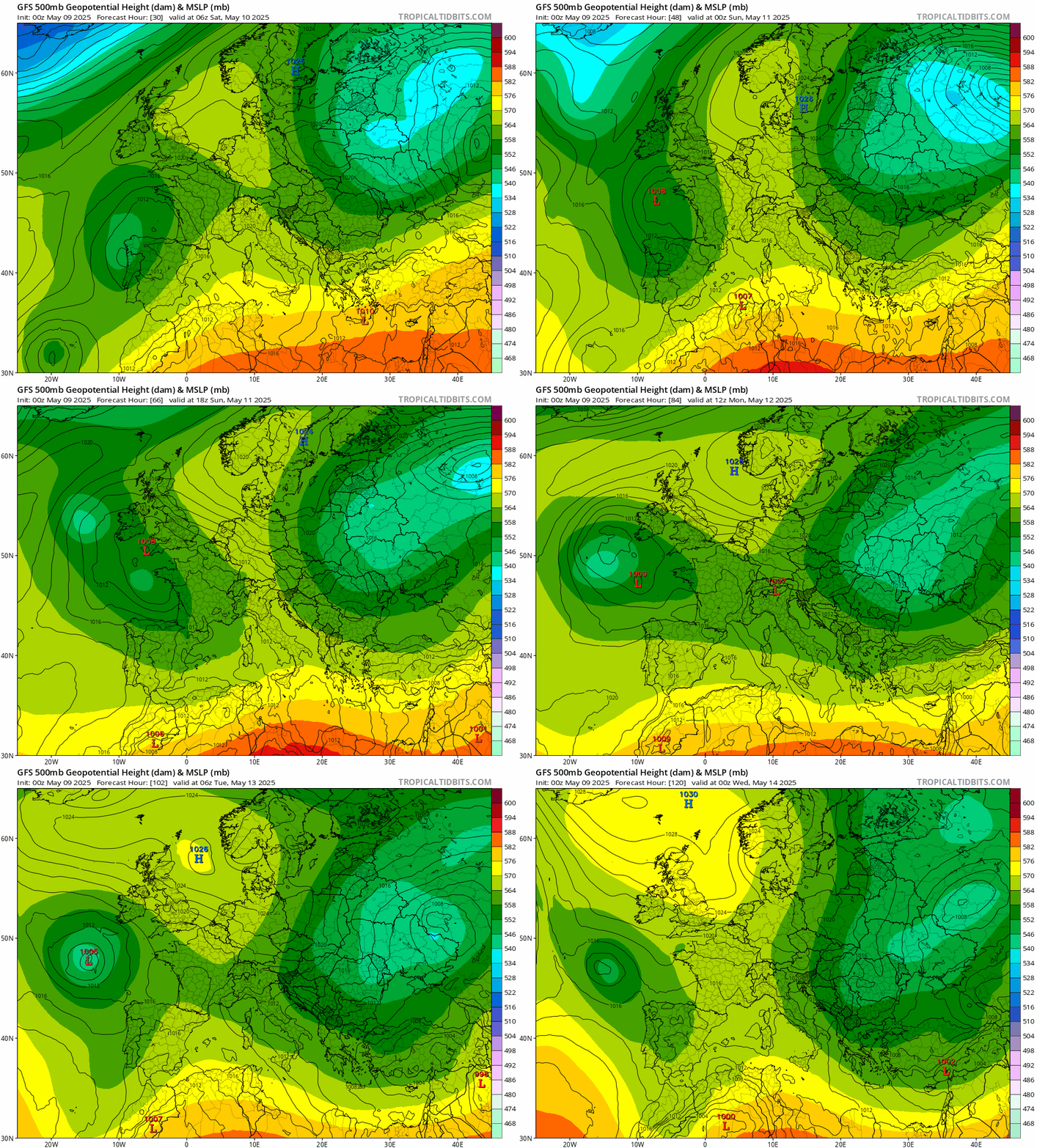
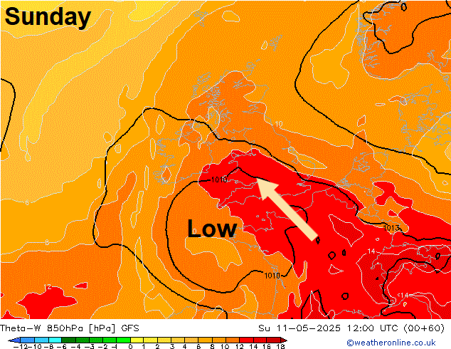
A cut-off upper level low looks to form over NW Spain on Saturday, this then looks to drift north over the Bay of Biscay towards southwest UK and southern Ireland over the weekend, with a surface area of low pressure moving north in tandem. As this occurs, it will pull north a plume of increasingly warm and moist air northwards in across England and Wales by Monday, with a corresponding increase in temperatures at lower levels spreading north from France.
Upper and surface low over NW Spain tomorrow drifts north to the UK, bringing showers and storms to the SW and south Sunday-Tuesday, before the low retreats and pressure builds by mid-week
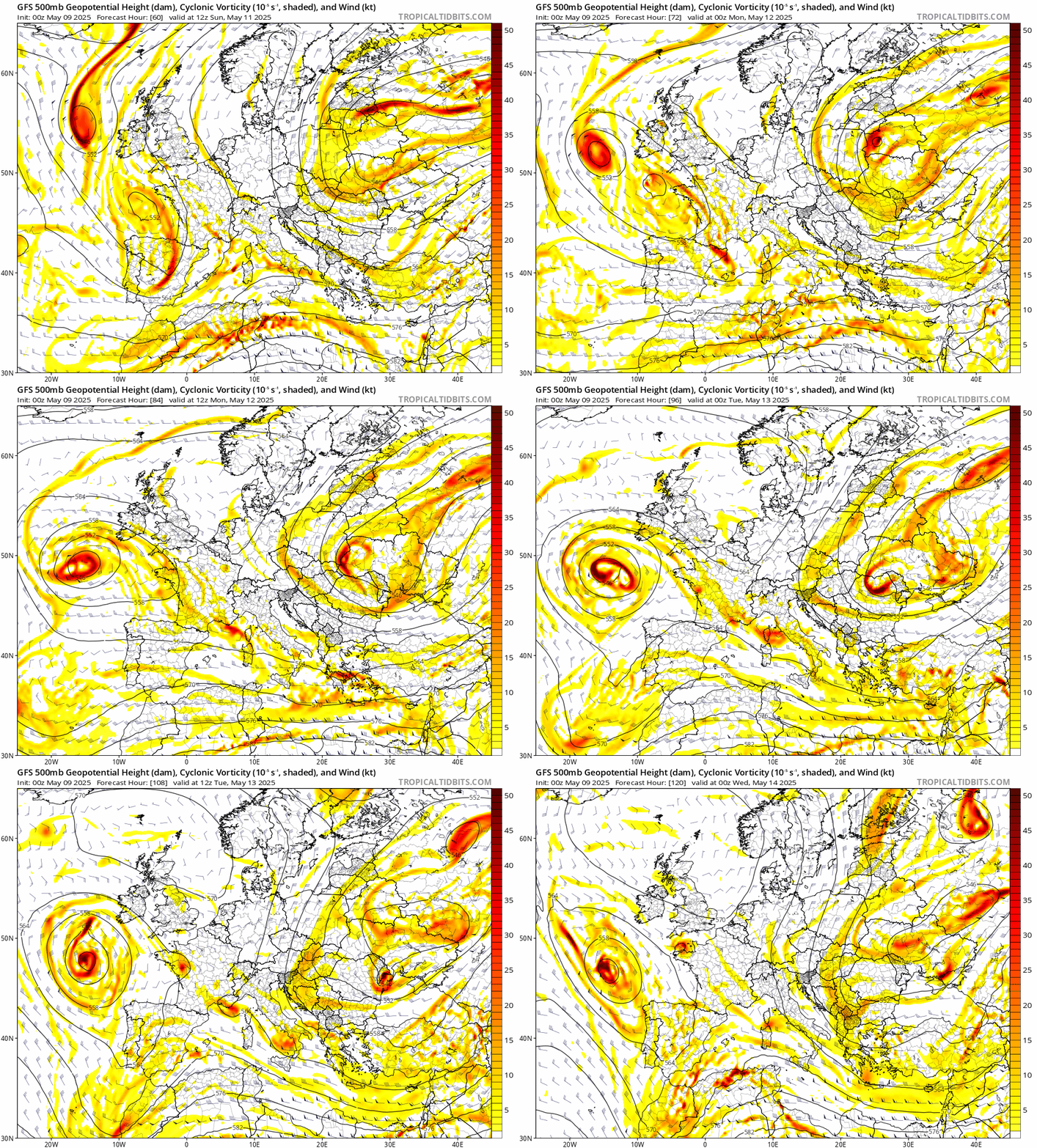
Cooling aloft atop the warming and moistening low to mid-levels towards the southwest, with the approach of the upper low later this weekend will steepen lapse rates across SW England and south Wales initially on Sunday. This will generate increasing CAPE (Convectively Available Potential Energy). This combined with lift of warm moist air from falling pressure / heights, lobes of enhanced vorticity and occluded front wrapping around approaching low - will likely generate an area of heavy showers and thunderstorms that will move northwest on the northern side of the upper low across SW England, Wales and across the Irish Sea to Ireland and N. Ireland.
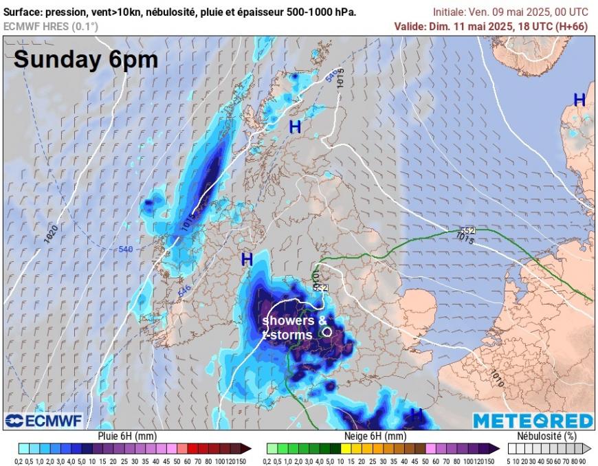
Increasingly warm & moist air spreading north by Sunday, pulled up by low pressure moving north over the Bay of Biscay
Upper low and areas of enhanced vorticity moving north from Sunday to affect the SW and S of the UK, increasing lift of warm moist air spreading north and generating showers or storms
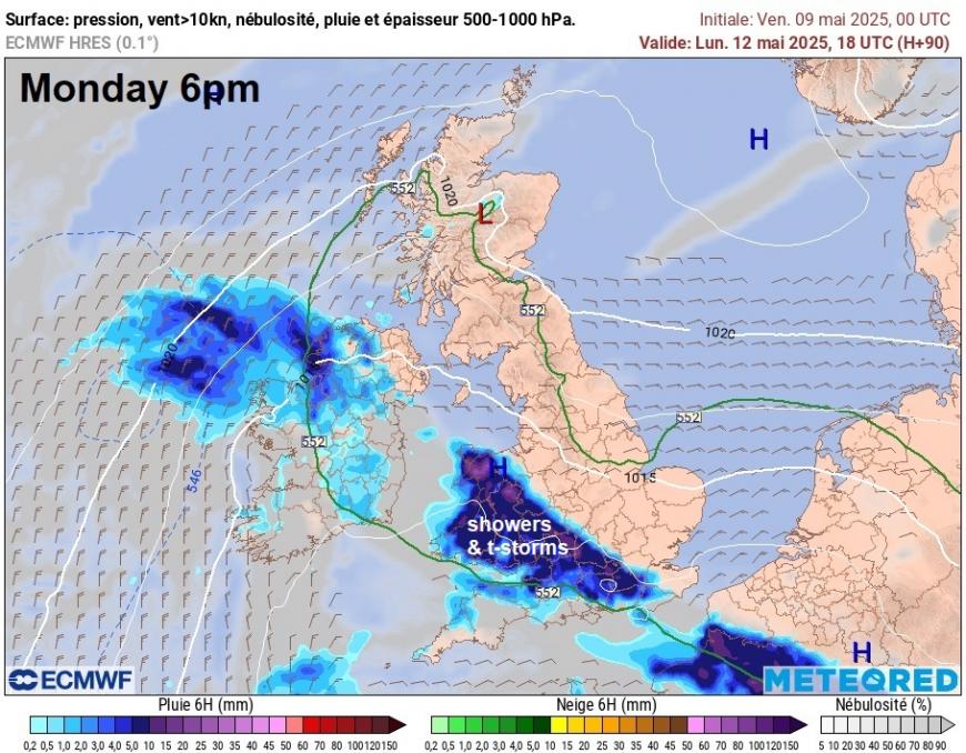
On Monday, the risk of showers and thunderstorms looks to shift a little further northeast to include parts of the Midlands and southern England too, as lobes of vorticity, breeze convergence and lift along the occluded front wrapping around low pressure to the southwest edges further north and east bringing increased forced ascent of warm and moist air.
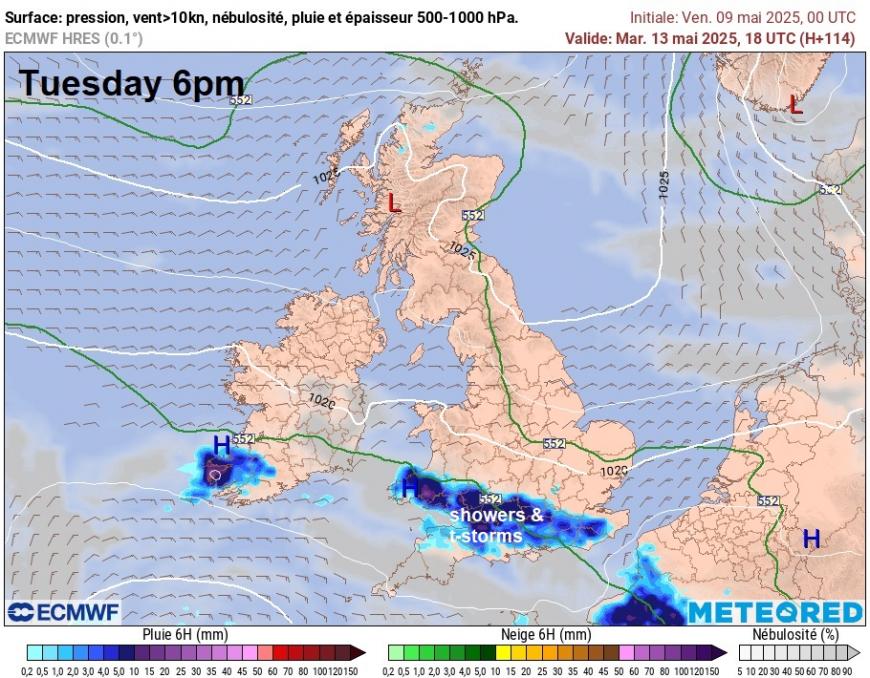
On Tuesday, a slow-moving occluded front still drapped across south Wales and southern England. Upper forcing looks weaker, but breeze convergence of warm most air and rising temperatures here could trigger further daytime heavy showers and thunderstorms.
Some rain is possible across parts of western Scotland on Sunday along a weakening cold front moving in from the west, then on Monday towards the southwest, in association with showery activity reaching northern Ireland from the south reaching here too. But otherwise, it’s looking dry for much of Scotland, northern England, north Midlands and eastern England this weekend and next week.
A blocking area of high pressure looks to build back in from the north from Wednesday, as upper low pulls away to the southwest, so turning drier, sunnier and settled for all the rest of the week.
Loading recent activity...