The dry spring continues this week, with the familiar pattern of high pressure in control that’s been established for weeks and brought warm and exceptionally dry weather in March and April. May continues in a similar fashion to the last two months, with high pressure generally in control - bringing yet another dry week for most of the UK and Ireland.
However, we may see a temporary breakdown in the settled conditions of late over the weekend and into early next week, more particularly in the southern half of the UK and Ireland. But even here, it comes with a caveat of uncertainty for now, with differences between weather models on how far north a cut-off upper low off Iberia on Saturday drifts north by early next week, as a ridge of high pressure over the UK this week retreats east by the end of the weekend.
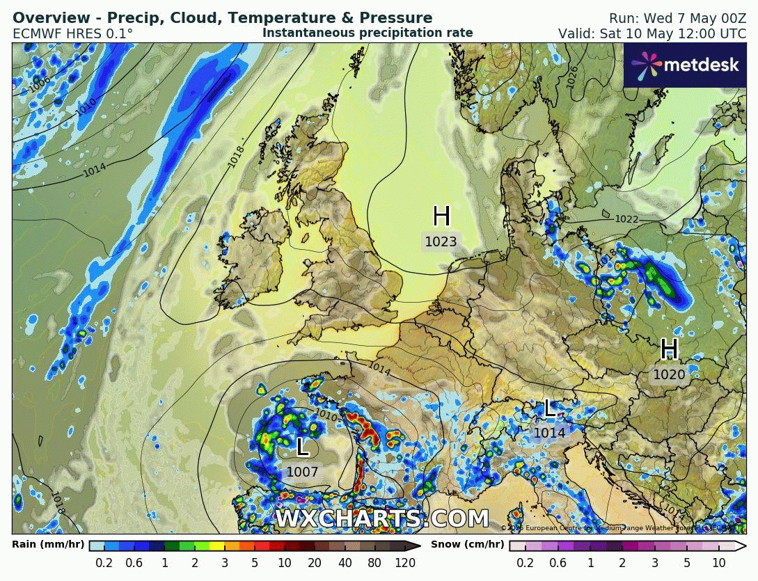
The 00z ECMWF run this morning has the most bullish with rainfall signal from early Sunday through into Tuesday across the southern half of the UK and also across Ireland. The model brings an area of low pressure north from the Bay of Biscay over the weekend, to be over SW England by early Monday morning. Bands of showers, perhaps thundery, spreading north across England, Wales and Ireland on Sunday, more thundery showers following from the southeast across the same areas on Monday and Tuesday. Though on Tuesday, showers become more confined to southern England, south Wales and southern Ireland.
00z GEM is most similar of other main models to ECMWF, while GFS and UKMO tend to confine the showery breakdown to SW England and southern Ireland.
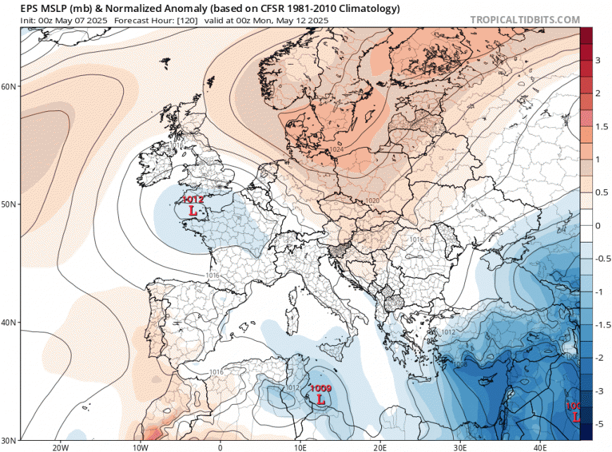
Increase in rainfall from Sunday from the south indicated by ECMWF ensemble mean 24hr accumulations
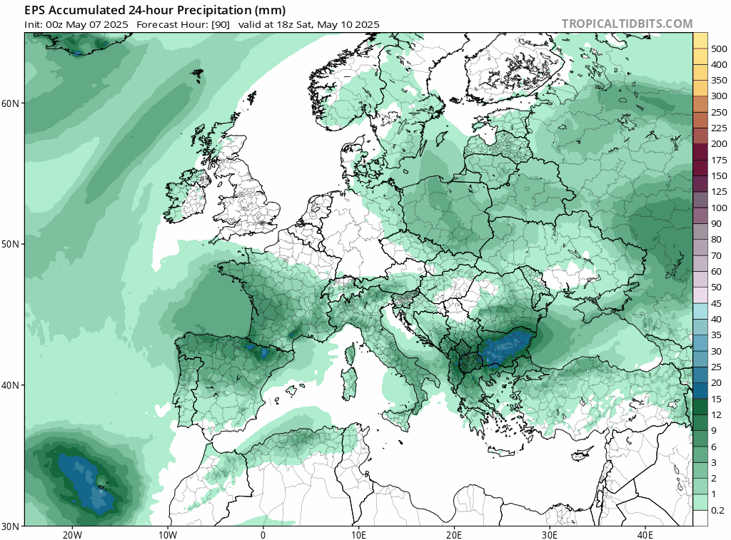
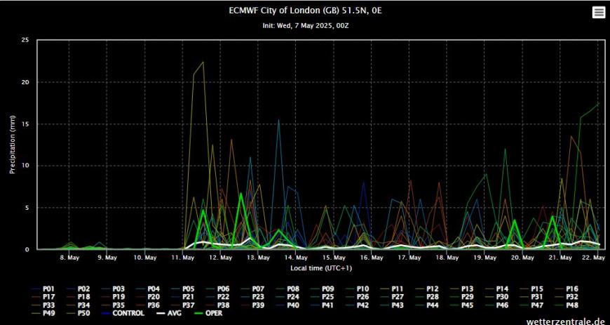
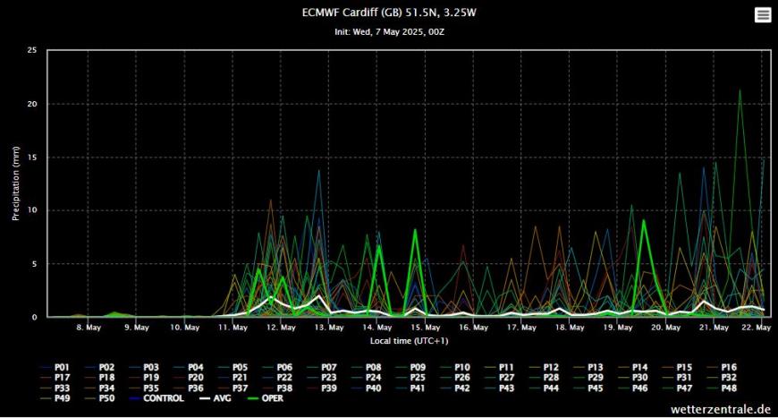
A look at the ECMWF ensembles shows an uptick in precipitation for London and Cardiff around the 11th-12th (Sunday-Monday). Though the high resolution run was one of the wettest members in the spread, but with a few wetter. More members bring rainfall for Cardiff, so the expectation, based on the ensemble spreads, would be that the greatest chance of rain will be towards southwestern areas of Britain.
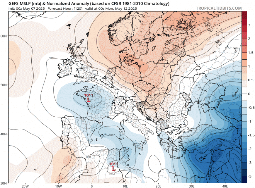
The 00z EPS mean sea level pressure mean has low pressure over western English Channel by Monday, this suggests some support for this morning's high resolution run. GEFS mean has the low a little further southeast for the same time.
The 00z GFS and UKMO kept showers confined to SW England and S Ireland in the period Sunday to Tuesday - when ECMWF and GEM bring showers further north and east across England.
So low pressure looks to move up from the south, but there exists uncertainty from Sunday over how far north or northeast the low moves and thus how far north and east showers may spread across southern UK and Ireland.
What it more certain - is that it will warm up from later this week after a chilly few days that started over the Bank Holiday Weekend, thanks to high pressure positioned to the northwest then now over northern Britain, feeding in a chilly northeasterly breeze across many areas, with overnight frosts over recent nights where skies have cleared.
Turning warmer over the weekend
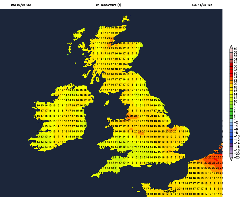
By Saturday, winds look to switch to more of a warmer easterly direction bringing air off the near continent in the south, with shorter trip over the sea, rather than longer fetch of a northeasterly wind off the cool North Sea, so temperatures creeping into the high teens or low twenties across the south. Then into early week, winds look to turn southeasterly, bringing in warmer air - so temperatures rising further in the 20s across southern Britain.
High pressure returns to be back in control later next week?
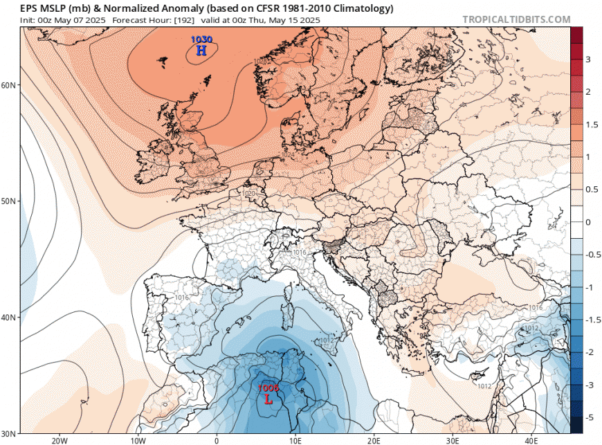
Looking further ahead, any potential breakdown signal from Sunday into next week could be a temporary blip, before high pressure once again builds back in from the north. Well that’s the current signal from models for now.
Loading recent activity...