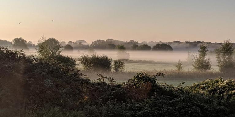
For the Bank Holiday weekend this year we have a mixed picture including rain, and bright spells with temperatures around average. This Easter weekend doesn’t look stunning or a complete washout, but there will be some heavy rain initially that will be worth noting if you are travelling or camping, and it will still be cool at night. As we've seen for the past few weeks, any sheltered sunshine will soon feel warm. There will be more taking off layers and putting them on again in the next few days.
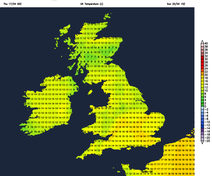
If you are packing for a few days away, yes, take a waterproof jacket and a warm jumper, but there will be sunny times too so include your sunglasses. Eastern Britain does look better overall. Here, there will be more fair weather with bright, even sunny spells and temperatures could peak in the high teens for southeast England. That would feel pleasant. It’s just not reliable Bank Holiday weather and the evenings will be cool, even chilly with a touch of frost in the north.
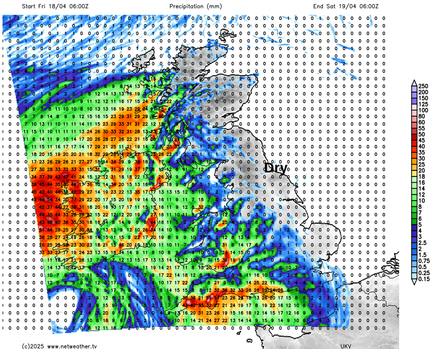
This long weekend looks changeable with rain focused on Northern Ireland and southwestern Britain in the first day and a half. Longer for Northern Ireland. The UK Met Office has issued a yellow rain warning for Cornwall and SW Devon for the overnight period of Friday evening into early Saturday.
“Rain…heavier and more persistent later on Friday and persists into Saturday…50 to 75 mm rain is likely over and near areas of higher ground, especially Dartmoor”.
The Mourne Mountains in County Down and the eastern end of the Brecon Beacons in south Wales could also see persistent rain, as eastern Britain stays drier into Saturday.
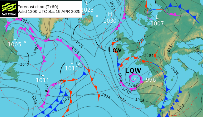
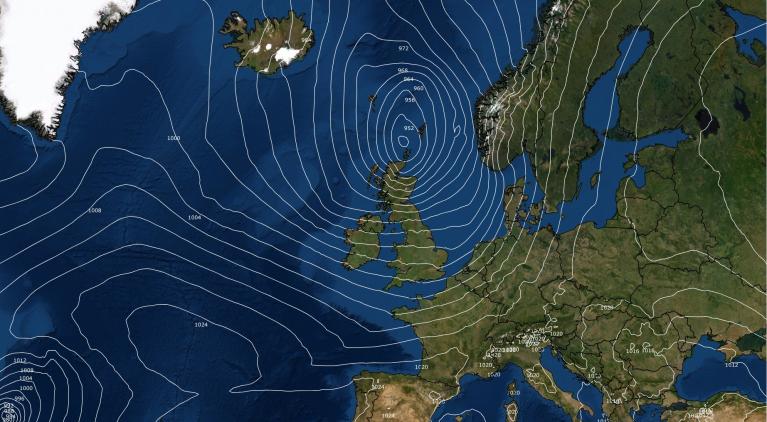
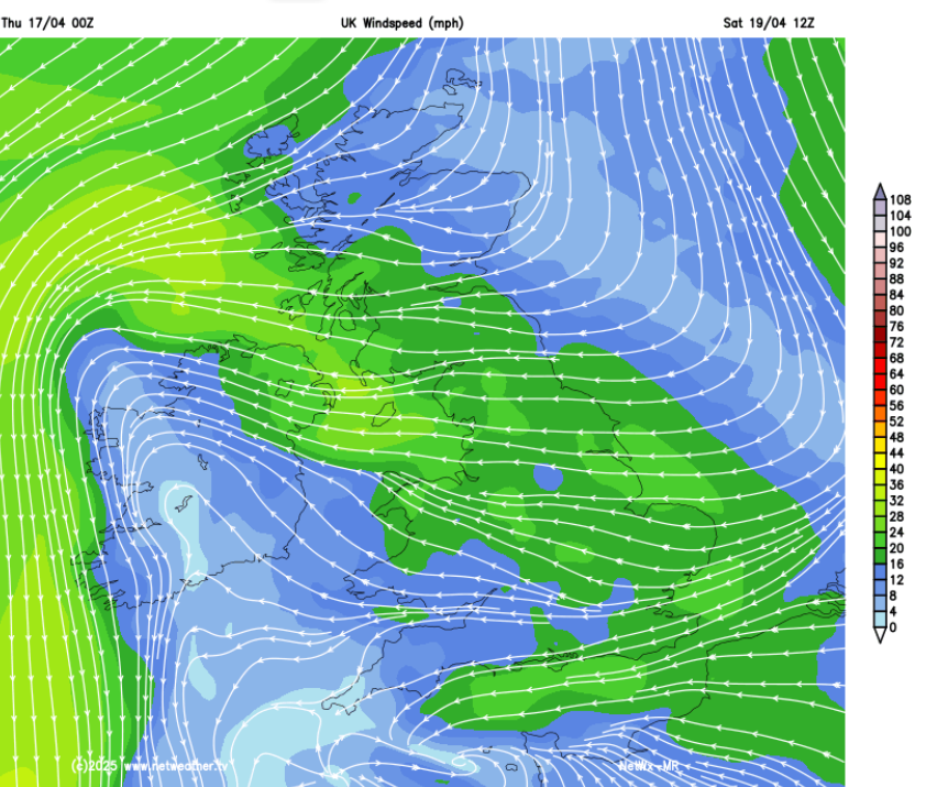
Without the protective shield of high pressure over the UK, Atlantic low pressures will be able to throw their frontal rainbands in from the west. We will see blustery April showers as the cool airflow moves over pockets of land that warm up in occasional sunny spells. During Thursday night, one Atlantic low will stall near western Europe, bringing unsettled weather to Spain, Portugal, France and the UK over the next few days. This will bring rain to Ireland, Northern Ireland and SW Britain later on Friday. It splits with a small low centre close to Northern Ireland and western Scotland with rain and fresh winds. Rain should clear from Wales on Saturday. The other part will linger as a low in the Bay of Biscay and throw a few showery outbreaks up into England on Sunday. By Sunday night, a new Atlantic low will approach from the west with a more mixed picture for Monday.
Tonight
It will be cold and calm for Scotland tonight with clear spells. For Southwest England, milder air will arrive with cloud, outbreaks of rain and a brisk SE wind.
Friday
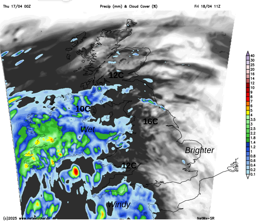
Much of Britain will fair with dry weather, brightness even sunny spells at times. There will be a cool breeze along North Sea coasts but London could reach 18 to 20C and that will feel warm in any sheltered sunshine. The frontal rain will be over Northern Ireland, western Wales and more of southwest England by Friday morning and if you are in the wind and rain, it will feel miserable. Through the afternoon, other areas will encounter outbreaks of rain and a blustery E or SE wind. The rain continues into Friday night over Northern Ireland and more of western Britain and central southern England.
Met Office warnings over a Bank Holiday weekend look at the amount of heavy rain but are impact-based. People will be travelling by road, perhaps in places that they are unfamiliar with or heading out for the day on low-level walks or hill climbs. The warnings anticipate that aspect of expected behaviours. For SW England, the impacts will be low as it’s just some heavy rain in April but the increase in traffic on the roads in this region could lead to issues as surface water and spray increases. Met Eireann has also issued yellow rain warnings with the risk of localised flooding for Ireland from the same low.
Saturday
There will still be a cool easterly wind off the North Sea and fresh winds around the low centre away to the northwest. There is still some uncertainty about the reach of the rain from the southwest but areas such as the West Midlands, New Forest and Wales should see an improvement on Saturday morning as the rain retreats. Aberystwyth and maybe Cornwall should brighten up in the easterly flow. Northern Ireland looks to have another wet, blustery day but much of Britain becomes fair and hopefully brighter later.
As the wet and windy weather in the far northwest rotates into western Scotland during Saturday night, a few showery outbreaks of rain could appear over SE England where it will be mild. Most areas will be dry but cool.
Easter Sunday looks to be a more settled day. There will be a good deal of fair weather with bright, even sunny spells. Most places will be dry but it will be worth keeping an eye on the Netweather Radar for a few scattered showers.
Easter Monday
Overnight, the shower activity will increase as the next Atlantic low gets nearer. Don’t try to plan for Monday using the weather details on an app. There will be bright or sunny spells and showers coming and going but it’s not possible to pin down the timings on those, for certain locations at this stage. There could be some heavier showers on Bank Holiday Monday, but again most of the wet weather starts further west, with brighter weather for central and eastern England. An easterly breeze off the cold North Sea will always be a reminder that we are only in April.
Loading recent activity...