Our weekend weather will be influenced by a large low pressure away to the southwest of the UK. The low centre will head towards NW Iberia bringing more unsettled weather to Portugal and Spain where there has already been impactful flooding and heavy downpours this week.
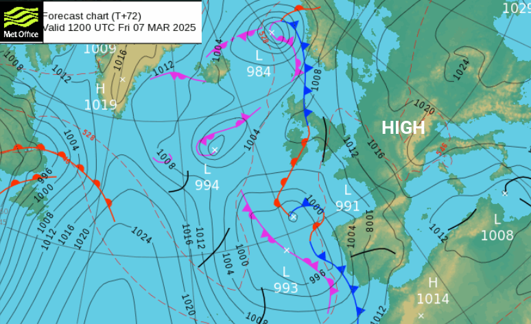
For the UK, a mild southerly flow will follow the main warm front which pushes Friday night’s cold air away from northern Scotland. (It will sink back southwards later on Sunday). The cold front will rotate across Spain, much of France and should end up over the English Channel by Sunday lunchtime. Something to keep in mind is that a band of frontal rain will be nearby for southern England. In between these two frontal bands, there will be a lot of fair weather at the weekend. Western counties could see showery outbreaks of rain but eastern areas have a much higher chance of brighter, even sunnier spells on Saturday. The skies clear on Saturday night with more sunshine for Sunday morning.
Friday evening
Scotland will be clear, calm and cool on Friday evening. The warm front will throw high cloud over Northern Ireland and the Southern Uplands with a light easterly breeze. Southern Britain will be mostly dry and quiet but still mild in the evening. East Anglia and Kent will turn chilly before dawn. Patchy rain and thicker cloud will creep up through northern England with murky conditions for higher level routes and along the A1 in northeast England.
Saturday
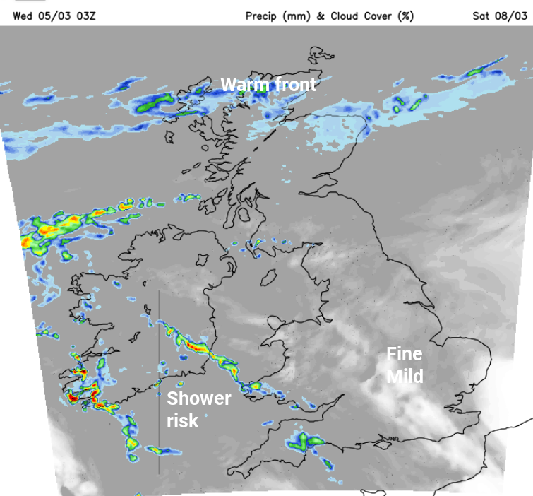
By Saturday morning much of the UK will be in the warm sector. The warm front will still be over the north of mainland Scotland with murky damp conditions. Grampian will be wet and feel chilly in an easterly wind. Much of England and Wales will have a fair, bright morning but there will be clusters of showers from the southwest. Temperatures will be in the mid teens, perhaps reaching 17 or 18C depending on the sunshine. Northern Ireland, Wales and counties around the Irish Sea will see a scattering of showers but still a good deal of dry weather in between.
For the Six Nations rugby, Ireland play France in Dublin. It should be dry at 11C, but there will be a risk that the clusters of showers from the south could pass across the game at the Aviva Stadium and as the blustery winds move by it will feel colder. Later, Scotland play Wales in Edinburgh and it should be dry but cool at Murrayfield.
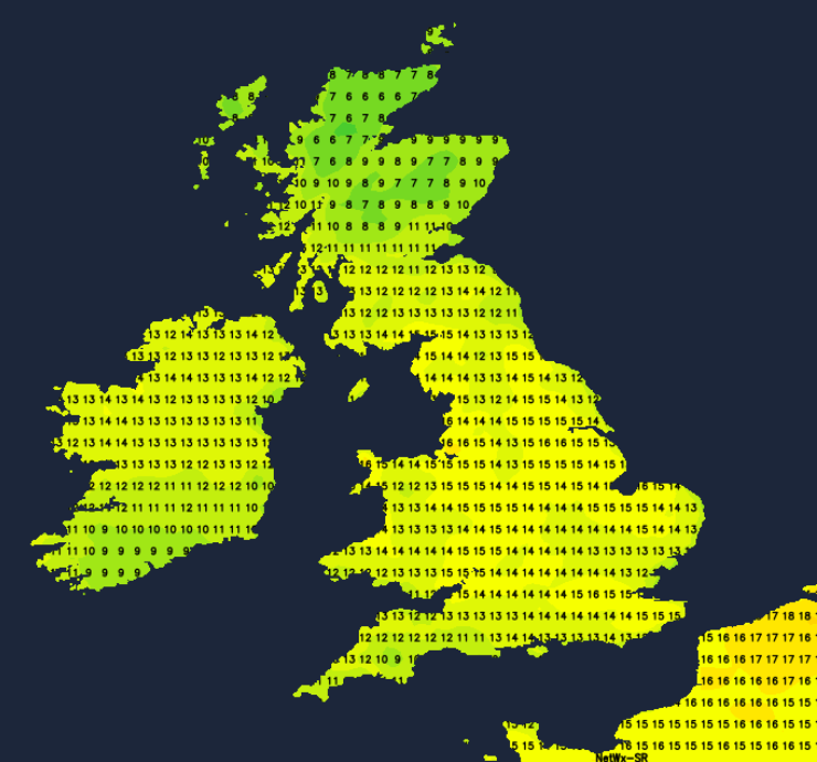
During Saturday night, the skies will clear as temperatures dip into single figures.
Sunday
Sunday will start fine and bright for much of the UK and it will be mild. England play Italy at Twickenham and it should be a fine, warm afternoon, although it will be worth keeping an eye on the progress of the cold front rainband away to the south if you have a ticket. The warm front will still be lurking over the Scottish Islands in a brisk easterly wind.
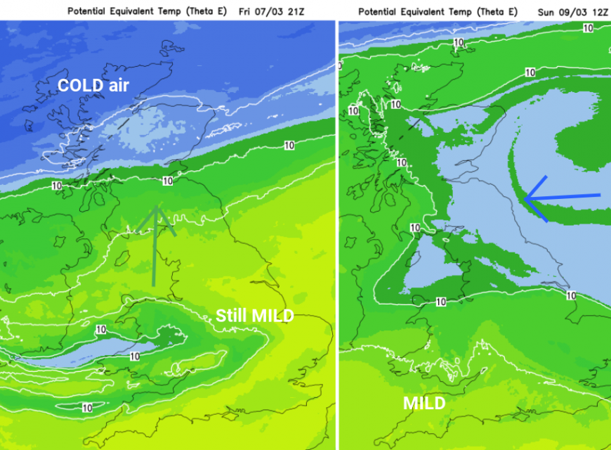
Although Sunday looks fine for most, the cold front could bring rain to Cornwall, even along the south coast of England. The winds across the UK back through the weekend, away from the mild southerly. Gradually colder air from the continent will reach over the North Sea and bring a chill to the east coast of Britain to end the weekend. Don’t head off to work on Monday in a light spring-time outfit. It will feel colder in the brisk easterly wind.
Loading recent activity...