We've all had enough of the grey skies and gloomy dullness. February 2025 seems to have been blighted by a cloak of stratocumulus and often a chilly east wind. Hints of spring seem distant and the weeks are trudging through a miserable tail end of winter. Half term holidays seem to be scattered through February this year, some just finishing, others next week or even later this month. Maybe the cloud will finally shift by then.
A few areas have seen sunshine, but with cold frosty nights. Aviemore saw temperatures fall to -8C early on Thursday morning. The lack of snow in this cold easterly flow will disappoint the Scottish Ski resorts as we reach the February holiday time. The snowmaking machines have been at work and the frozen ground is not ideal.

Is it any better abroad?
Over in mainland Europe, there is light snow today for the Alps. This is linked to a low pressure which will head south through Italy taking any strong winds on Friday away from Alpine ski runs and leaving behind a clear, sunny more settled week. However, the weather will deteriorate under this low for Rome and Venice, Croatia on Friday. This low will bring wind and rain over the weekend for western Greece, including islands such as Kefalonia, Zakynthos and also to Corfu.
The Canary Islands are a popular destination early in the season. This weekend the weather starts with heavy showers but will improve by Sunday with temperatures in the low 20sC. It's better than the 5 to 7C we’ve been seeing in the UK, often with a nippy wind. The weather does vary next week for Tenerife and Lanzarote with further outbreaks of rain.
Weekend weather for the UK
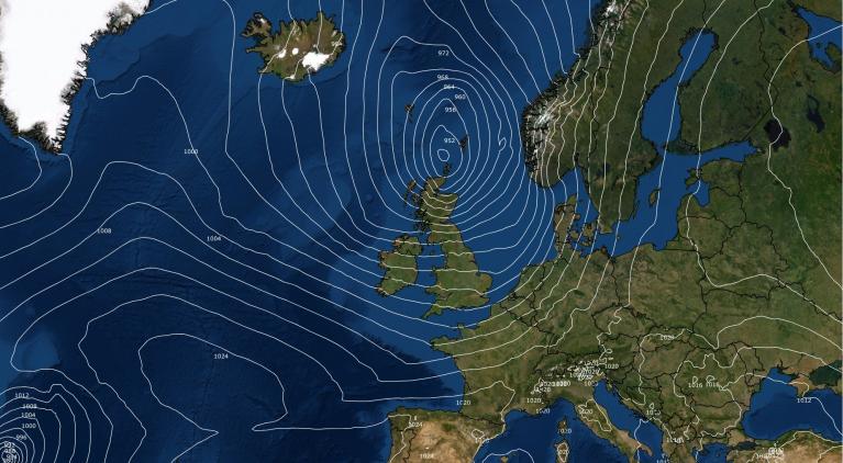
There is a coming together of two air masses over the UK for the end of this week. The cold easterly flow continues from the North Sea with even colder air by Saturday evening into the far north of Scotland. This is linked to a mass of very cold air spilling from the Arctic over all of Scandinavia, western Russia and eastern Europe. Pushing against this is milder Atlantic air which is a bit of a shame because Friday looks sunny. The flow of cloud from the east and southeast will be confined to eastern England resulting in welcome sunshine inland but as Atlantic frontal bands move in they bring cloud from the west and southwest.
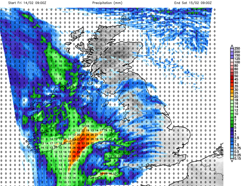
This cloud and patchy rain will already be over Northern Ireland and SW Britain by Friday afternoon and will work its way over more of Britain ready for Saturday morning. The interesting part of the forecast for the weekend is how the incoming frontal outbreaks of rain interact with the cold air in the east or northeast.
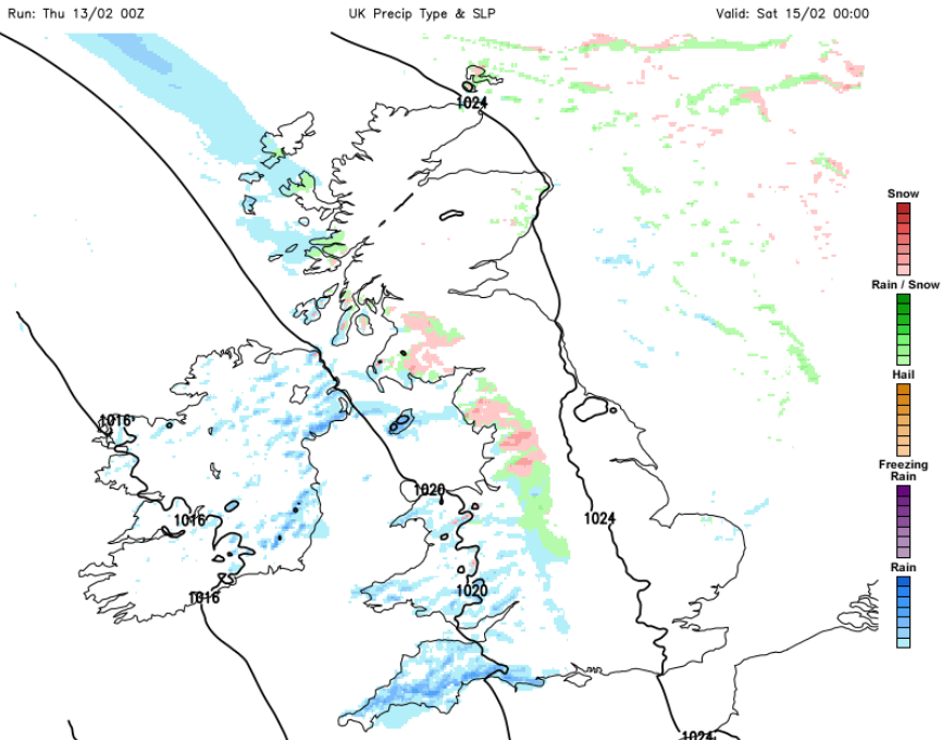
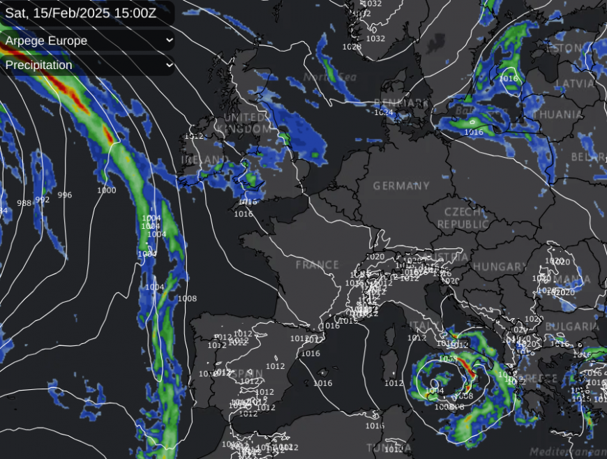
Whilst Saturday will start damp and grey for many, there could be sleet and hill snow on bands reaching over the Peak District, Pennines and parts of Scotland. The models vary with the reach of the very cold air in the northeast and the progress of the Atlantic air from the west. London and the Home Counties could escape the damp weather, perhaps even seeing some brightness on Saturday. Greater London will be around 6 or 7C by day but down near to zero by night.
There are rain, sleet and snow showers showing for the Northern Isles and Grampian by Saturday night from the North Sea. The wavering back and forth continues into Sunday. There have been signs of Sunday being the day when the coldest air reaches the east coast of Britain. The day looks drier overall but cloudy for most with frontal rain for western Scotland.
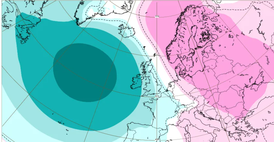
ECM extended range: MSLP weekly mean anomaly, significance level:10% hPa Mon17th - Mon 24th Feb. Next week low pressure exerts more influence on the UK weather (shown in blue over the Atlantic) but the higher pressure (pink) remains to the east as a continuing buffer.
Slowly through Monday and Tuesday, clearer air should arrive from France. So hopefully more sunshine by Tuesday for England. The Atlantic influence looks to spill wet weather in the far northwest and there will still be a good deal of grey cloud about. Looking further into next week, southeastern half of the UK looks drier but the northwestern half could see bands of rain passing by. Although the high pressure over Poland and southern Sweden could hold these fronts at bay, bringing drier weather at least until midweek. It’s quite a tussle between these two influences but there seems little opportunity for disruptive weather, which is good news if you are travelling.
Loading recent activity...