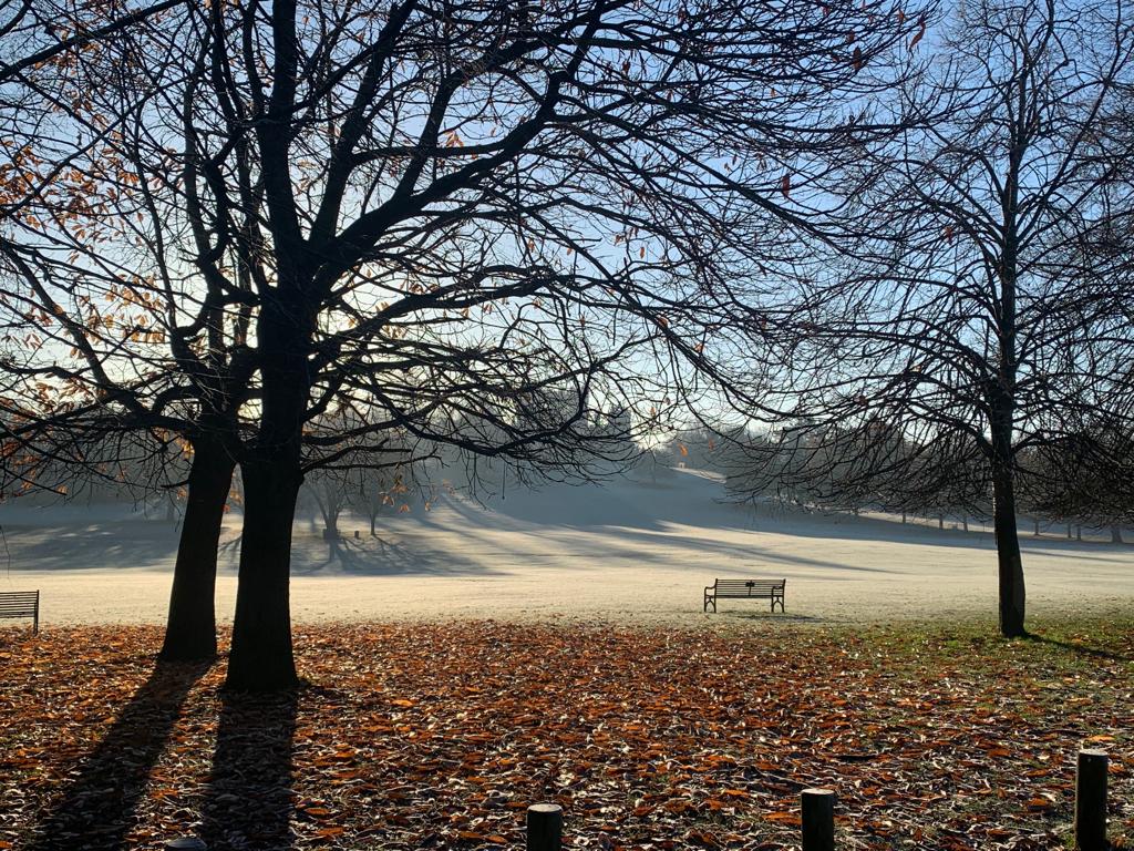
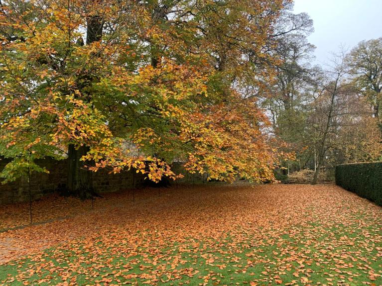
This week the weather will settle down, becoming cold with widespread frost, pockets of fog and midweek winter sunshine as high pressure moves over the UK
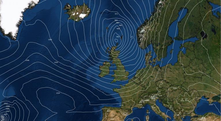
For Tuesday morning, it is a low pressure near Greenland that is stirring our weather. It has been a windy night for Scotland and Northern Ireland as a band of heavy rain, a cold front, passed by. This will continue to bring squally conditions as it heads southeastwards today but will ease by the time it reaches southeast Britain this evening.
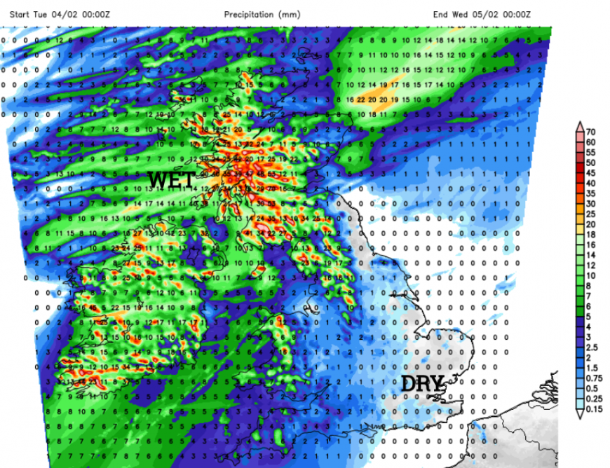
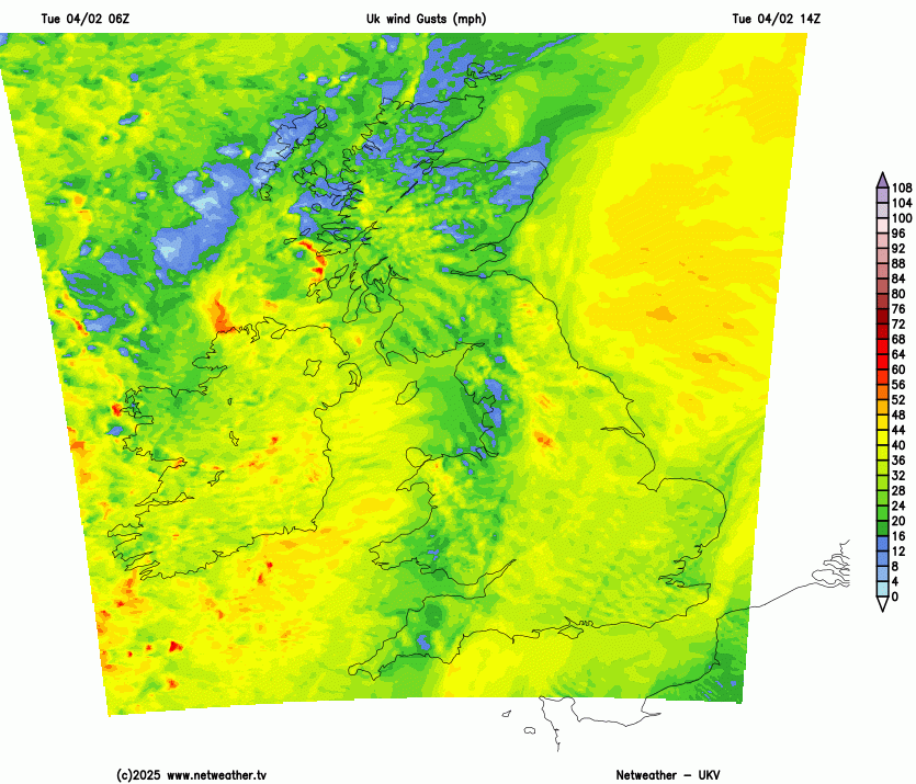
With onshore winds and this continuing feed of frontal rain today there is a weather warning for rain and flooding for SW Scotland into Strathclyde with possible disruption to travel. There will also be heavy rain today for Cumbria, Wales and SW England but the band will move through in the middle of the day. Be prepared for poor visibility, sudden gusty winds and plenty of surface water and spray. Behind this band will be colder unstable air. The UKV model has been showing a lively small low centre developing north of Northern Ireland and heading to the west coast of Scotland later afternoon into early evening. This could bring severe coastal gales and high gusts. It then looks to move close to Glasgow and then on through the Central Belt this evening bringing a spell of wild weather for the evening rush hour. Commuters will know where the exposed high parts of the M8 are and of the A1 south as the brisk westerly funnels through the Lowlands.
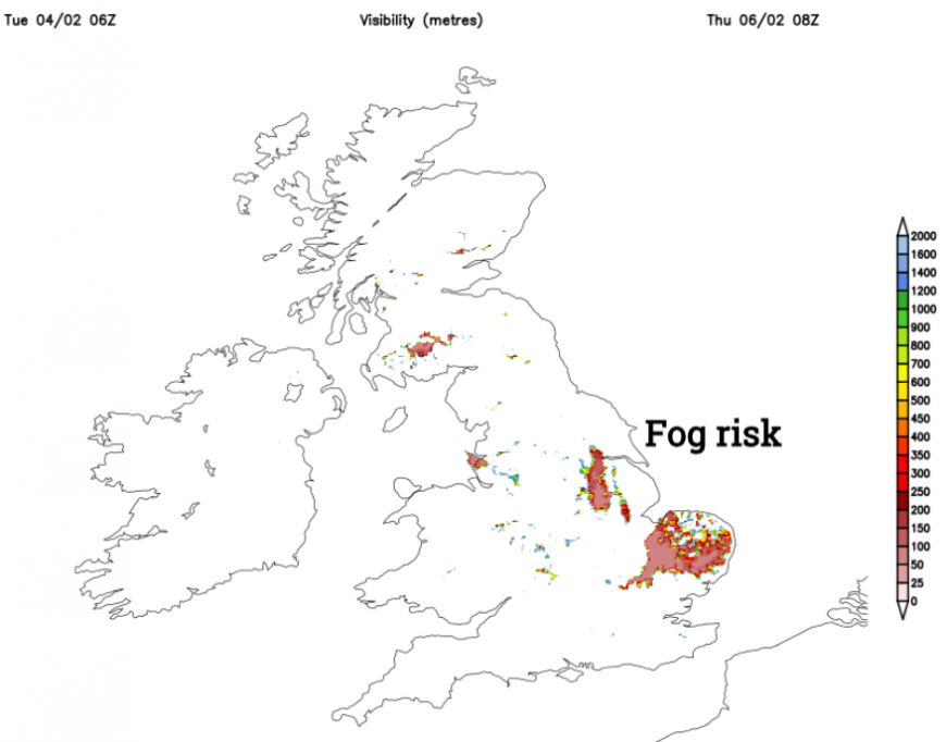
The cold front will clear from Kent leaving clear skies for most of the UK but just an ongoing feed of showers for northern Britain and Northern Ireland which become more confined to western Scotland by dawn on Wednesday. These will be a mix of rain, sleet, hail and mountain snow. It stays windy here so will be cold. There will be a bit of frost in places and a low risk of ice after the wet weather of today.
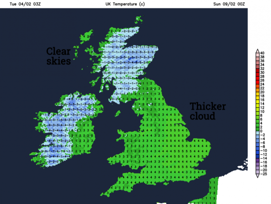
Wednesday will be sunny with just a few showery bits from cloud over SW England, these won’t amount to much. The next few nights will see widespread frosts with the risk of freezing fog in places.
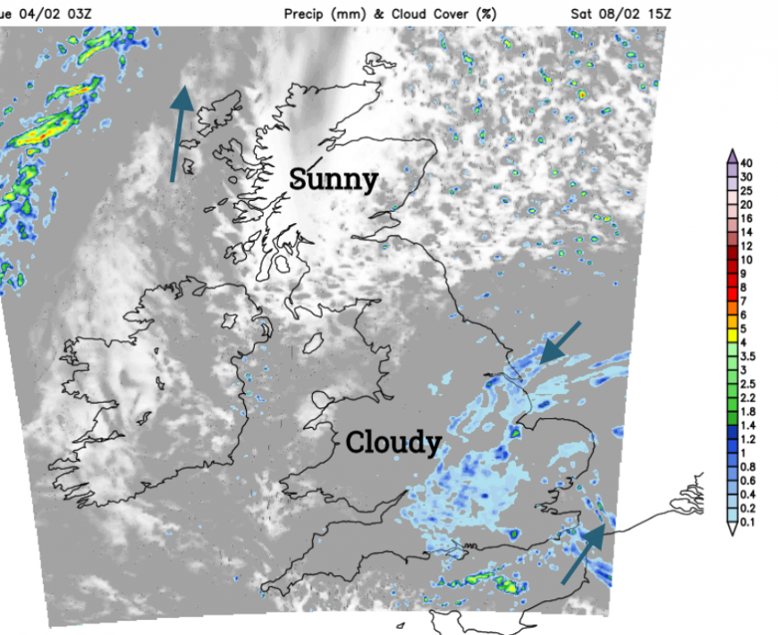
East Anglia and Southeast England look likely by Thursday morning. Temperatures will fall a few degrees below freezing and reach around 7C by day. It will stay windy in the far NW of Scotland pushing damp air against the Highlands with more cloud here.
During Thursday night an east to northeasterly breeze will pickup off the North Sea. This will bring damp air and cloud from east and change how the end of the week looks. Again there will be widespread frost, the risk of fog in places but Friday will feel colder under grey skies and with a noticeable chill from the wind. England and Wales will have a cold day so wrap up warm. This flow could bring showery precipitation over southern England, perhaps more of southern Britain by Friday night. Mostly it looks like icy rain or sleet.
This feed of damp air will continue into the weekend with a cloak of gloomy cloud which may give light precipitation, at times wintry as areas further north and west keep the sunshine and clear skies by night, so a severe frost.
The overall setting is this cold high pressure with frost by night and a cold easterly wind picking up later this week. You might see wintry flurries for southern or eastern Britain, causing an exclamation of “oooh, it’s snowing”. Currently, not much more is expected but the ingredients are there. With a bit more forcing, a more organised trough, a pool of cold air aloft it wouldn't take much for there to be a slight temporary covering of the white stuff and chaos ensuing on the roads of southern England.
Loading recent activity...