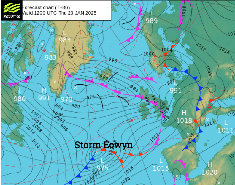
Storm Eowyn will be over the UK and Ireland on Friday with warnings of rain, snow and damaging winds from Thursday night into Saturday. Prepare now and expect travel disruption.
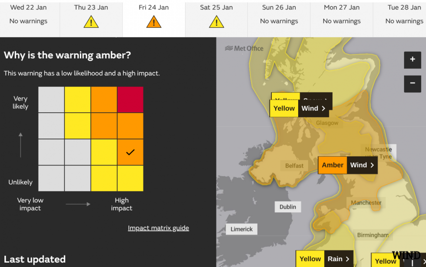
Warnings of severe weather cover most of the UK and Ireland ready for the arrival of storm 'Eowyn'. By Wednesday morning Met Eireann had issued a rare Red warning for high winds on Friday. Their warning system is different to the Met Office's which includes Likelihood and Impacts.
Red Storm Eowyn: Gale force southerly winds becoming westerly will bring severe, damaging and destructive gusts in excess of 130km/h (80mph) Met Eireann

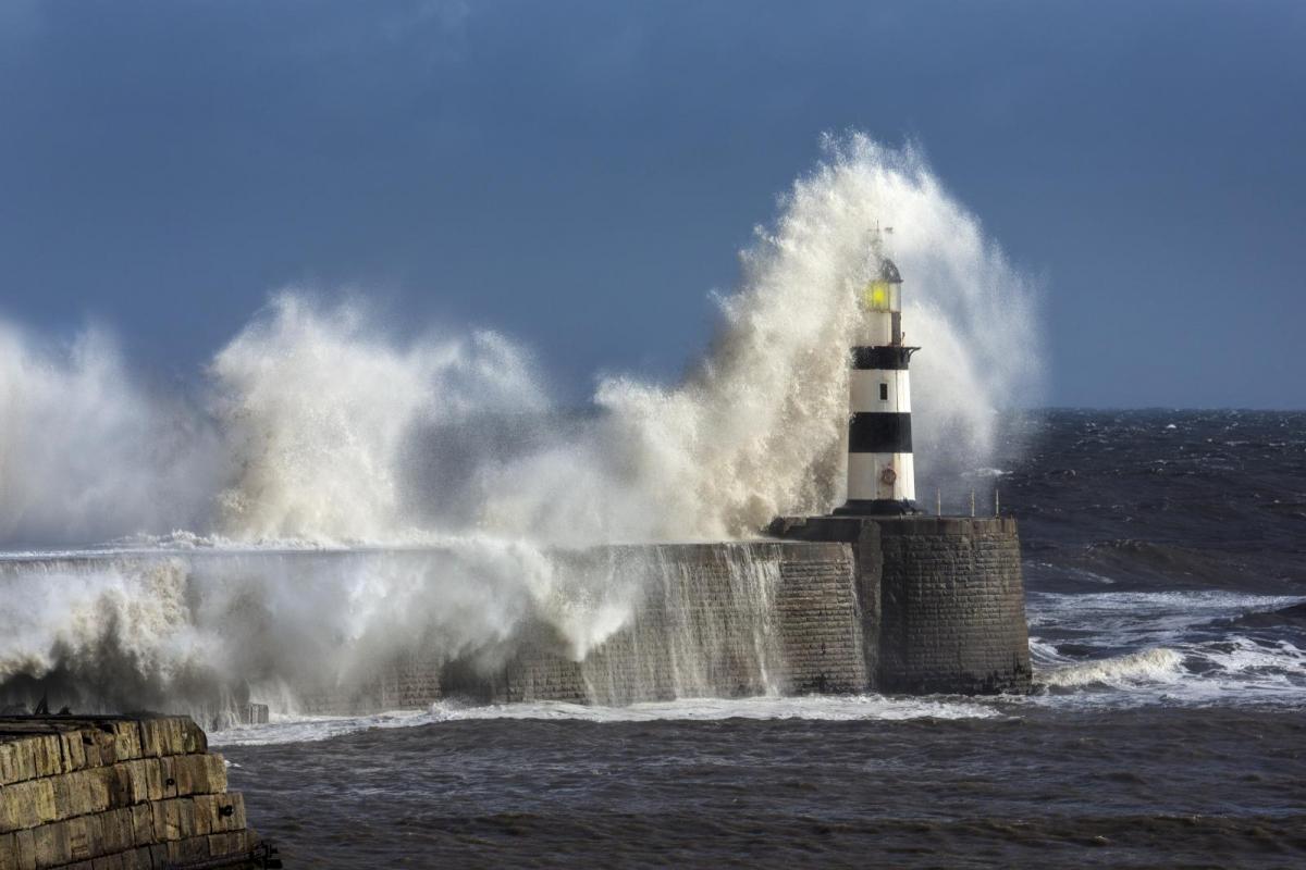
The UK Met Office has now issued an Amber warning for winds on Friday with "a spell of very strong west to southwesterly winds, with peak gusts of 60-70 mph fairly widely inland, 70-80 mph in some areas, and 80-90 mph along more exposed coasts and hills (perhaps even higher in a few locations)." There are rain and snow warnings too.
The storm is due to cross Northern Ireland on Friday morning and Scotland through the afternoon. Damaging gusts around the Irish Sea are being forecast that could result in flying debris, power outages and fallen trees, with hill snow in the North an additional hazard. If you're travelling on Friday, make sure you have the latest information to hand and take heed of these warnings that will be constantly updated.
For the remainder of today, although mixed, it remains relatively quiet. We currently have a couple of fronts that will affect the country: one that is giving patchy rain in the East that will clear this afternoon, and another approaching Northern Ireland that will bring some rain in from the West. Elsewhere, once any remaining patchy fog has cleared and apart from a few showers, Wednesday afternoon will be dry with sunny intervals in light winds, although cloud amounts will vary. Top temperatures 5 to 9C.
There will be further showers over Northern Ireland into the evening, where a freshening southerly wind will bring heavier bursts of rain overnight. The West will also see a few showers, but for remaining parts, it will be mainly dry under broken skies. Light winds allow a touch of frost and patchy fog to return, with lowest temperatures zero to -3C in the coldest spots, but you will stay above freezing where you keep cloud.
After a dry, bright but cold start over Scotland and in central and eastern areas, Thursday brings an end to the quiet spell as winds freshen from the South. This will bring a spell of rain from the West that will be heavy in places, preceded by some snow on northern hills. But this will be quickly followed over Northern Ireland by a 'veer' of wind and a clearance to just a few showers, that should have spread to all but northern Scotland and some eastern areas by dusk. Although not feeling so cold, top temperatures of 5 to 7C in the North and 8 to 10C further South will be the beginning of a milder trend.
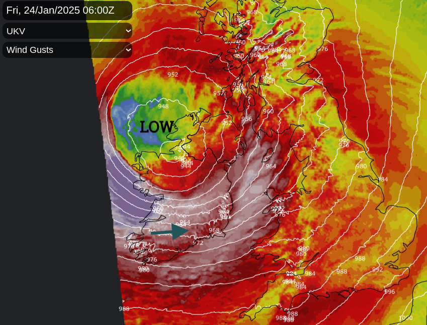
After a brief lull into the early evening, we see the approach of storm 'Eowyn'. This will bring strengthening South-East or southerly winds up from the South-West, with Northern Ireland and much of England and Wales turning wet and windy overnight. Gales become severe especially in the West, giving damaging gusts of up to 70 or 80 mph along some exposed Irish Sea shorelines by morning.
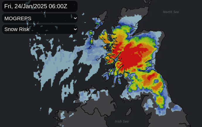
By then, the increasingly severe weather will be moving into Scotland with heavy, driving rain in places preceded by blizzards over the Pennines, Cumbrian Fells and Scottish hills causing travel problems. Before then, parts of the North and East may turn chilly enough for a touch of frost in places, although temperatures will be rising later in the night as milder air begins to move up from the South.
The weekend, although milder everywhere, remains very unsettled. Storm 'Eowyn' clears to the North giving somewhat of a lull for England and Wales on Saturday with just a few showers mainly in the West and South. But it won't be long before another Atlantic depression brings more wet weather from the South-West on Sunday.
Loading recent activity...