Most places will be sunny but cold today and tomorrow, with widespread frost overnight, wintry showers near coasts. Disruptive snowfall looking likely across Ireland, N England and S Scotland Saturday night through to Monday morning.
There is potential for some disruptive snowfall across northern England, Scotland and N. Ireland Sunday and Monday, as an area of low pressure currently near the Azores moves northeast and over the UK on Sunday. It will bring plenty of rain with it off the Atlantic, but as the rain bumps into the cold arctic air across the UK over the next few days, it will readily turn to snow before turning back to rain across the south, as milder air makes inroads, but may remain as snow in the north.
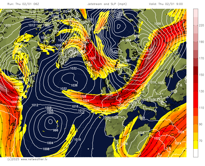
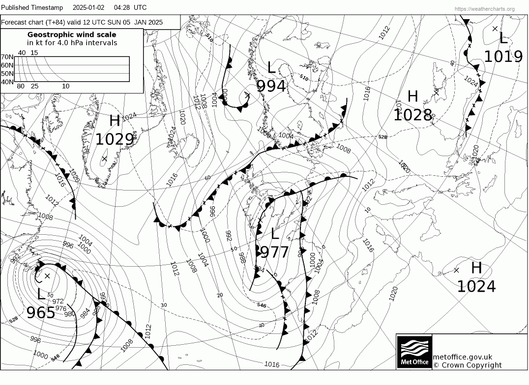
An area of low pressure which has been loitering to the west of the Azores since the weekend, will get scooped up by a strengthening jet stream across the North Atlantic and will move towards the UK and deepen. Although there have been some differences between models on the track of the low during the week, some further north, some further south, most are converging over the idea of the low arriving over the Celtic Sea or southern Ireland from the southwest Sunday morning, before tracking northeast across Wales and northern England later on Sunday, then exiting over the North Sea Monday morning.
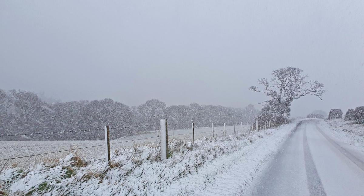
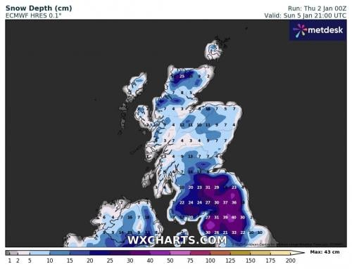
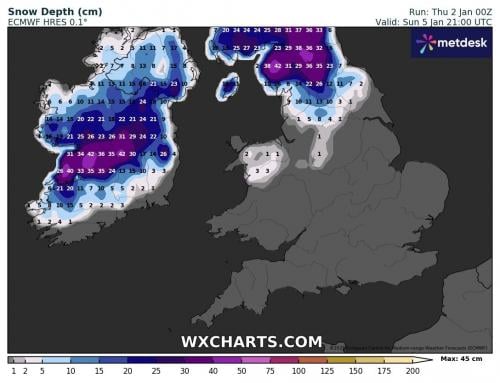
Snow is likely ahead of the warm and along the occlusion pushing northeast ahead of the low on Saturday afternoon and evening, snow turning to rain across southern areas of England and Wales as milder air pushes in behind the warm front and occlusion, but may remain as snow across northern England and southern Scotland, with milder air not making inroads here. Given the subtropical origins of the low, it will have quite a lot of relatively warm and moist air wrapped up in the circulation - so heavy snowfall or heavy rain could well be an issue where the fronts linger for longest - which looks likely to be across Ireland, Wales and northern England. There is potential for 20-40cm across parts of Ireland, the far north of England and southern Scotland. Further south over mainland UK, Wales, Midlands and southern northern England may see temporary accumulations of up to 5-10cm, Saturday night and Sunday morning before a thaw sets in during Sunday, as milder air pushes in from the southwest.
Milder air pushing in with low moving NE over the weekend, but cold air remaing across the north until it returns back south across all parts on Monday, as the low clears east.
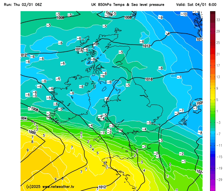
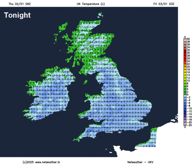
For now, all of the UK is now in cold northerly flow, after a cold and frosty start, for most it will be dry and sunny, though northern Scotland, N. Ireland and eastern coasts of England will see sleet and snow showers. A widespread hard frost tonight under clear skies in the arctic flow, temperatures falling to -1 to -4C inland. A more organised band of snow showers along a cold front moving south across Scotland may bring a risk of ice. Temperatures reaching 2-5C at best.
Then Friday will be another cold and mostly dry day with plenty of sunshine, winds will back northwesterly, so wintry showers will affect coastal areas across N. Ireland, NW England, western Scotland and NE Scotland. Temperatures will reach 3-5C at best.
Saturday is looking mostly dry and bright but cold during daylight, though some wintry showers possible in the northwest. However, to the southwest of Ireland, an area of low pressure will approach from the southwest during the evening, with a spell of snow just north of warm front and occluded front pushing northeast across Ireland, Wales and England Saturday night, turning back to rain across Wales, Midlands, East Anglia and southern England.
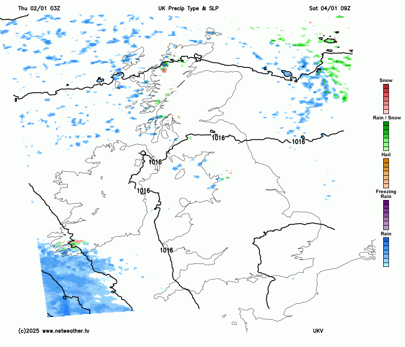
Lying snow depth animation from UKV Saturday PM to Monday AM
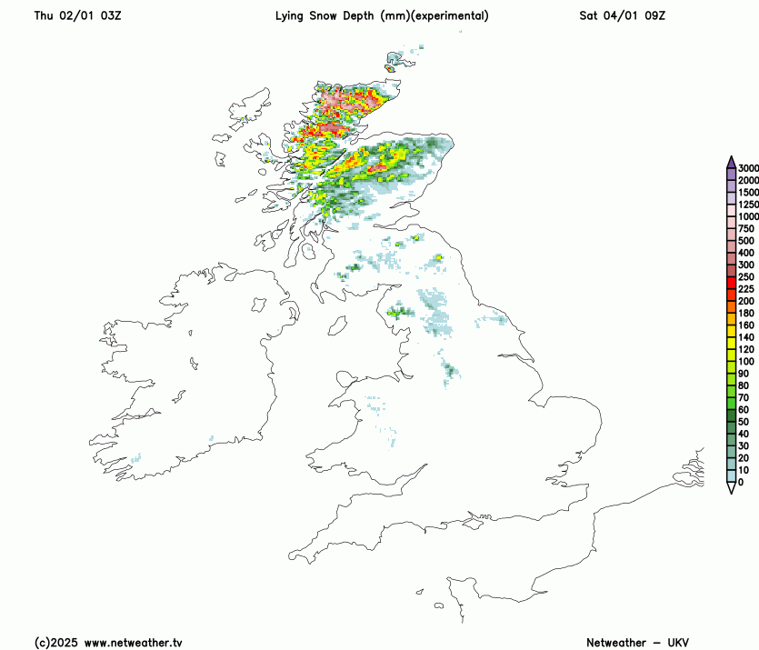
For northern England, uncertainty how much inroads milder air will make from the south, if cold enough air remains, further snow throughout Sunday before clearing east Sunday night. Further outbreaks of rain or showers further south across England and Wales and it will be windy too. Snow, perhaps heavy, also likely across southern and eastern Scotland on Sunday wrapping around the northern flank of the low moving across England before clearing east early Monday, but uncertainty on northern extent for now. But Ireland, north Wales, northern England and southern Scotland look most at risk from some disruptive snowfall on Sunday and into early Monday. Potential for significant accumulations of snow, with higher routes becoming impassable and disruption to travel likely as people head back to work on Monday morning.
ECMWF snow depths by late Sunday
Early next week, the cold air returns as winds turn northerly on Monday behind the Sunday low crossing England clearing out into the North Sea, then backing northwesterly on Tuesday. Sleet and snow showers likely in the north and along eastern and western coasts further south on Monday, perhaps a disturbance moving south may bring wintry showers inland too. Still cold on Tuesday, but wintry showers becoming confined to the far north and northwest coastal areas.
Loading recent activity...