November 2024 has been a month of contrasts. The first half was exceptionally dry and had a lot of anticyclonic gloom except in northern and eastern Scotland. Some of us saw our first significant snow of the season during a very potent cold spell between the 18th and 23rd. It then turned wet, windy and very mild via Storm Bert on the 23rd and 24th, but then colder weather returned, with plenty of sunshine for most but further rain for much of England and Wales on the 27th. Overall, November’s mean temperature looks set to come out not far from average.
Tomorrow we are entering meteorological winter, and the weather looks set to be rather ordinary into early December, quite changeable and windy at times, especially in the north, but also with some quieter spells. With winter approaching, it is worth looking back at recent winters over the UK and Europe.
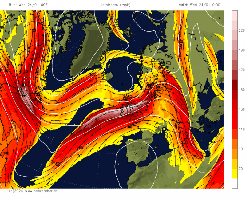
The winter of 2023/24 was a somewhat unusual one. With it being an El Nino winter, long range forecasts generally went for a mild and changeable start to the winter over the UK, but turning colder and drier through January and February with frequent blocking anticyclones over Greenland. However, in reality, mild and changeable, and often very wet, weather persisted for most of the winter. Blocking highs over Greenland were indeed quite frequent, but there was also persistent high pressure over southern Spain, and a strong jet stream kept passing over the British Isles. This kept most of Britain, especially the south, in milder air.

There were some cold episodes in late November/early December 2023 and during the middle fortnight of January 2024, which brought snow for some, and some areas briefly had snow around 8 February, but on the whole it was a mild and wet winter for most with below average snow.The persistent wet weather followed a wet October and November, and with further wet weather into spring 2024, crop yields widely suffered this year. However, with the jet stream often running to the south of its most common position, north-west Scotland had a relatively dry winter.
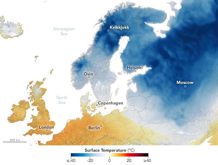
Over Europe, it was a mild winter for central and southern Europe, with some record breaking temperatures especially in Spain and Portugal. In contrast, Scandinavia was frequently affected by cold northerlies associated with the Greenland blocking high, and had a much colder than average winter. December 2023 and January 2024 were both very cold across Scandinavia, and although February 2024 was quite mild, it was not warm enough to offset the cold weather earlier in the winter.
 January 2024 cold in Scandinavia (Image from NASA)
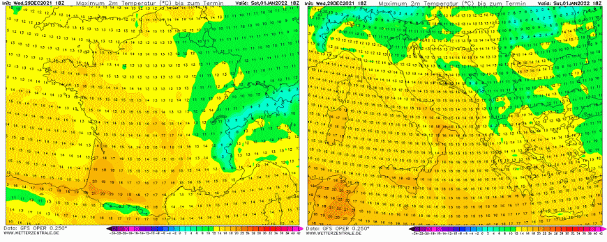
The general trend is for winters to become milder and wetter in north-western Europe. Two recent winters - 2021/22 and 2022/23 - had record breaking temperatures over much of Europe around the New Year.

Winter 2021/22 was also generally mild in the UK, and following a dull December in 2021, January 2022 saw record high sunshine totals in some parts of the country, particularly eastern England. However, winter 2022/23 was closer to average for the UK and had some colder spells. There was a prolonged cold spell in the first half of December 2022, and the second half of January 2023 was also generally cold. However, February was very mild. Many regions saw some snow around 10 March, before mild and wet weather set in for most of us for the rest of March.
Winter 2020/21, although not unusually cold by historical standards, had some noteworthy cold spells, particularly a cold easterly in the first half of February 2021 which brought widespread snow to eastern and northern Britain. Temperatures fell as low as -23C at Braemar in northern Scotland, which was the lowest temperature anywhere in the UK since late December 1995.
.png?w=800)
April 2021 was an unusual month, being very cold but also very dry and sunny. Some parts of the UK had notable late snowfalls around 5/6 April and 11 April.
However, winter 2019/20 was exceptionally mild and wet and westerly dominated. In north-eastern Europe it was widely the mildest winter on record by a large margin, with long-running sites at Helsinki and Moscow smashing all previous records. February 2020 was the wettest February on record for the UK as a whole, just beating February 1990, with particularly intense rainfall events from storms Ciara and Dennis around the middle of the month.
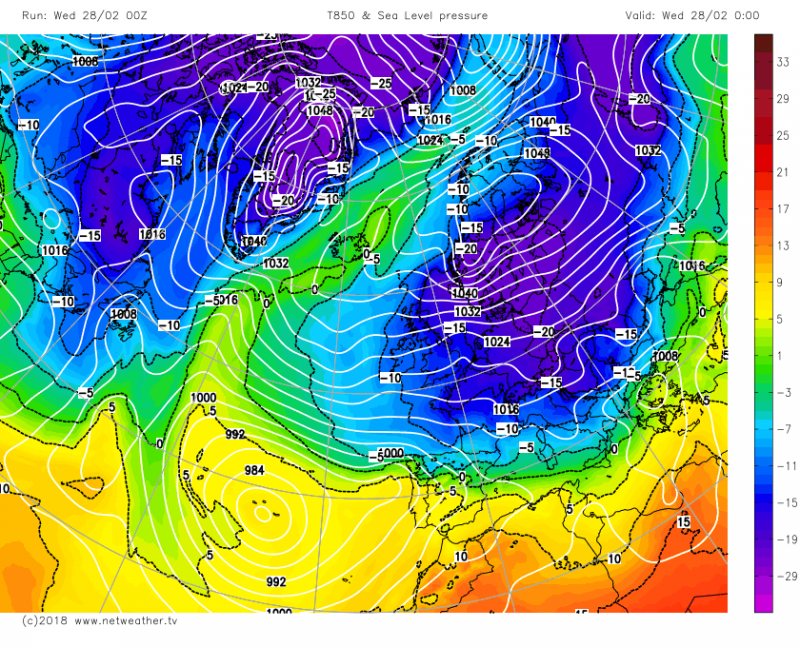
Further back, winter 2017/18 was on the cold side and produced a severe, if brief, cold spell at the end of February and the beginning of March, which has become known as “the Beast from the East”.

However, 2018/19 was a mild winter and was most notable for record breaking temperatures and sunshine totals during February 2019. It is common for very mild winter months to be generally cloudy, but February 2019 was very sunny as well as very mild for much of the UK, and 20C was breached in winter for the first time around the 25th.
In general, with the underlying warming trend, the cold winters are becoming less intensely cold, and the milder winters are becoming more exceptionally mild. However, there have continued to be colder spells. We have seen ample demonstrations that it is still possible to get spells of cold snowy weather in winter, and indeed recently as early in the season as mid to late November - these spells just tend to be fewer and further between than used to be the case.
Loading recent activity...