


After a week of cold, snow and ice, conditions will deteriorate over the weekend, as Storm Bert rolls in from the Atlantic bringing multiple hazards. Bert will sweep gales and heavy across all parts on Saturday, the rain turning to heavy snow for a time across the north – as it bumps into cold air.
The Met Office have issued several yellow warnings for rain, snow and wind, along with an Amber Warning for an area north of the Central Belt of Scotland – where 20- 40cm of snow could fall over higher ground. The snow will be temporary away from the highest ground, turning back to rain for most, but the heaviness of the snow will likely cause travel disruption across northern areas.
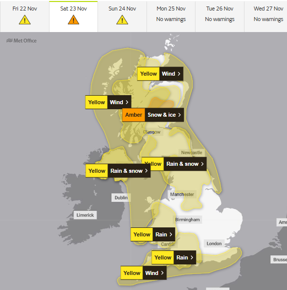
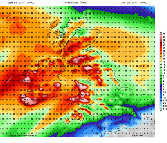
In addition to the disruption from snow, heavy rainfall could lead to treacherous driving conditions and lead to localised flooding – with 50-150mm possible over western hills over the weekend. Gales could also lead to travel disruption and damage, with gusts of 60-70mph likely across southern, western, northern coasts.
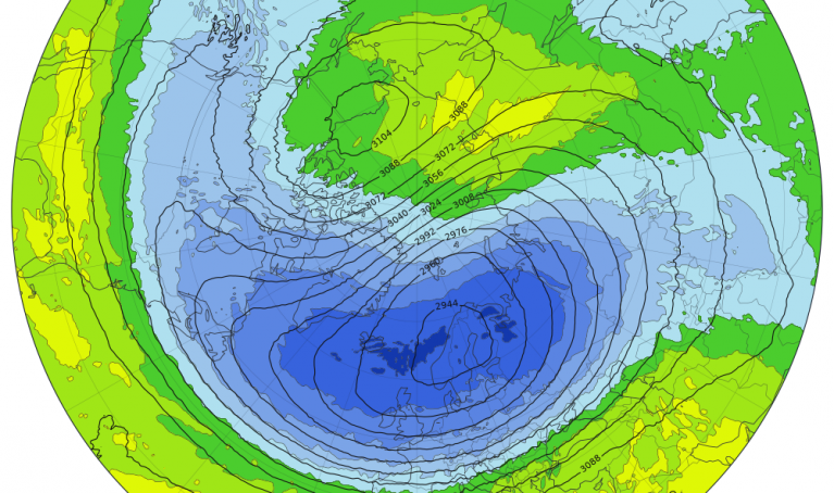
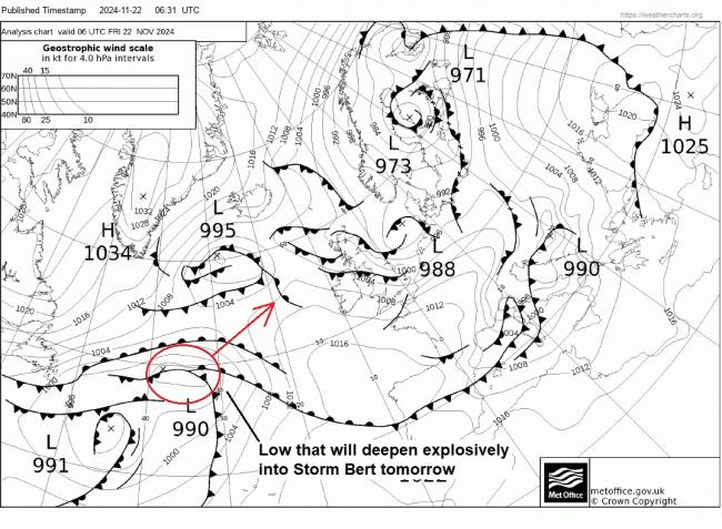
Storm Bert develops today out over the middle of the far North Atlantic in response to a sharpening thermal boundary created by a trough of cold air dropping down from the north meeting tropical maritime air along the boundary with polar air to the north. A fairly innocuous looking low for now, mid-North Atlantic on the T+00 fax chart for 6am this morning, is already moving east along the boundary looks to rapidly deepen as the trough moving south engages the boundary, sharpening it, while the low also interacts with the developmental right entrance then left exit of strong jet streaks moving along the sharp polar air boundary across the Atlantic.
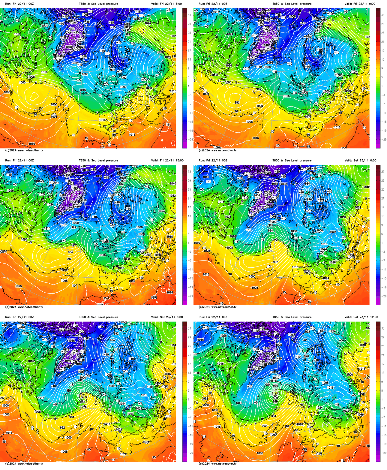
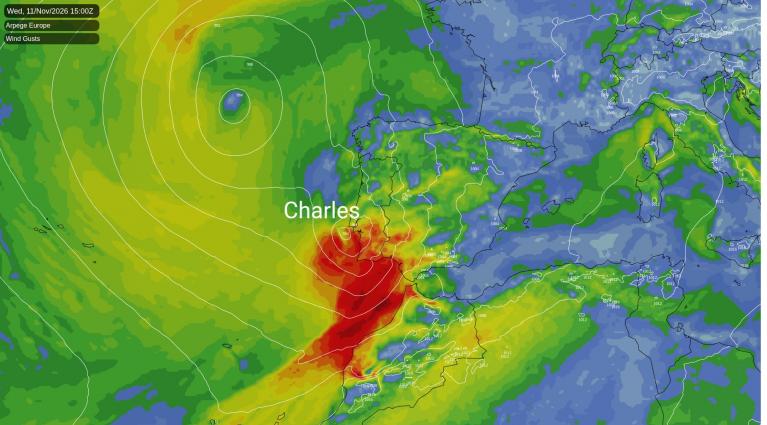
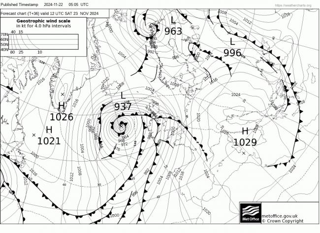
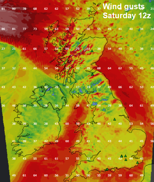
Bert undergoes rapid cyclogenesis over the next 36 hours, sometimes referred to as a ‘bomb cyclone’, deepening to as low as 933 hPa by early tomorrow evening, according to GFS. Fortunately, the UK will be spared the strongest winds wrapping around the northern flank of the low, but nonetheless, winds of 60-70mph are likely around southern, western and northern coasts.
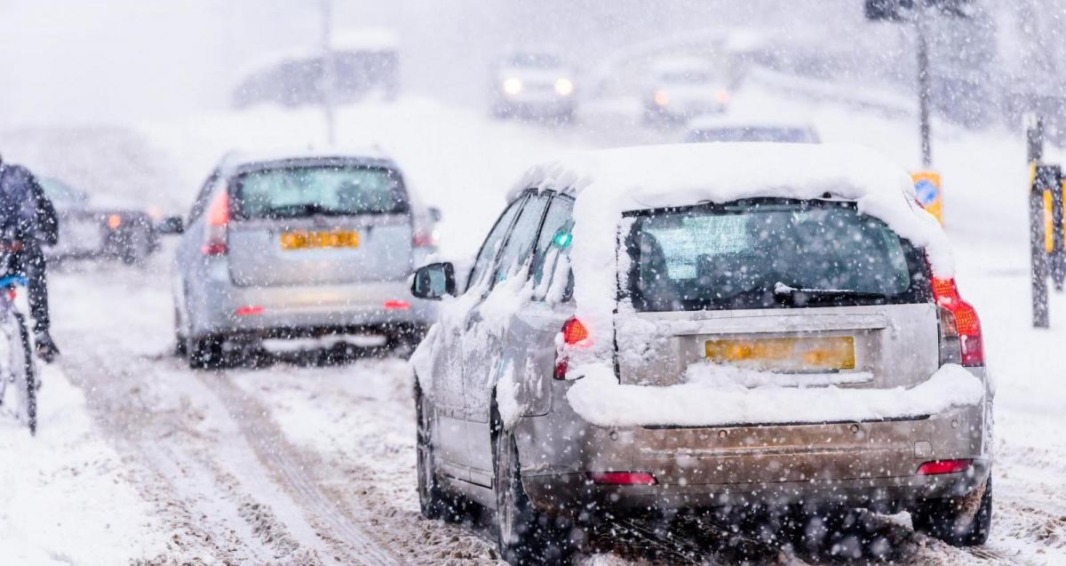
A relatively quiet picture across the UK on Friday, but not without its hazards to start the day. Heavy snowfall across SW England on Thursday means there is a risk of ice on untreated surfaces this morning, as snow has turned to ice overnight, some railways and roads still blocked or treacherous this morning.
Otherwise many places are starting cold, dry and sunny but with a risk of ice where wintry showers have passed overnight. Frequent sleet and snow across NW England, north Wales and through the Midlands overnight will tend to ease through the morning. Heavy snow showers also continuing to affect northern Scotland, but these should also ease back to coasts. Otherwise, most areas having a dry, sunny and cold day.
Perhaps an early frosty this evening, before cloud increases in the west, the wind and temperatures rise, heralding the arrival of Storm Bert. Heavy rain and gales will sweep in before dawn across the west, turning to heavy snow for a time across N. Ireland, then northern areas of mainland UK through the morning. The snow will be temporary before turning back to rain as milder air arrives, but as the snow will be wet and heavy, it will readily stick to all surfaces and will quickly accumulate – with as much as 5-10cm falling at lower levels, and as much as 20cm over some hills and mountains, locally more in the Amber area in Scotland, which combined with strong winds will give very poor visibility and treacherous driving conditions. This will lead to travel disruption and even power cuts.
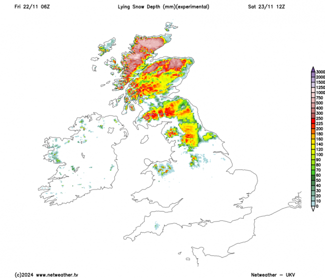
Besides the disruption likely from the heavy snowfall, heavy rain could also lead to treacherous conditions on the roads along with a risk of flooding. The heaviest rain looks to be across Wales and SW England – where as much as 150mm could fall over higher ground.
It will become very windy across all areas on Saturday too, with south to southwesterly gales around coasts, perhaps 60-70mph around southern, western and northern coasts – which will likely cause disruption to crossings while rough seas could bring coastal flooding, especially at high tides.
Rather warm in the strong southwesterly winds continuing Saturday night, temperatures may fall now lower than 15C in some spots in the south, in contrast to widely freezing or below last night. Sunday looks to remain windy across all parts, a band of rain will move eastwards across England and Wales, but drier and sunnier conditions following, but with showers in the west. Much milder across all parts, with temperatures perhaps reaching the mid-teens degress Celsius in the south.
Loading recent activity...