Did you remember the clocks went back an hour earlier this morning? So we have gained an extra hour of light this morning, probably quite noticeable with the clear skies and sunshine across many parts. However, an earlier sunset later means the evening will spend longer in darkness.
It's a rather mixed picture this weekend with regards to the weather. Saturday saw cloud and patchy rain affect the eastern half of England through much of the day, however, further west it was a sunnier story across the western half of England and Wales, with Exeter seeing 9 hours of sunshine. Scotland and N. Ireland turned rather wet, as a band of heavy rain moved east. Today will be drier with sunshine more widespread across England and Wales compared to yesterday, however, rain will move in across Scotland and the west later though.
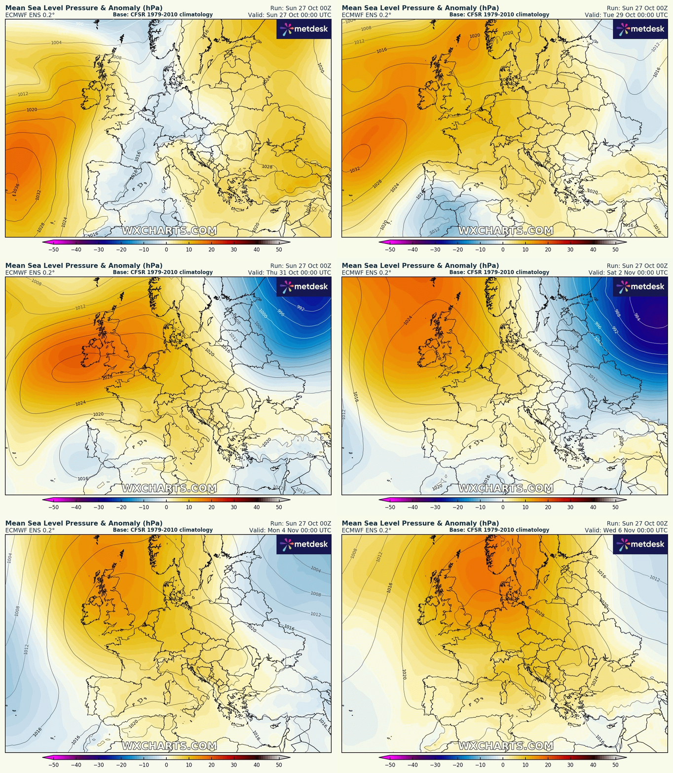
High pressure building in through the coming week, but it will be rather cloud during the first half of the week, more sunshine for England and Wales from the middle of the week
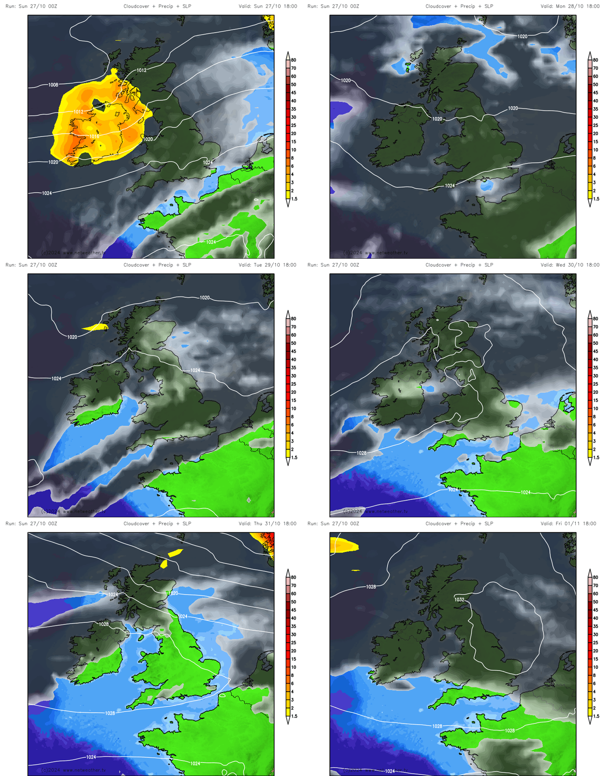
The start of next week is looking rather cloudy but mild for many, with some patchy light rain or drizzle around, with an increasing risk of fog forming overnight too, as winds fall light. But it will be a slowly improving picture by mid-week, as high pressure starts to build in from the southwest. So from Wednesday to the end of the week, it will become mostly dry across England and Wales, still a lot of cloud around but a better chance of some breaks to allow some sunshine. Risk of fog forming overnight, which may be slow to clear each morning. Scotland and N. Ireland breezier and more prone to Atlantic fronts which will feed in cloudier skies here, with patchy rain at times, particularly in western areas. Turning colder across Scotland to end the week, perhaps with some wintry showers over northern hills. High pressure looks to hang around through next weekend and perhaps into the start of the following week too. So a dry start to November looking likely!
High pressure moves in next week and could hang around into the following week too, so a dry and settled start to November
In more detail, Sunday starts promising this morning after a chilly start across large parts of the UK, with clear skies and sunshine away from the far west. Much of England and Wales should stay dry and sunny until dusk, but cloud and rain will spread in from the west across Scotland, N. Ireland and the far western areas of the UK further south through the afternoon and evening. Temperatures reaching 11-13C in the north, 13-15C in the south.
Cloud and rain moving into northern and western areas early evening will spread southeast across all parts tonight, tending to become more patchy in nature, most areas staying cloud with patchy rain overnight. Rain may be heavy at times over western hills. This will lead into a rather dull and damp day on Monday for most, with a string of weather fronts across the UK bringing cloudy skies with hill fog and patchy outbreaks of rain almost anywhere. Perhaps turning drier and brighter across N. Ireland and western Scotland, some brightness can't be ruled out elsewhere too. Mild though, with temperatures reaching 15-16C quite widely away from northern Scotland.
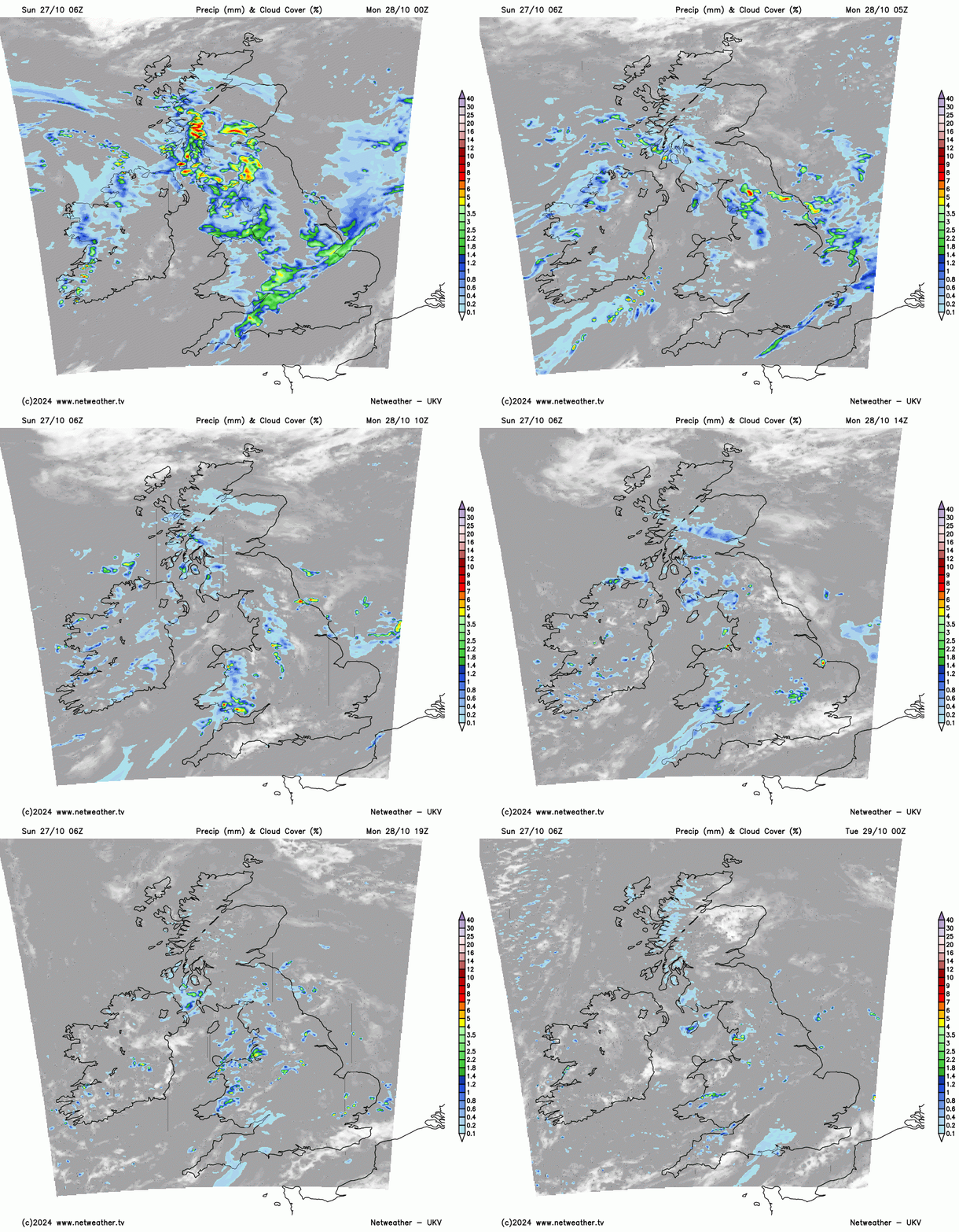
Tuesday sees a ridge of high pressure start to build in across the UK from the southwest, but there will be a lot of cloud trapped under the ridge building in, so it will be another mostly grey and overcast day for many, with limted brightness or sunshine. Some patchy light rain or drizzle still possible at first, especially over hills. Still mild though, temperatures reaching 14-16C widely.
High pressure building in stronger across England and Wales on Wednesday and Thursday, so mainly dry here with a greater chance of breaks in the cloud developing to allow increasing amounts of sunshine in places. And with light winds, fog will readily form where remain clear overnight, the fog perhaps slow to clear in the mornings. So, it could feel the part on Halloween on Thursday evening, with some spooky mists and fog around!
Scotland and N. Ireland, on the other hand, will be cloudier and breezier both days, further away from high pressure and under the influence of passing Atlantic fronts, with patchy rain at times, more especially across western Scotland.
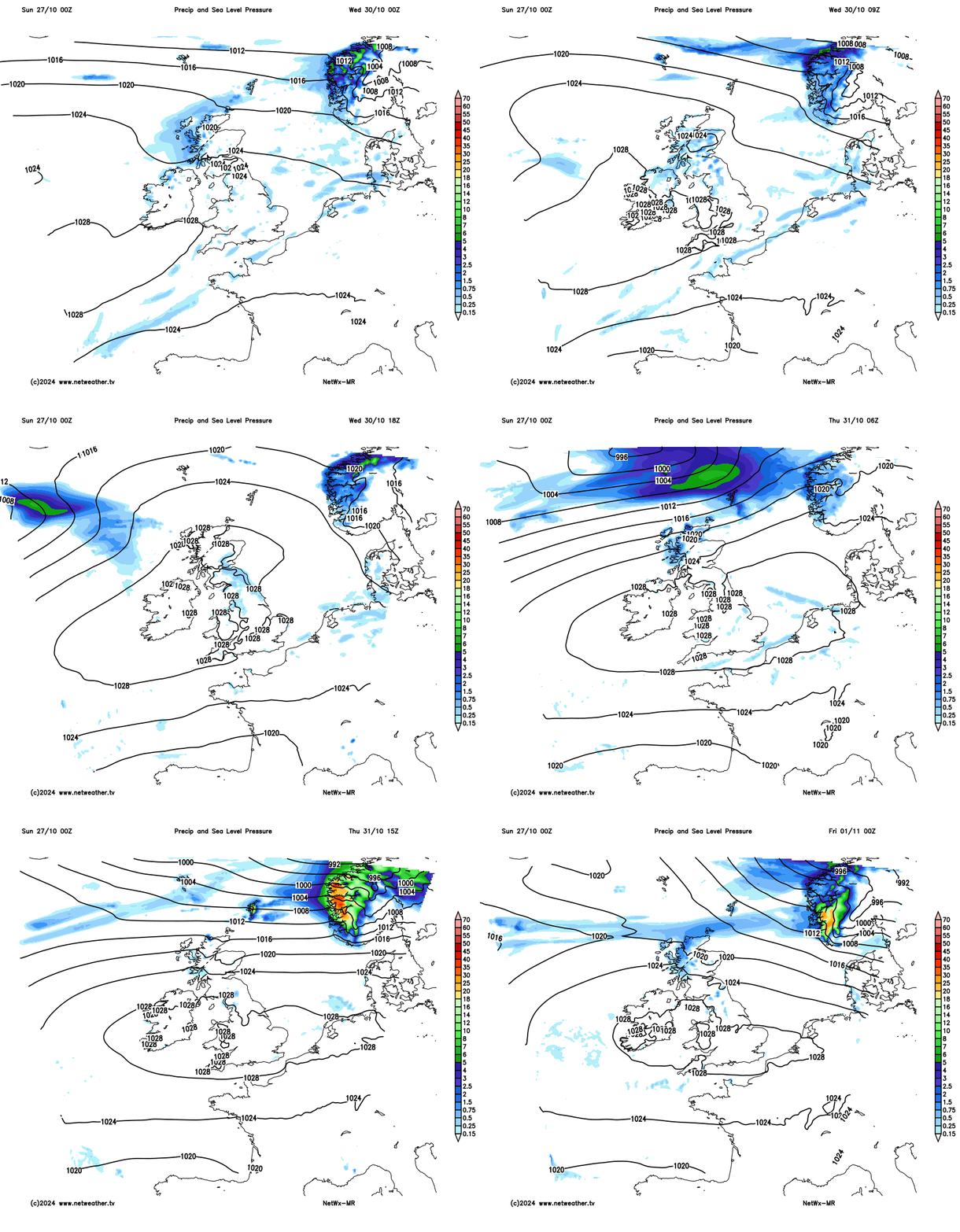
England and Wales staying largely dry and fine on Friday, with sunny spells once any early fog clears, Some uncertainty for Scotland, but it may turn wet and windy for a time, before winds turn northerly here, bringing some wintry showers over higher ground.
High pressure building back in across the UK next weekend, so most areas looking dry and fine with sunny spells by day, but perhaps cold at night, with a risk of frost, where skies clear, following colder and drier air moving south on Friday and overnight into Saturday.
Loading recent activity...