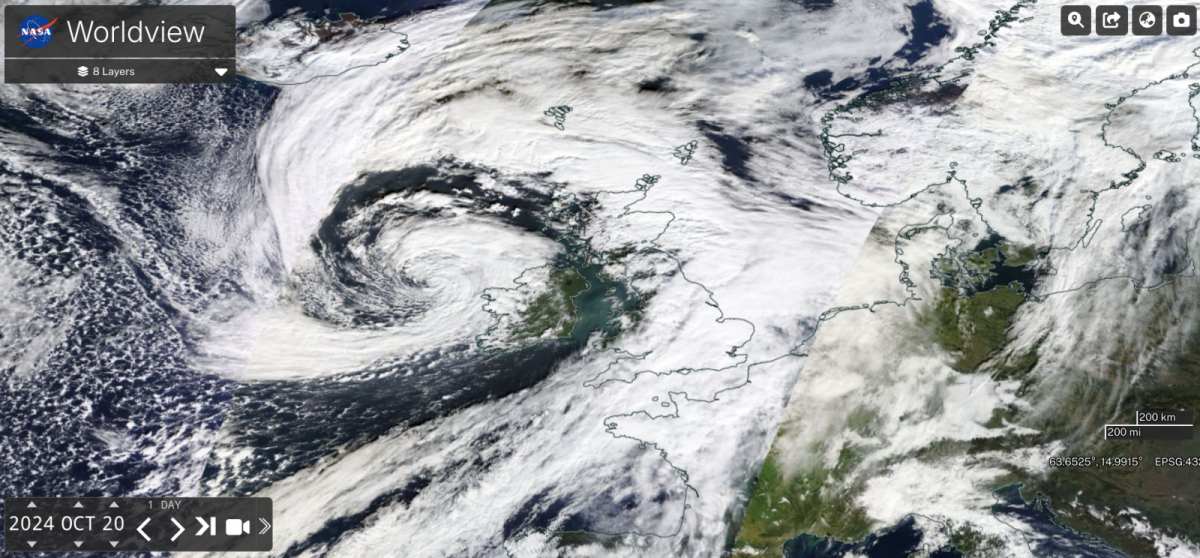
Storm Ashley is pulling away from the Northern Isles towards the Norwegian Sea. Named by Met Eireann due to the forecast severe gales, even storm-force winds and high gusts combined with very high tides. Western counties of Ireland, coastal Northern Ireland, and the Western Isles all saw coastal flooding as the tides peaked. At high tide there were issues around the UK with large waves hitting the coasts and part of the Thames Path falling away near Kew Gardens after high river levels last week. Other parts of the UK saw disruption to rail services as large waves and overtopping reached coastal tracks or the strength of the winds meant speed restrictions were placed on exposed lines.
Network Rail Scotland
“Our response teams are patrolling the Mallaig and Oban branches of the West Highland Line overnight following #StormAshley, using road-rail vehicles. They've cleared several small trees and branches so far to keep the railway open.”
Ferry services were cancelled in the wild conditions in the Irish Sea and around the coasts of Scotland. Flights were also disrupted or cancelled with those managing to land gripping on tight as the planes were buffeted about and subjected to a bumpy landing.
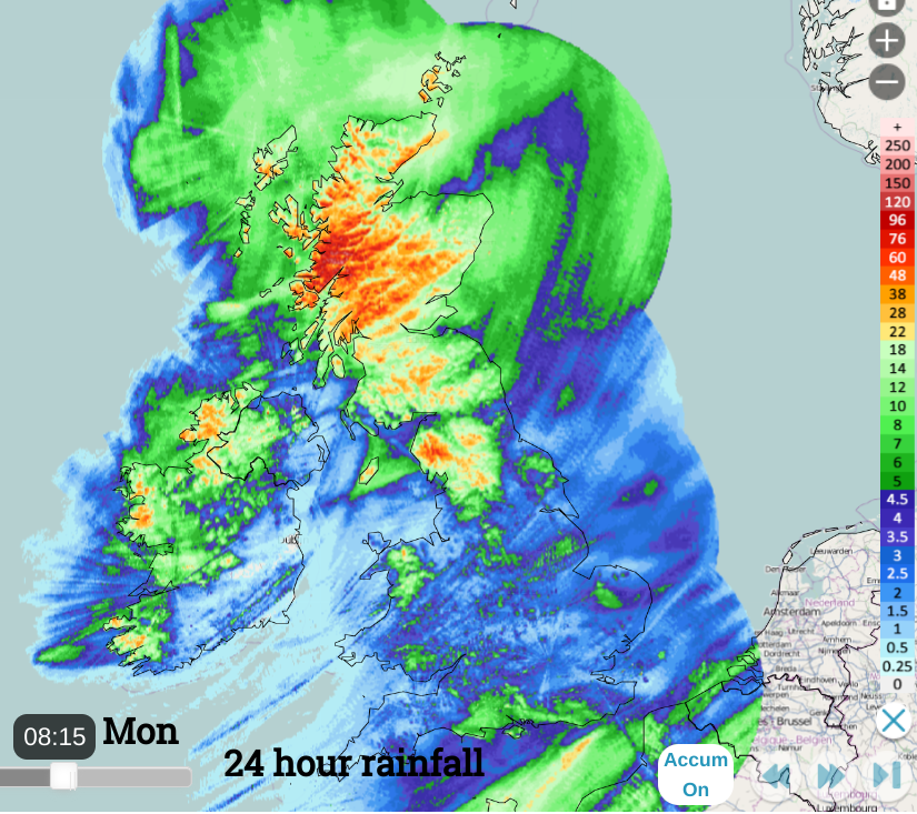
Netweather radar 24 hour rainfall totals showing heavy rain for western Scotland as the wrap-round occlusion brought heavy rain on Sunday evening along with the strongest winds.
In Ireland, power supplies were hit as the gales continued
“ESB Networks teams restoring electricity supply to approximately 53,000 impacted customers. Worst impacted counties include Mayo, Galway, Sligo, Clare, Cork, Kerry and Dublin. If you come across fallen wires or damaged electricity network, never, ever touch or approach these as they are LIVE and extremely dangerous. “
By Monday morning, ESB Networks said 16,000 customers were without power.
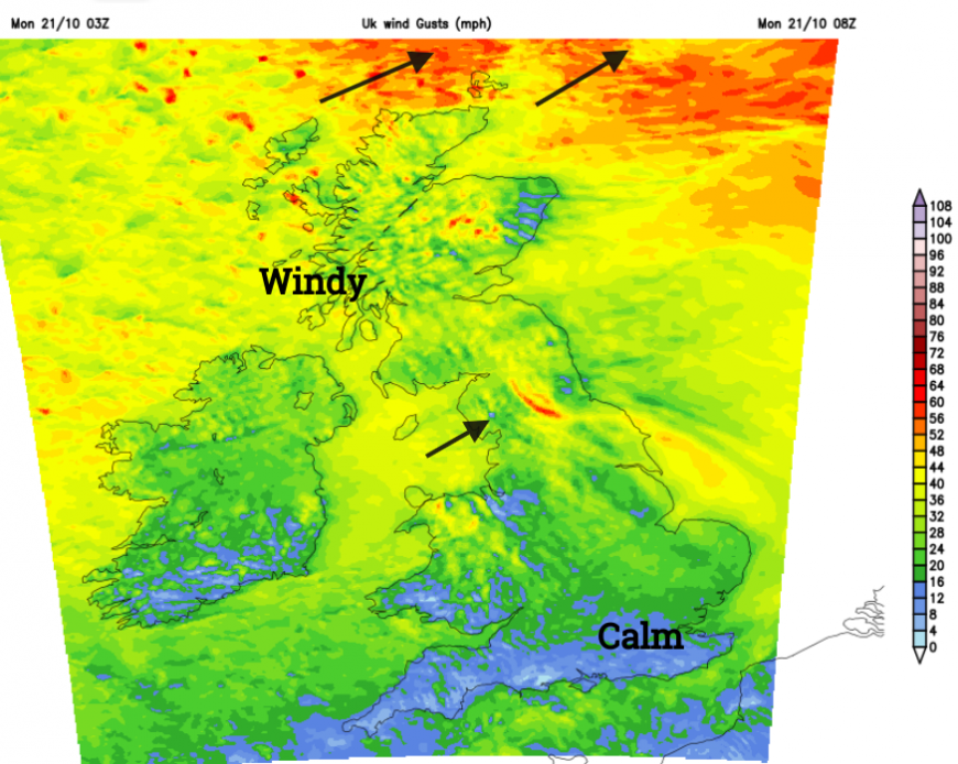
Over the tops of the Scottish mountains, the gusts were over 100mph. At lower and more populated levels one of the highest wind gusts was 82mph at Aberdaron, on the Llŷn Peninsula, Gwynedd.
Monday
Scotland is left in a brisk southwesterly flow with heavy showers from the west. There has already been lightning south of Mull. These will increase and become more widespread during the day but southern Scotland and the east coast will stay more sheltered with bright or sunny spells. Temperatures will be around 11 to 13C. 13C for Edinburgh.
Northern Ireland will have a fine sunny start but the winds will freshen as a scattering of showers moves in from the west this afternoon. Belfast should reach 14C.
Wales will see an improving picture this morning as the sheet of frontal cloud pulls away to the east. There are a few heavy showers but these will fade as temperatures across Wales reach 14 or 15C, Cardiff perhaps 16C in the sunshine.
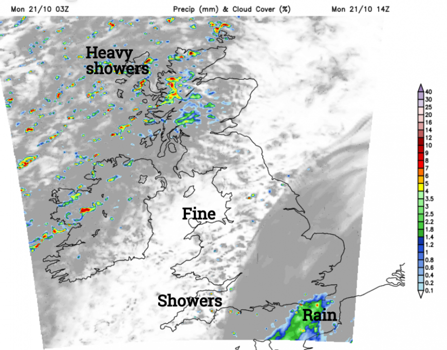
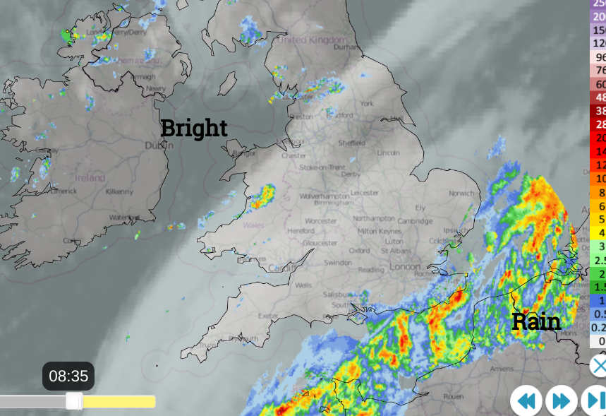
There will be a few showers about over England today and some could bring sharp downpours. A frontal band is lurking. This is the same rainband that went across Britain on Sunday morning, linked back to the centre of Storm Ashley. It is waving back into SE England bringing rain and a large shield of cloud. Temperatures across England will be around 14 to 16 but could nudge a few degrees higher in Greater London if the cloud breaks as the rain clears.
Tonight
The winds will remain light here and this dampness and calm means that there will be the risk of patchy fog during Monday night. This looks focused on Kent and Sussex and so likely to affect the M20 and M2.
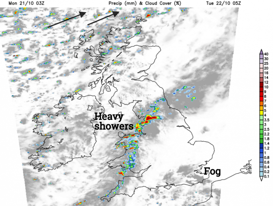
Further north tonight the heavy showers will move as a band from Northern Ireland and NW Scotland down to the Irish Sea. Reaching into Wales with heavy downpours for NW England as commuters set off on Tuesday.
More discussion and chat about Storm Ashley.
Loading recent activity...