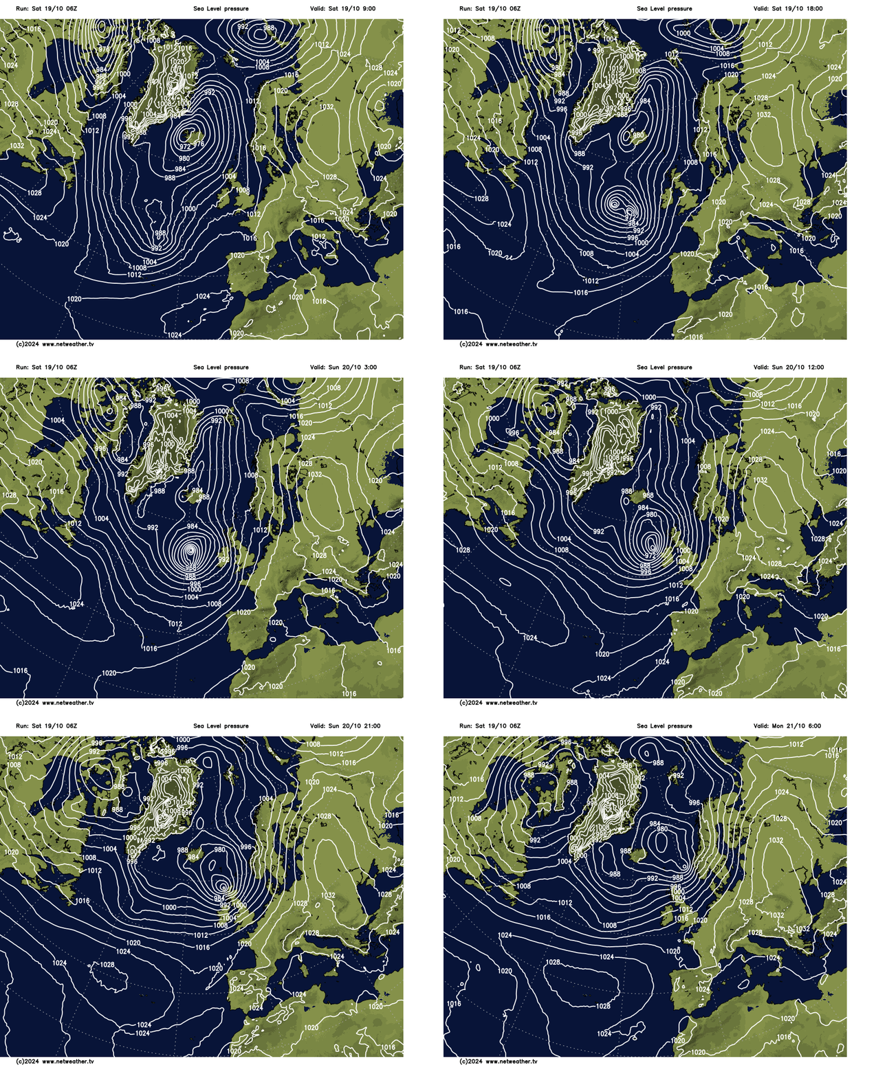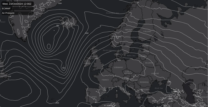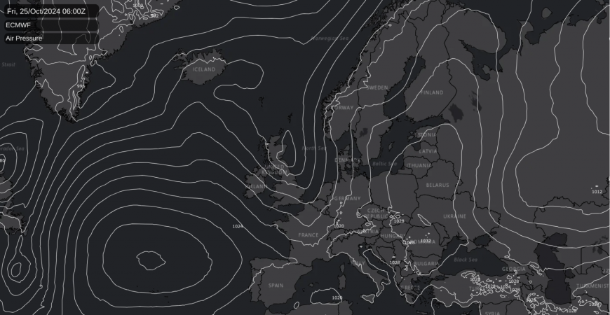
As Storm Ashley looms, memories of last year's Storm Babet resurface. While Ashley brings gale-force winds to parts of the UK, rainfall is expected to be less severe. Looking ahead to the latter part of October, high pressure is expected to play more of a role.
This is around the first anniversary of Storm Babet, which brought persistent rain and strong winds to many parts of central, northern and western Europe. The low pressure system was held in place over southern Britain via a Scandinavian blocking high, which resulted in rain-bearing frontal systems stalling over parts of the country for a substantial period.
Flooding especially hit areas of eastern Scotland, due to a combination of persistent rain and easterly winds, resulting in the heaviest and most persistent rain affecting the east of Scotland (whereas traditionally, with the usual prevailing westerly and south-westerly winds, it is western Scotland that receives the majority of the rain). Flooding was also widespread in the eastern half of England, including Tyne and Wear, Yorkshire and the east Midlands, and rail services were heavily disrupted due to the flooding. Overall, for the east Scotland region, October 2023 was the wettest October in a Met Office rainfall series from 1836, and for the UK as a whole it ranked inside the top 10 wettest. This was due to several notable rainfall events through the month, but for many regions Storm Babet produced the most notable such event.
Most of us will not see those sort of quantities of rain during the next two days, but we are looking set to see our first named storm of the season - Storm Ashley - which is forecast to deepen considerably as it moves north-eastwards across the eastern side of the North Atlantic. This is known as a "weather bomb", where a depression deepens by at least 24 millibars in 24 hours due to explosive cyclogenesis. The depression is currently weak and located close to the Azores, but by tomorrow morning it is forecast to have deepened dramatically and to lie to the west of Ireland.

The Met Office has issued a yellow weather warning for wind that covers all of Scotland and Northern Ireland, together with Cumbria and north-west Wales. An amber warning has been issued for coastal areas of western Scotland from around the Firth of Clyde northwards, indicating that this region is especially forecast to see strong winds and disruption and potential for injuries and danger to life from waves and beach material. The Scottish islands are especially forecast to be heavily hit. While the strongest winds will generally arrive tomorrow, in northern Scotland they are forecast to continue until Monday morning.
As the system will move through quickly, rainfall totals are not forecast to be unusual, with most of the country forecast to see less than 10mm of rain in total from the system. The main exception will be coastal areas of north-west Scotland, where totals of 30 to 40mm are likely. While this is not as unusual for north-west Scotland as for most other areas of the UK, the combination of gale force winds and 30 to 40mm of rain is likely to bring flooding as well as damaging gusts of wind, which will lead to disruption.
After Storm Ashley moves away, the general trend will be towards high pressure building from the south, bringing more settled weather especially to southern and eastern parts of Britain. There will be a temporary build of pressure around Wednesday, with the associated dry weather extending to all parts of the country for a time.

Although winds will be southerly around midweek next week, it is not expected to be unusually warm because the air will be coming in from continental Europe rather than from the Mediterranean or north Africa. There is potential for some areas of the country to see plenty of sunshine as well as dry weather, especially in southern, central and eastern England.

A low pressure system is forecast to bring some wind and rain eastwards through this coming Friday and Saturday, with the high pressure area moving away eastwards, but another area of high pressure will develop to the south of Britain at the end of October and into early November. However, due to its placement, it is probable that most areas of the country will be cloudy, with some light rain and drizzle near west-facing coasts and some more persistent rain for the north and west of Scotland, due to a feed of warm, moist tropical maritime air around the northern flank of the area of high pressure. Areas to the east of high ground, particularly in eastern Scotland and north-east England, tend to see the most sunshine in this type of setup. Temperatures are forecast to stay mostly above the seasonal average for the rest of October, but they may fall close to normal at times in the south when high pressure builds and we see some colder nights and fog patches.
Loading recent activity...