For the start of this week, the main steer for our UK weather is a large low pressure lurking to the west of Ireland during the weekend. For most of Britain and Ireland, there will be bright or sunny spells with clusters of showers from the south and very light winds. These will need watching on Monday evening as heavier, even thundery ones arrive over SW Britain. There will be mild air with temperatures of 16 to 19C.
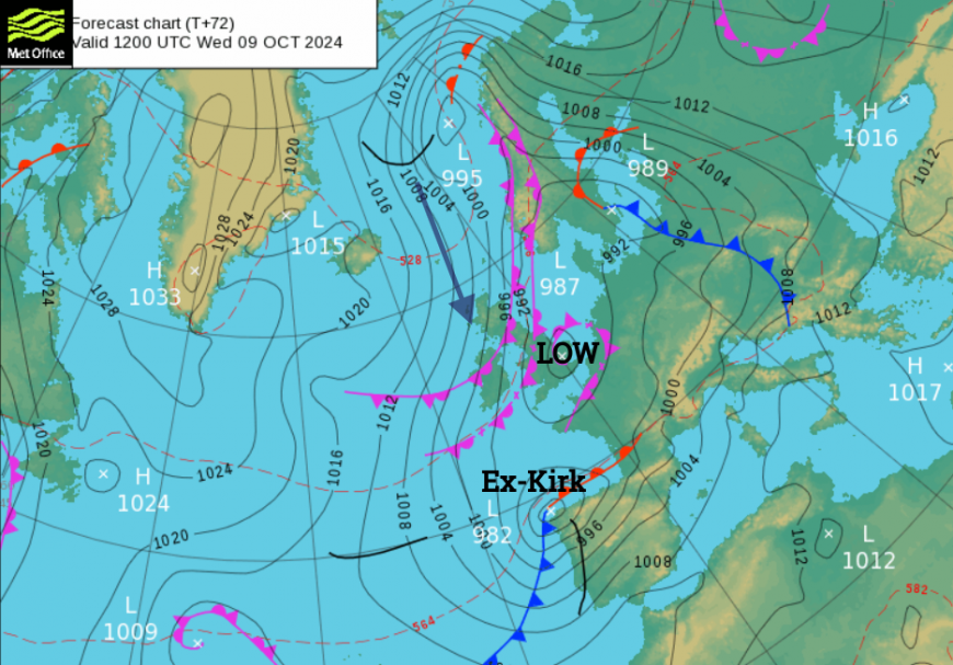
Occluded fronts will settle over the far north of Scotland in a fresh easterly wind. There is cooler air to the north of these rainbands and colder air from the Arctic will feature for the UK later this week, with a bit of snow in the forecast. The change from a mild southerly to a chilly northerly will happen as ex-Hurricane Kirk moves by.
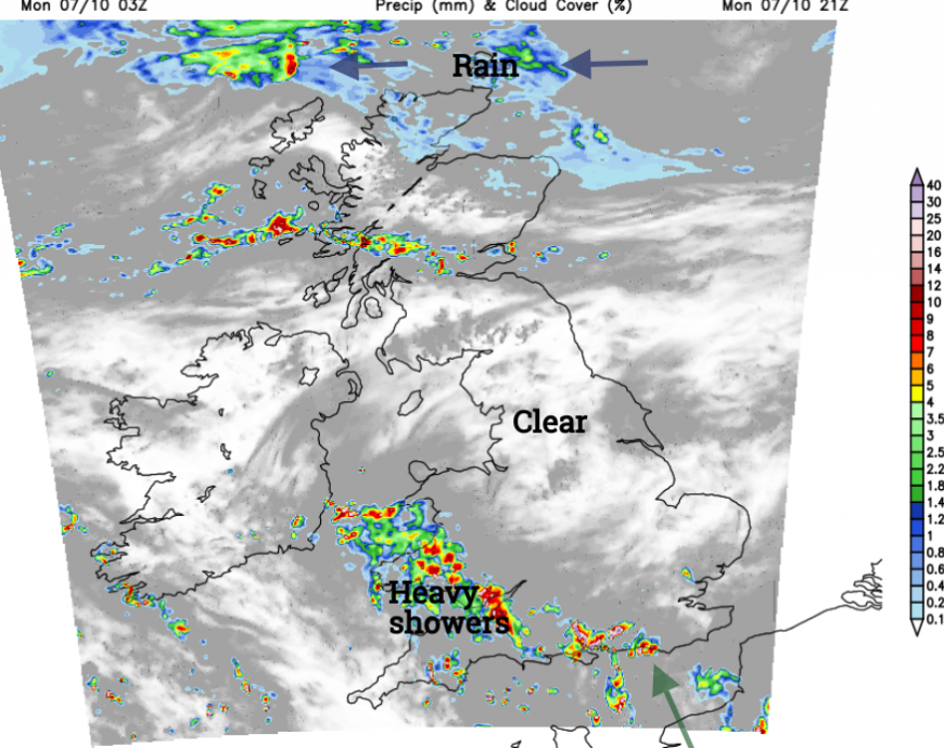
There will be heavy downpours tonight, you might hear the rain but they will be edging northwards, not stuck in the same place. A band of showers looks to settle over NE England, and SE Scotland across to Northern Ireland on Tuesday, pushed on shore by the developing northeasterly wind. That will make the day feel cooler. Across England and Wales, there will be a rash of showers by the afternoon, again with the change of thunder and lightning.
By Wednesday, it will be bright and still mild for southern Britain as a scattering of light showers develops. In the far north, there will be sunny spells, a colder N/NE wind and a scattering of showers. For a central swathe of Britain, especially the northeast of England, there will be plenty of cloud and outbreaks of rain in a cool N wind but the rain will become confined to the east coast of England later.
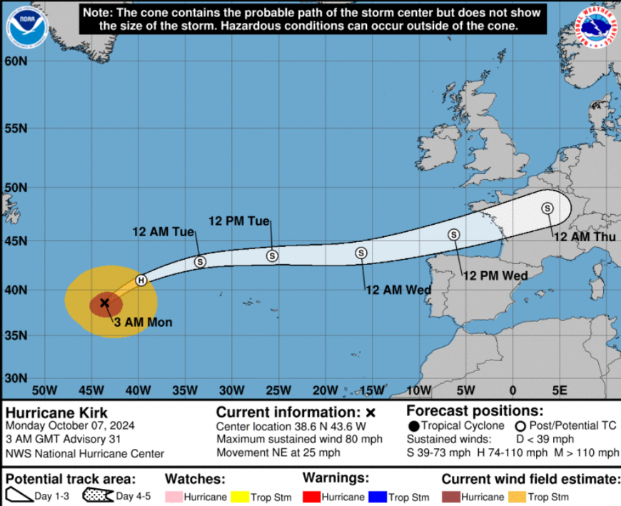
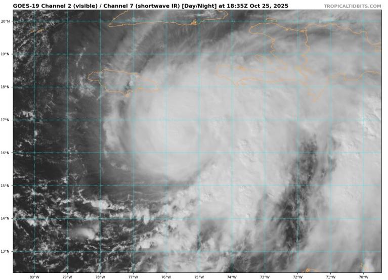
NHC “Kirk is in the process of transitioning into an extratropical cyclone…Extratropical transition should be complete on Monday when the system moves over water temperatures in the low 20's C and into an environment of nearly 40 kt of vertical wind shear.”
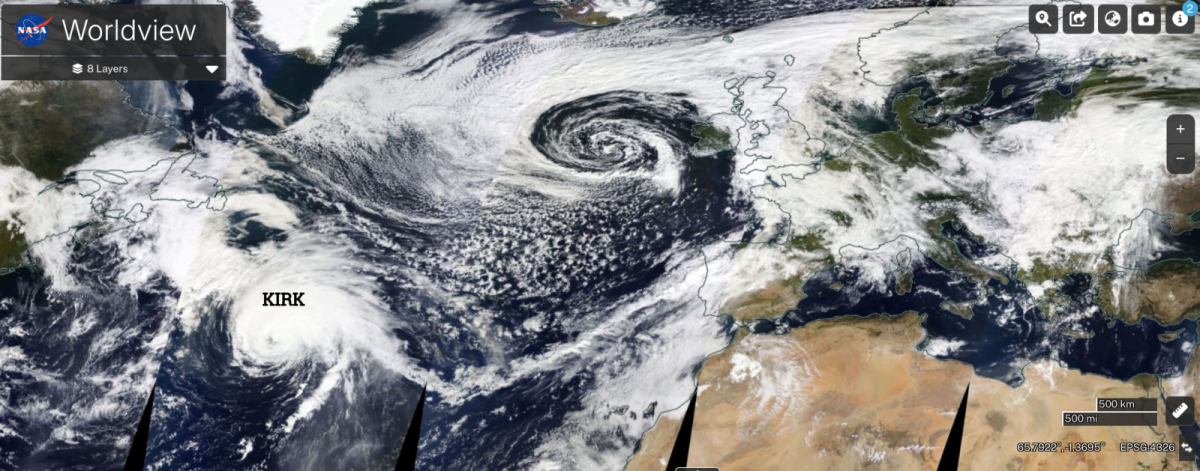
Hurricane Kirk is way out in the Atlantic on Monday and changing from a tropical cyclone to an extratropical low. This low, ex-Kirk, will get caught up in the mid-Latitude westerly flow, move to the north of the Azores on Tuesday and then head towards the Bay of Biscay. AEMET has amber warnings for heavy rain, strong winds and large coastal waves across the north of Spain midweek, as does IPMA for northern Portugal. IPMA also have various warnings for the Azores, including a red wave warning for ‘Waves from the west, reaching a maximum height of 19m’ accompanied by heavy rain and strong winds.
Ahead of ex-Kirk, Meteo France is warning of a Mediterranean episode ‘ of heavy rain and thunderstorms are expected between Mon Oct 7th afternoon and Tues Oct 8th, particularly in the South-East… in the Cévennes’.
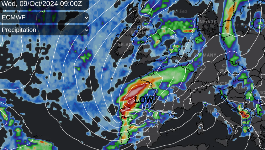
Although there are variations in the path of ex-Kirk, western and NW France look to bear the brunt of the wild weather next. Heavy even torrential rain and coastal gales. The ECM model then takes ex-Kirk across the Low Countries, even towards northern Germany and Denmark, possibly Sweden with more heavy rain and a wider risk of flooding.
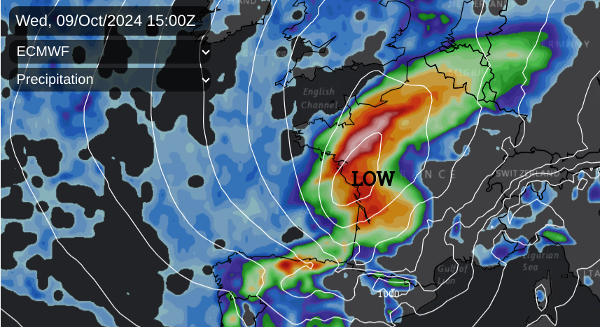
The UKV isn’t interested in any rain reaching SE Britain on Wednesday afternoon as the low moves across France but other models have shown light to moderate rain reaching the Home Counties but not amounting to much. The cloud cover will clear slowly on Thursday from England.
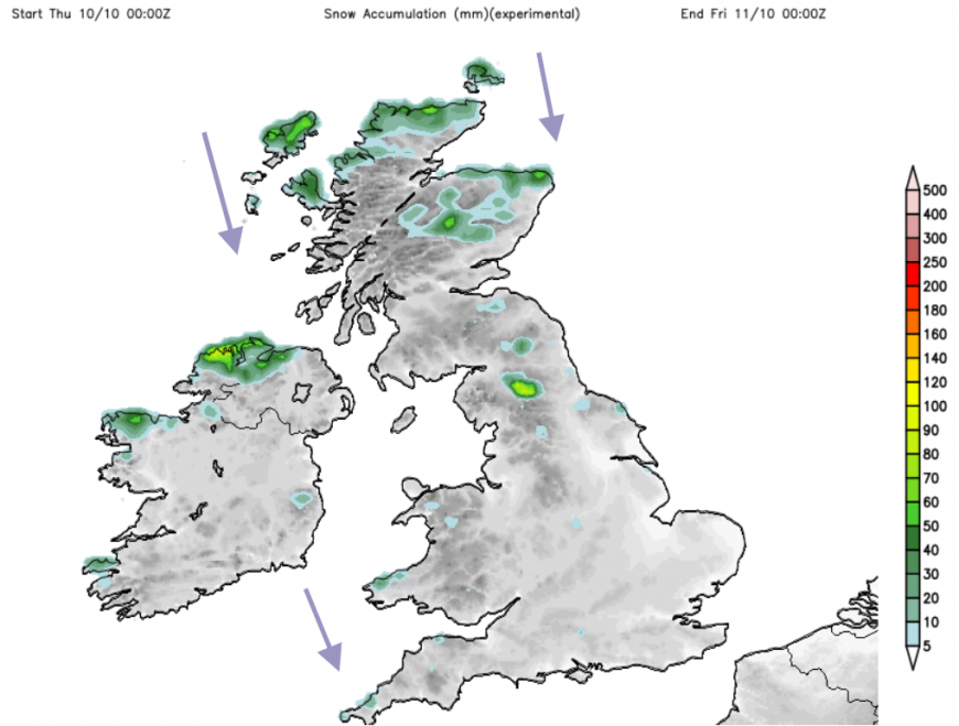
As the low swings up through Europe, the UK experiences a cold northerly flow. Many places will see autumn sunshine but with a nip in the air. There will be scattered showers and these will include settling snow on the hills of Northern Scotland and the tops of the Pennines, as well as wintry flurries perhaps reaching Eryri National Park (Snowdonia) and Exmoor. Nighttime temperatures will fall, and there will be a frost for some by Thursday night. We miss ex-Hurricane Kirk but end the week in colder air behind that low pressure.
Further discussion and chat on all the Hurricanes, including Kirk, Leslie and Milton on the Netweather community.
Loading recent activity...