More heavy rain on Monday with warnings for northern England. This rain will clear over the North Sea as the low pulls away and high pressure brings a settled midweek.
In the past week, there has been disruption due to flooding on the rail network, an ongoing issue in the West Midlands.
“Flooding between Shrewsbury and Wolverhampton means all lines are blocked. As a result, trains may be cancelled or revised. This is expected until the end of [Monday].
High winds brought down a tree on Thursday onto the West coast mainline in southern Scotland and there have been planned engineering works this weekend. After the heavy rain of last week and more today, further disruption seems likely although there is a more settled outlook for midweek. It will become dry and clear but chilly with frosts by night.
Network Rail extreme weather impacts : Heavy rainfall can cause flooding that results in tracks being underwater and embankments being damaged, causing potential landslips. Flooding can affect points and signalling equipment, which allow trains to move from one line to another

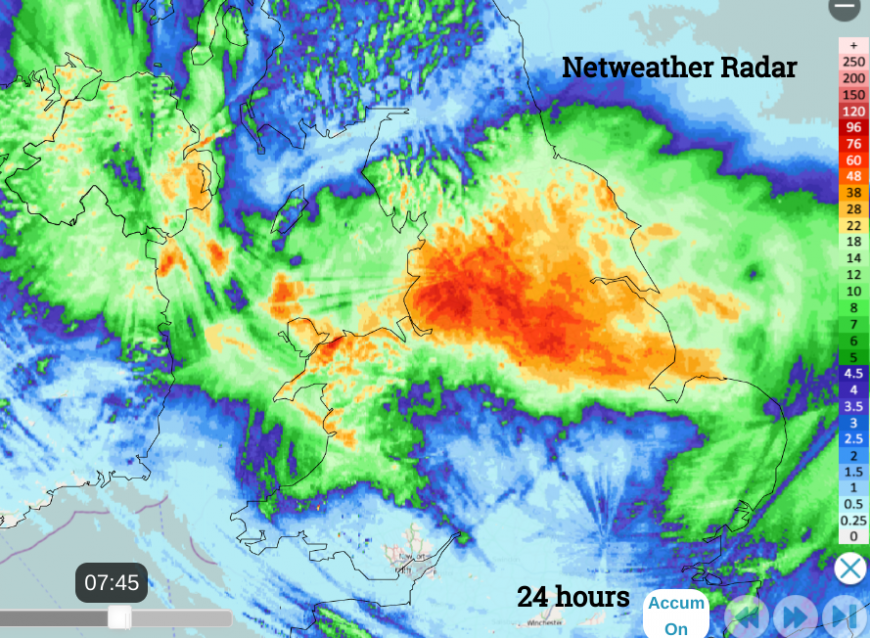
Netweather Radar 24 hours accumulated rainfall until 7:45am Tues 1st
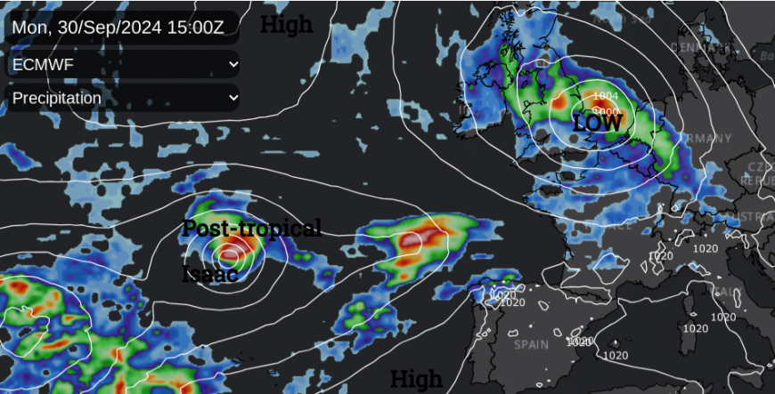
A slow-moving low pressure will continue to edge across Wales and England for the start of the working week. On Monday there is a lot of cloud over the UK but most of the frontal rain is to the north and east of the low centre which means there is some respite from the downpours for a large part of southern Britain. A blustery west-then northwest wind will make the West Country feel colder today and along the English Channel to Kent. The mild air clings on to East Anglia this afternoon with temperatures of 14 or 15C and up to 17C in London.
"Flooding is possible but not expected from surface water and local flooding from rivers is probable today (Monday) and Tuesday in parts of the Midlands, East and North of England." Env.Agency
Scotland becomes drier later in the day but there is a band of wet weather. From Northern Ireland, down to northern Wales and across northern England. There are warnings for rain, due to the existing conditions and the rain rotating around this low pressure into the night., The low centre will be over The Wash with heavy rain around the Humber by teatime.

As the low slowly sinks S/SE the heaviest rain will move down eastern England into East Anglia as areas to the north and west become drier in a colder northerly flow.

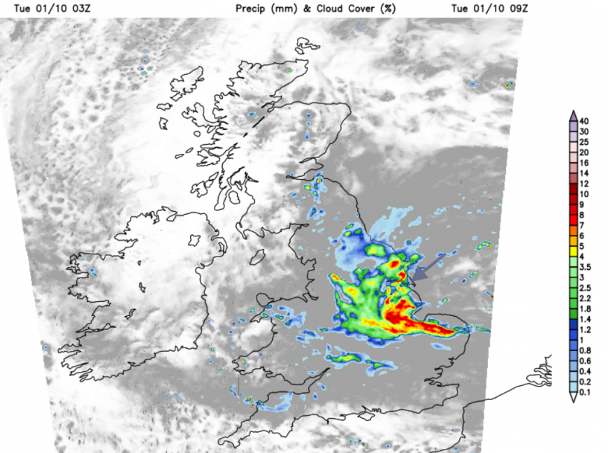
There will be a wet and windy start for Tuesday for eastern England with a chilly northerly from North Yorkshire into Lincolnshire. The frontal rain continues to rotate around the low centre for the Tuesday morning rush hour, with outbreaks over east London but also driven further inland for eastern Egnland. Cooler air in the north will be offset by sunshine but it will feel colder after dark. The cloud and outbreaks of patchy rain off the North Sea will continue for eastern and central England into Tuesday evening, reaching Wales and Devon overnight as a scattering of showers appears for East Anglia and Kent.

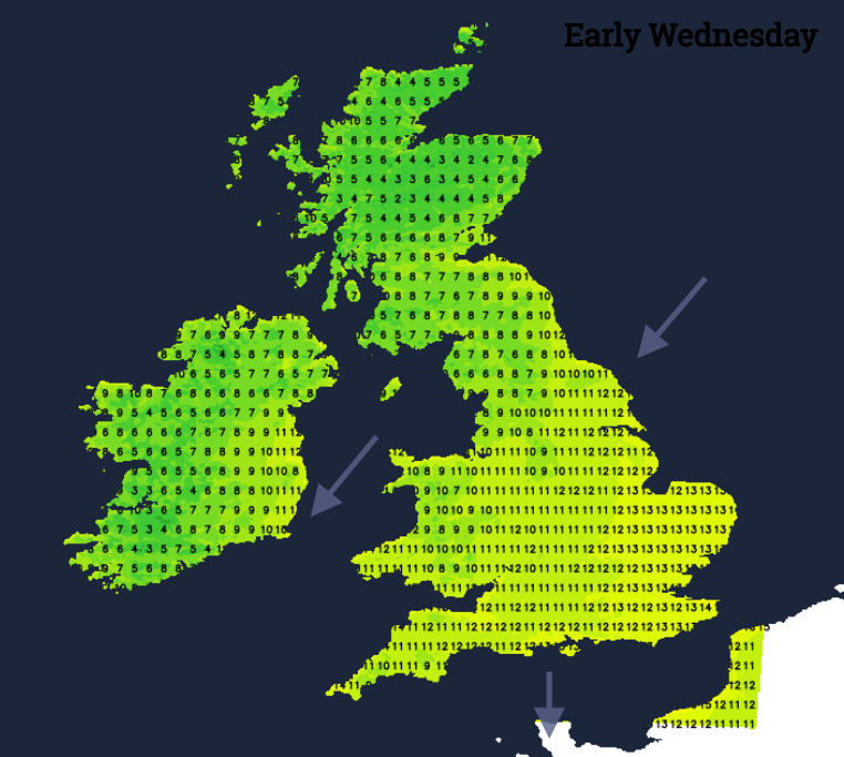
As the low pressure pulls away to Germany, high pressure rolls in over Scotland. The northeasterly flow will keep many parts feeling cool even with good sunny spells but southern England could reach 18C although with scattered showers over SE Britain in the flow off the North Sea.
The UK weather becomes clear, settled and dry with lighter winds and a chilly night Wednesday into Thursday. Again there will be the chance of frost for the northwestern half of the UK.
The high pressure doesn’t stay put. It rolls over Scotland and to the North Sea by Thursday. There will be very light easterly winds for eastern England with a more southerly flow for western Britain and Northern Ireland. Thursday will be dry and sunny with temperatures in the mid-teens.
The high pressure will have blocked any Atlantic low pressures and rain (including the weak remnants of Hurricane Isaac) but by Friday there will be outbreaks of rain toppling into northern Scotland and much later in the day, into Northern Ireland with blustery southerly winds.
So a drier outlook after another wet spell today for parts of England.
Loading recent activity...