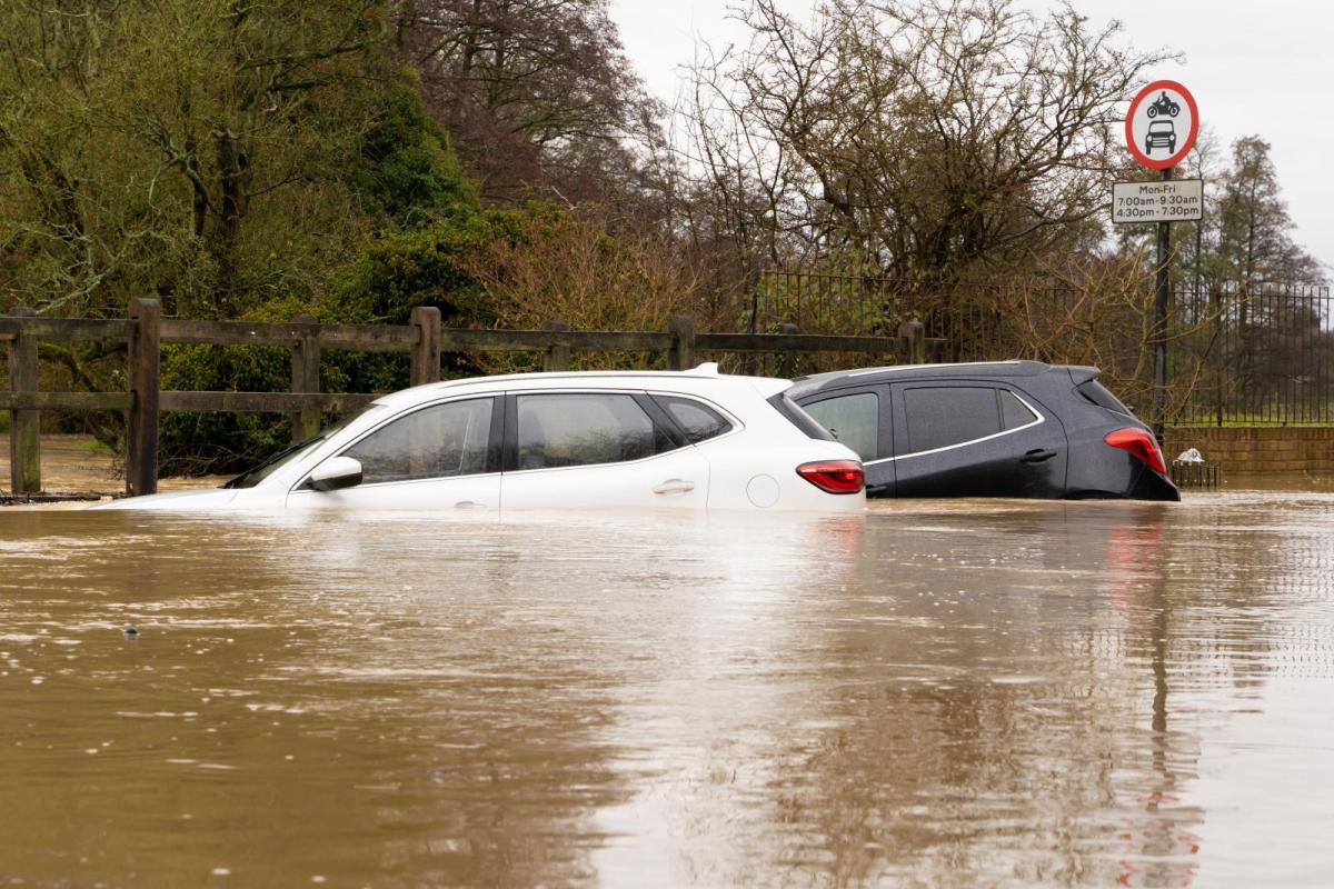
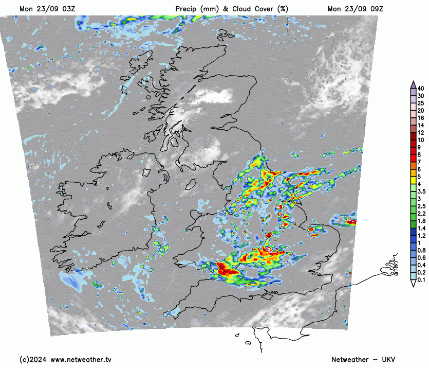
There is an amber warning for more heavy rain on Monday 23rd September. Through the weekend there was intense rainfall with over a month’s worth falling in one day for parts of England. With thunderstorms and at least two tornadoes spotted, it has been a lively spell.
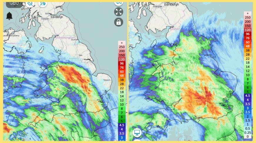
Weekend 24 hour accumulation rainfall totals Sat 21st 10:20am til Sun am and Sun 22nd 10:20 am til Monday am. Showing highest totals in red. The radiating lines are where objects block the radar beam from one source.
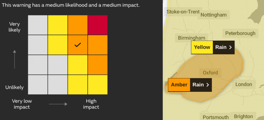
A wider yellow warning for rain extends over much of England and Wales. There has already been 50 to 100mm of rain in places and as a low pressure slowly rotates its weather fronts over Britain today, the same amount could impact some areas.
The Amber warning covers central and eastern England, with moderate impacts likely due to the weekend rain and existing surface water. The Met Office warns of further flooding and travel disruption.
Gradually through today the band of rain will edge eastwards, over East Anglia tonight and clearing away over the North Sea to leave drier weather for Tuesday.
There is a new Atlantic low heading our way for the middle of the week, bringing another band of rain for Wednesday night. Autumn is here.
Loading recent activity...