The steady, dry weather of midweek will be interrupted this weekend. Southern Britain will see heavy, even thundery downpours with bright and sunny spells. Low cloud and murk will continue to feed off the North Sea into northeast Britain with drizzle, leaving northwestern parts brighter with warm sunshine.
The surface winds are from the east, bringing in thicker low cloud by night. This will keep daytime temperatures subdued but will save the overnight temperatures from dipping away into single figures. Cooler air will move over Scotland at the weekend as warmer air remains further south. Temperatures could reach 24 or 25C around London.
The details in this weekend's forecast will be tricky. There will be regions prone to different weather types; a warm day with sunny spells but with a risk of hefty downpours, haar or seafret giving a drab, cool and damp day, or a fair day which will feel warm in sheltered sunshine.
For Friday afternoon the showery zone looks to be SE Britain in a northeasterly breeze with showers popping up in the sunshine and low to mid 20sC. Through the evening the risk of showers moves through the Midlands, SW England and over Wales. During Friday night clusters of heavy showers will appear from the English Channel into southern England and south Wales on Saturday morning.
The well-scattered shower risk edges north and west during the day. Some areas will miss the showers and stay dry. You might catch a light one or experience a slow-moving torrential downpour with lightning. The UKV model takes most of the heavy showers towards Merseyside and north Wales by Saturday evening.
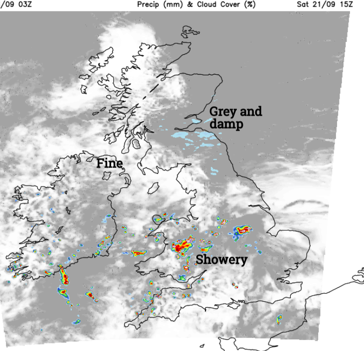
Around the Firth of Forth looks dreich all day in the easterly flow.
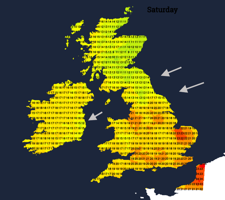
Further clusters of heavy showers feed up from the southeast on Saturday night with more showery outbreaks by Sunday morning. Maybe not so much for eastern England but across much of Wales and the southern half of England there will be a higher chance of seeing a shower on Sunday with more cloud about.
A zone of showery rain will continue into Sunday night over southern Britain.
Western Scotland and Northern Ireland will see the best sunshine but the air will be cooler. Central Scotland could brighten up in a more northeasterly flow.
Europe
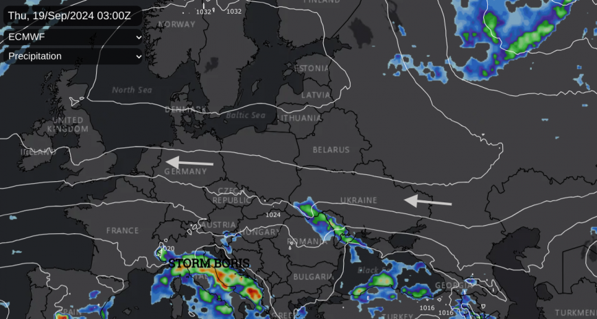
Our showery breakdown starts with a few showers on Thursday night from a feature from Poland and Germany. A low pressure develops over northern Spain and generates showers over France and then into southern Britain. Italy, the Adriatic, particularly Croatia have a few more disturbed days of heavy downpours, strong winds and flooding. Rain showers will spread into mainland Greece at the weekend. Other parts of central and eastern Europe are still reeling from Storm Boris and the devastating flooding as high river levels move downstream, widening the reach of the incredible rains.
 Steppe Grey Shrike - off course in East Lothian
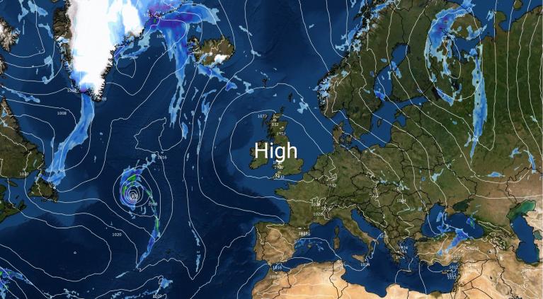
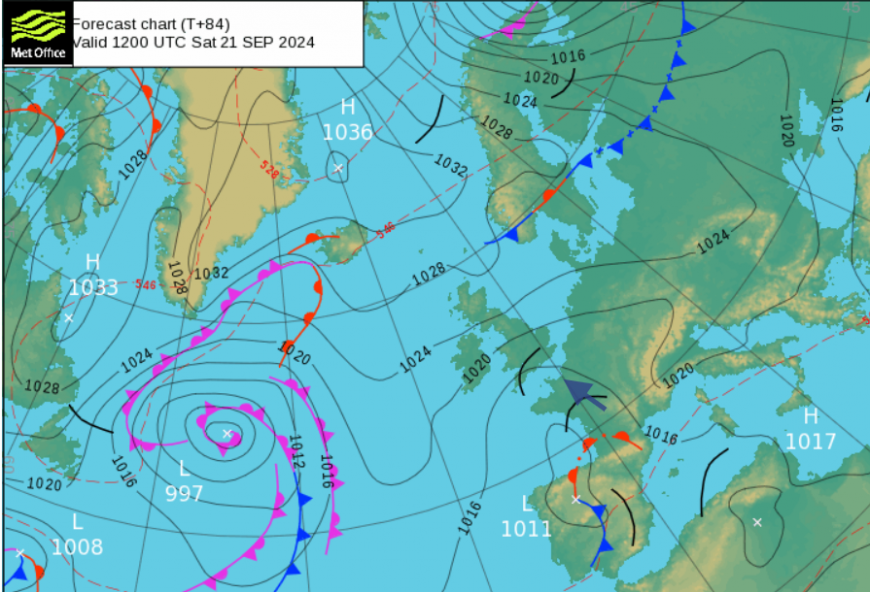
High pressure over northern Europe has been steering our weather from the east or warmer southeast. The glorious September sunshine and this warm continental airflow delivered a late taste of summer to the UK. The cooler North Sea will generate more low cloud later this week. This easterly flow right across continental Europe has resulted in some unusual and scarce bird sightings in the past week or so. Drift migrants can appear from the North Sea landing, tired on the east coast of Britain. The haar event of last week could have disorientated birds as well resulting in eastern vagrants. Twitchers and local bird watchers may have been enjoying some rare sights this September but it looks like Atlantic low pressures will return next week, bringing wind and rain.
Loading recent activity...