High pressure over or near the UK will bring a lot of settled, dry weather this week. The nights will turn chilly where the skies are clear but by day there will be warm sunny spells and light winds. As the harvest continues, the trees are beginning to change colour, with hints of yellow now appearing on the leaves after last week's colder spell.
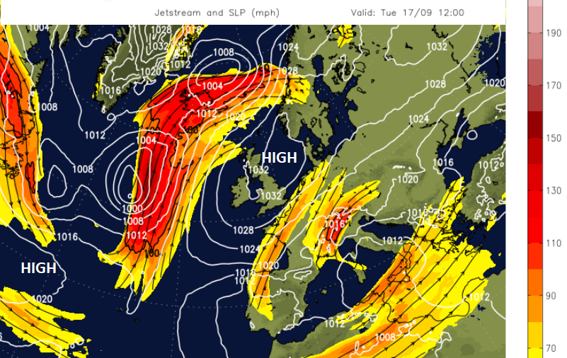
Huge buckles in the jetstream with anchoring high pressure are keeping the weather steady and locked into place. For the UK, that means we have a fine September week but it is also responsible for the terrible flooding in central Europe with stuck low pressures. Unsettled weather with further torrential rain remains over Italy and the Adriatic this week.
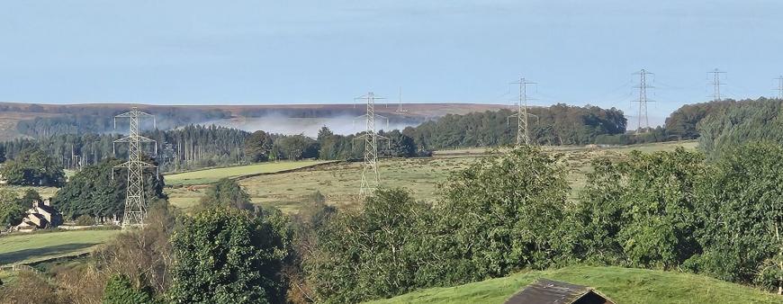
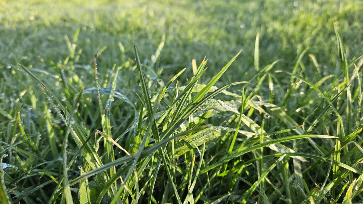
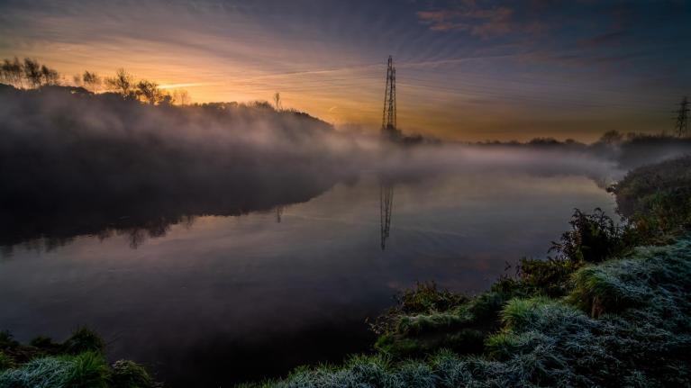
There has been dew, fog and a touch of frost on the grass already this week. Weather fronts with a little bit of patchy rain will brush past Lewis and Shetland today. There is more cloud for the Scottish Islands, the west coast and into Northern Ireland. There is a bit of cloud for East Anglia and SE England this morning with a few showers off the coast of Dover and a NE breeze. Everything rotates around, clearing and brightening from Northern Ireland but persisting for The Wash and East Anglia.
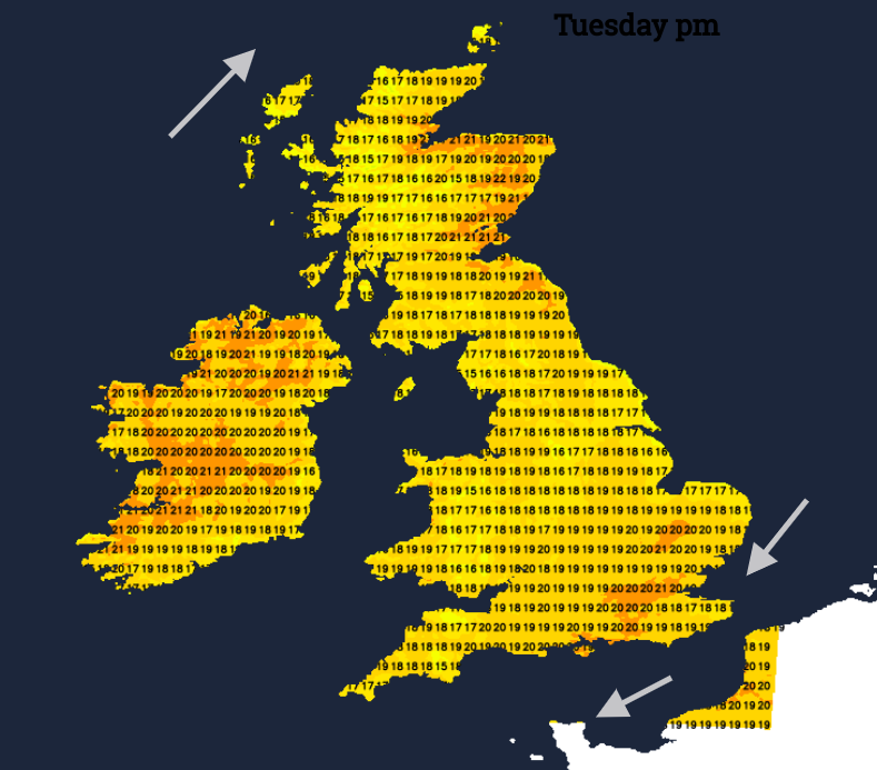
Northern Scotland should reach into the low 20sC as will southeastern England inland. Places that could see 21C (70F) today are Aberdeen, Manchester, Derry, Cambridge, Cardiff, Southampton and London.
Tonight the winds will fall light everywhere with a central swathe of Britain seeing temperatures down into single figures and the same for Northern Ireland. What will interrupt will be increasing cloud, over mainland Scotland but also flowing in off the North Sea for England and inland Wales.
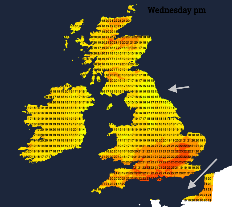
There will be patches of mist and fog overnight so a slower start for Wednesday morning until the cloud thins and breaks. Eastern coasts of England could hold onto more cloud through the day but for most, it will become fine. Aviemore could reach 24C, Carlisle and Swansea up to 21C as inland SE Britain moves into the low 20sC. Overnight the low cloud returns from the North Sea, again with a cool mix of fog and murk.
Northern Britain and Northern Ireland will be the cooler regions for Wednesday night. As the centre of the High slips over the North Sea and southern Sweden, the east/ northeasterly wind continues over southern Britain as the rest of the UK sticks with hardly any breeze.
Thursday sees a similar setup but could have different results for your location. There will be low cloud and fog, but other parts will stay clear and colder, even with a touch of frost on the grass for rural areas. The cloud will erode allowing more sunshine and warmth. Again the temperature will widely be in the high teens or low twenties CElsius but cooler for some eastern coasts where the cloud sticks.
By Friday, the cloud could bring dampness into eastern Scotland and northern England as showery outbreaks of rain arrive in southern Britain.
Loading recent activity...