
As much of the UK basked in blue skies, sunshine and early September heat other parts of Britain were stuck under thick coastal fog for days, feeling chilly and damp. Warm, moist air from Poland and Germany had crossed the cool North Sea, advecting towards the east coast of England and Scotland creating a low cloud covering. These fogs are part of local climates with different names. For northeast England it is a fret, or seafret and along the coast of Scotland, the haar. This one was stubborn, lasting for four days
The contrasts were dramatic. A sultry warmth in the sunshine with temperatures of 25 to 28C provided a late taste of summer whilst others were shrouded in a dense, damp blanket
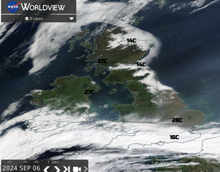
This type of fog is known as advection fog. Warm, humid air moves horizontally across a cooler surface. The air in the lower levels cools down below its dewpoint and water vapour condenses out. This forms small droplets of liquid water. These are visible and fog forms. Fog being just a cloud on the ground.
A light breeze continued, helping the coastal fog to form and thicken and it crept inland with intriguing dendritic patterns seen on the satellite imagery. Filling in the valleys, such as the Tweed, Loch Ness and through the Forth into the Central Belt.
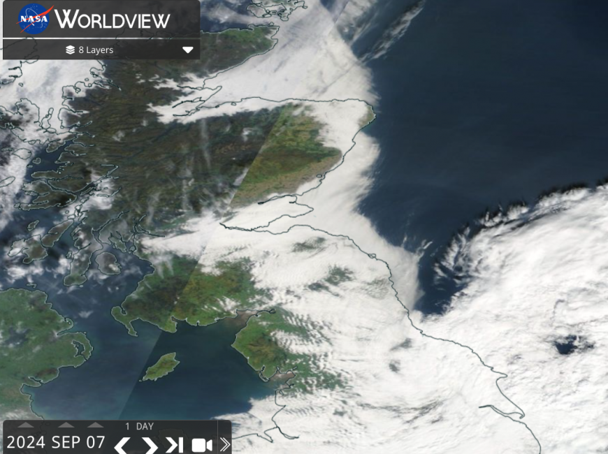
From the 5th until the end of the weekend on the 9th September synoptically, very little moved. Low pressure in the Bay of Biscay slowly edged towards Belgium by Sunday night with high pressure over the extreme north of Europe. Between these two was the slow flow of air heading westwards over the relatively cool sea.
On other days there was frontal cloud over southern England, subduing the temperatures and giving rain. Then the low pressure threw more bands of showery rain over England and Wales with thunderstorms breaking out in the warm, humid air. Still, there was enough flow towards northern Britain for the advection fog to persist.
Warm air can hold more water vapour than cold air, which results in a thick fog. By night, the land cools as any warmth from the sunshine is lost, radiating away into the clear skies. Sometimes East Coast locals can see the sea fog waiting, lurking, off the coast, ready to return at night.
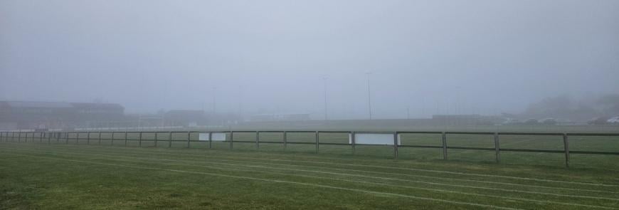
Summer tourists and holidaymakers may feel short-changed in the gloom, waiting for the sun or a stronger breeze to pick up later in the morning. This September fog was very reluctant to clear.
Inland it did ‘burn back’ or thin. There were tantalising glimpses of yellow sunshine, hinting at warmth. Yet how far inland to travel to reach the edge of the fog bank? On the NASA imagery you can see the green areas of clear, sunny land but also large clear gaps over the North Sea, behind the fog area.
“There are occasions in summer when the day begins bright and clear, with fog patches drifting parallel to the coast in a light wind over the sea. Then, suddenly, when the sea breeze sets in, an alarming transformation occurs. The fog swirls coastwards relentlessly and the beaches clear of holiday-makers in a matter of minutes. The rigour of a thick haar may be judged by the manner in which the most ardent golfers on the string of links that fringe these coasts, ruefully but without a trace of hesitation, give up as it closes in upon them. “ (Paton 1951)
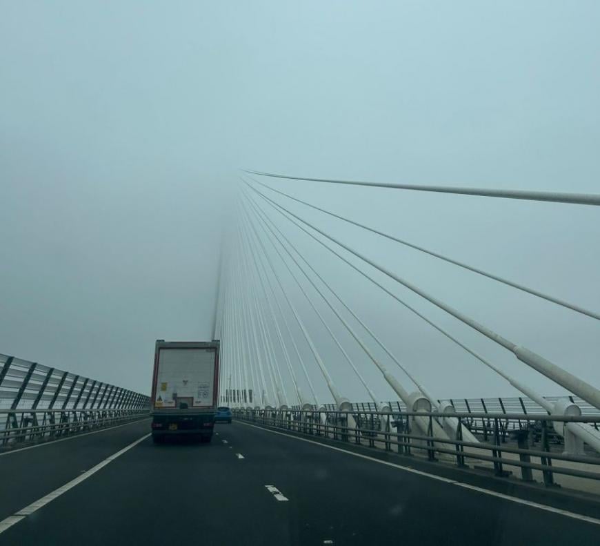
Fog impacts travel, with tricky, even dangerous conditions on the roads and for shipping. It also dampens the harvest, as those who’d not yet baled their straw saw things getting soggy without any helpful rain for the fields. The fog was like a swirling fine drizzle, thickening to a pea-souper by night.
When relative humidity is over 95%, mist and fog are defined by the visibility (distance you can see to recognise landmarks). When visibility is under 1000m it is known as Aviation Fog. Visibility between 1 and 2km is Mist. Visibility under 200m is Thick Fog and visibility under 50m is Dense Fog.
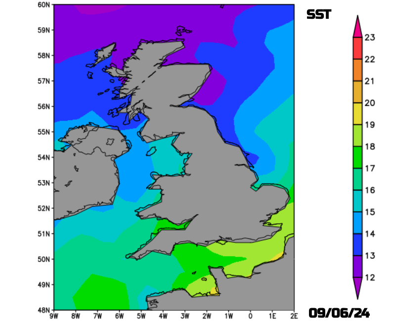
Germany and Poland had seen early September heat and thunderstorms with temperatures in the high 20sC, even the 30sC at the end of August. The Sea Surface Temperatures (SSTs) for northeast Britain were closer to 13C and the air near the surface contained plenty of salt nuclei to help form the fog. The warm air near the sea surface cools by being close to the colder sea but it also moves onwards towards the coast. There is often a bit of uplift or slowing of the air here and the fog continues to thicken.
Depending on the wind direction, different areas missed or got stuck with the fog. On the 6th Sept, a northeasterly breeze kept the Haar offshore for Angus in the day but piled it into the Scottish Borders, East Lothian and Edinburgh.
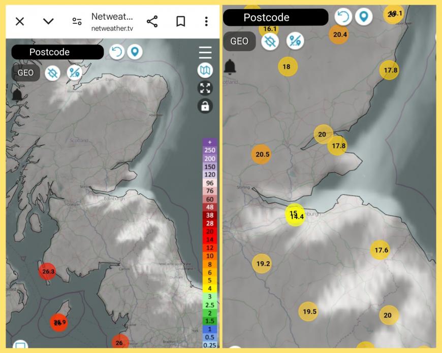
Netweather radar and satellite showing the coastal fog with hourly late afternoon temperatures 06/09
The Scottish novelist, Ian Rankin, observed in one of his Inspector Rebus novels, “In a haar, Edinburgh seemed to shift backwards through time. You half-expected to see press-gangs on the streets of Leith, hear coaches clattering over cobblestones and cries of gardy-loo in the High Street.” Strip Jack 1992
Finally on Monday 9th Sept, the low pressure moved away over the Low Countries and a colder, fresher northwesterly flow set in.
Loading recent activity...