It has been a mostly warm start to September 2024 but not as warm as the first third of September 2023 was, when we saw a long run of days when the temperature reached or exceeded 30C somewhere in the UK. Temperatures during the rest of the first half of September 2024 are set to fluctuate somewhat. It will remain on the warm side this weekend, but from next Monday it will cool down, and from Tuesday to Thursday we can expect a cool and showery period with north-westerly winds.
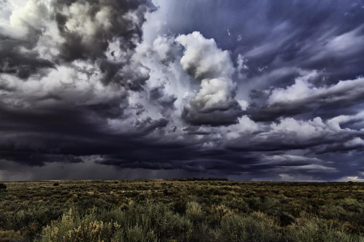
In the near term, heavy rain is set to spread northwards into southern England during this evening and through the rest of England and Wales overnight, and this has the potential to be accompanied by thunderstorms, especially in the south-east of England, East Anglia and the Midlands.
A convective forecast has been issued for today, with a watch for severe thunderstorms.
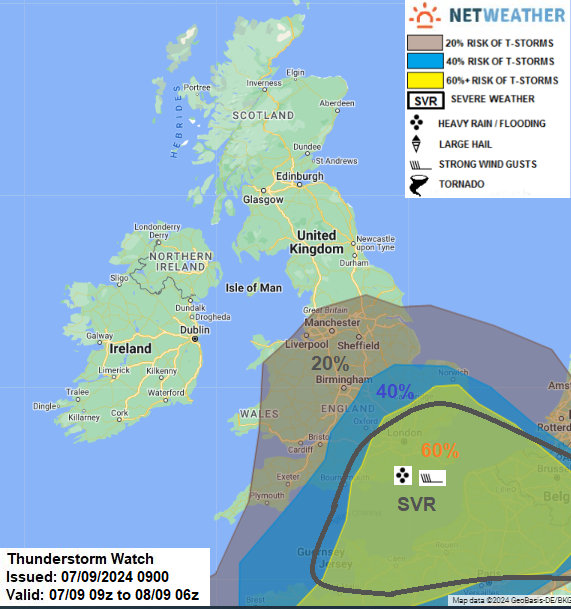
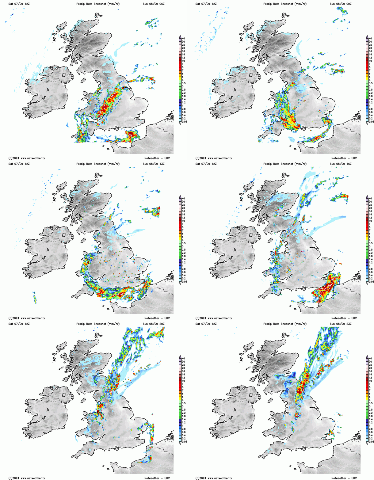
Much of Scotland, Northern Ireland and northern England can expect a predominantly dry sunny day, but fog and low cloud may persist throughout the day in counties bordering the North Sea. The rain, with potential for embedded thunderstorms, will come into south-west England from early evening and then will establish over East Anglia and the south-east towards midnight. Overnight, this will spread through Wales and the Midlands and into the north of England. Overall, the largest rainfall accumulations are likely to be in southern England, especially near the English Channel coast, with around 30mm in places, close to half a month's worth of rain. Especially as this same region has also been very wet recently, there is potential for this to cause some problems with flooding.
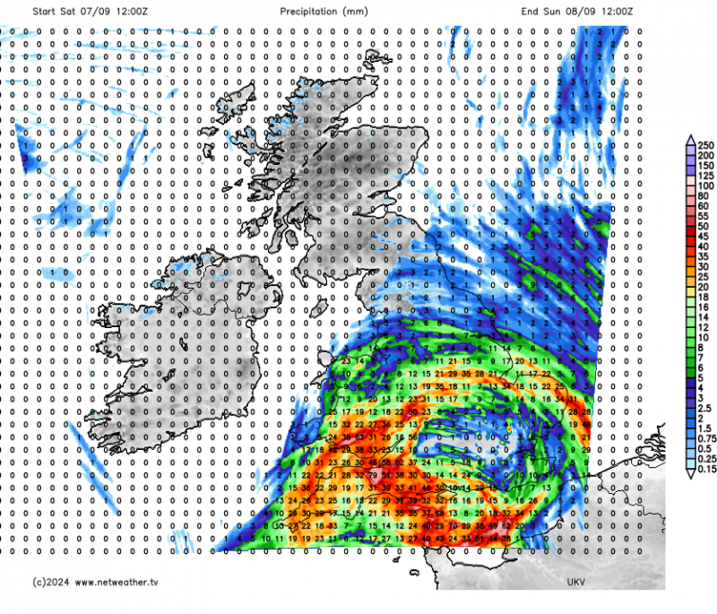
The map above is from the UKV model. There is some disagreement between the models regarding how far north the rain will get - some model runs have heavy rain and thunder extending up the eastern side of England as far north as the Midlands and perhaps Yorkshire, but others have the rain tending to ease somewhat as it pushes through the Midlands and into northern England.
The main rain belt will probably not make it into most of Scotland and Northern Ireland on Sunday, but it may turn wet around the Scottish Borders. Brighter weather will follow behind into most of England and Wales, but again there will be potential for heavy and thundery showers to break out, particularly towards the south-east. Temperatures are forecast to reach the low to mid-20s Celsius in the Midlands and north-east England, and also over a large part of Scotland.
A plunge of cold air from the Arctic is forecast for the middle part of this coming week. A deep depression will introduce the cold north-westerly flow on Tuesday, bringing a band of rain south-eastwards through the country, accompanied by strong winds, particularly in northern Scotland, and parts of eastern England may also turn very windy for a time.
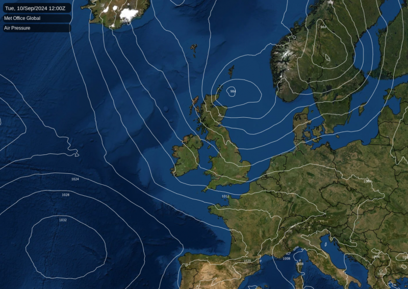
Then through Wednesday and Thursday, low pressure over Scandinavia will slowly fill, resulting in a slackening north-westerly flow bringing air right down from the Arctic, and a mix of sunshine and scattered showers. Temperatures will generally fall a few degrees below the seasonal norm, peaking at around 15 or 16C in most parts of England. As the north-westerly airflow slackens, it will also turn cold overnight, and there is potential for some northern areas to see a slight frost particularly overnight Thursday/Friday.
Although we are now into September, we are still looking at a pulse of hot weather spreading eastwards through the Mediterranean this weekend. Temperatures through Corsica and Sardinia are forecast to reach the high 30s Celsius today, and this heat will move eastwards into Italy and the Balkans during tomorrow. This heat will move away into early next week, but north Africa will remain somewhat hotter than normal for much of next week, which means that any southerly flow will tend to bring that heat back into the Mediterranean.
It will also become hot next week in the far east of Europe and western Asia during next week, particularly through Ukraine and western Russia. This will be down to southerly winds on the eastern flank of the low pressure system that will bring Britain a cool north to north-westerly flow.
Looking further ahead, the UK outlook is rather uncertain but there is a growing hint among the medium-range forecast models that we could see high pressure re-establish from the south towards mid-September, accompanied by somewhat warmer temperatures.
Loading recent activity...