August will move into September this weekend and meteorological summer into autumn. It will be back to school for many more pupils next week which always makes it seem like summer is quickly fading. If you aren't in the hell of buying school shoes or trying to get everyone, or anyone, to try on their uniform for size you might be wondering if this warm weather will last for the weekend?
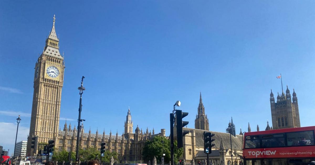
Cambridge reached 26.7C on Tuesday with the peak of this week’s warmth or heat expected on Wednesday. Sunday might become very warm again in the south but there is some uncertainty here. Eastern and northeastern Scotland have been enjoying temperatures over 20 Celsius on Wednesday even if the schools have been back for a while. Greater London is expected to pass 28C today with much of southeast England and East Anglia in the mid-20s Celsius. It’s not intense heat, not into the 30s Celsius that we can see in the UK but still, it’s a very warm spell with sunshine. And lighter winds for central and western areas will make a difference.
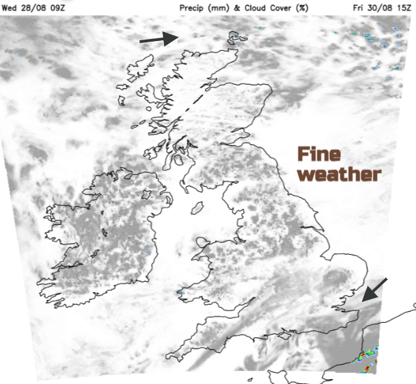
There will be a lot of fine weather about at the weekend. Often dry, mostly bright but with variable amounts of cloud.
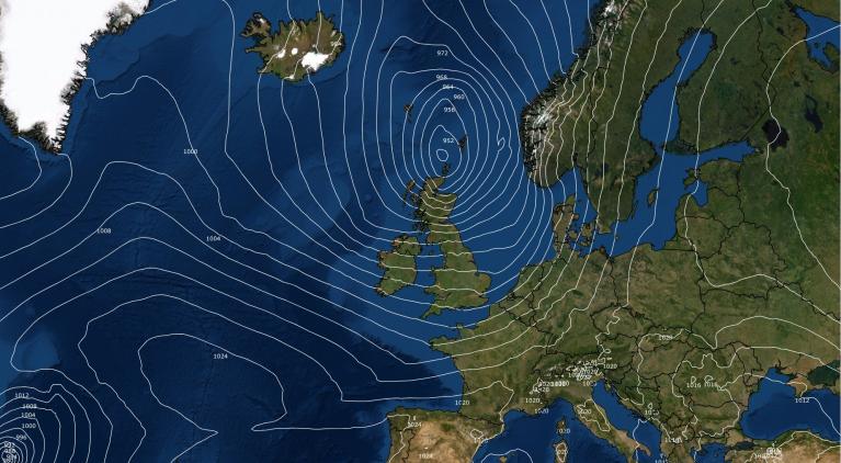
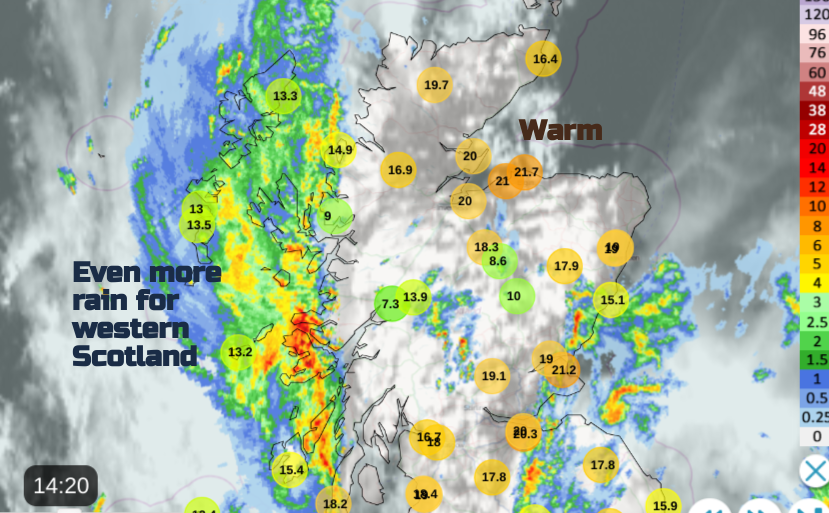
There will be a change from the midweek setup. Currently, high pressure over northern mainland Europe is helping direct the very warm southerly flow from north Africa, through Spain and France towards the UK. A large loop in the jetstream is aiding surface blustery winds with a low pressure near Iceland. This brisk wind is helping dry out the air as it rushes over the mountains and hills of Britain. Although there are weather fronts with more cloud and outbreaks of rain strewn across the UK, the southeast has seen a good deal of sunshine to help heat the ground in the very warm air.
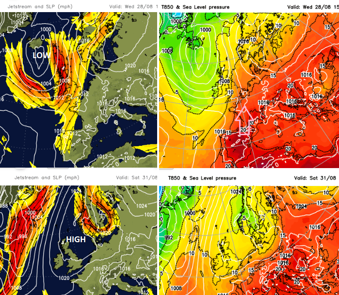
What changes is the direction of the flow. We lose this very warm continental air and once the cold front moves towards the North Sea, a more westerly flow takes hold with cooler, fresher air from the North Atlantic during Thursday and Friday . The nights will feel cooler in the north of the UK. The jetstream loop moves towards Norway and high pressure begins to build for Friday evening. That high pressure soon slips towards Scandinavia.
The High pressure will bring a lot of fair, settled weather and it will still feel warm in any sunshine.
Friday looks fine and bright with sunny spells and hardly any breeze so it will feel warm.
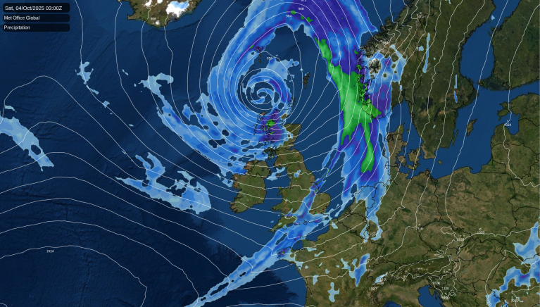
France will be very warm as a line of showers edges northwards and this weakness could introduce elevated showers across the English Channel. As an east/NE breeze picks up over SE England in the warm air, there could be big raindrops on Friday night.
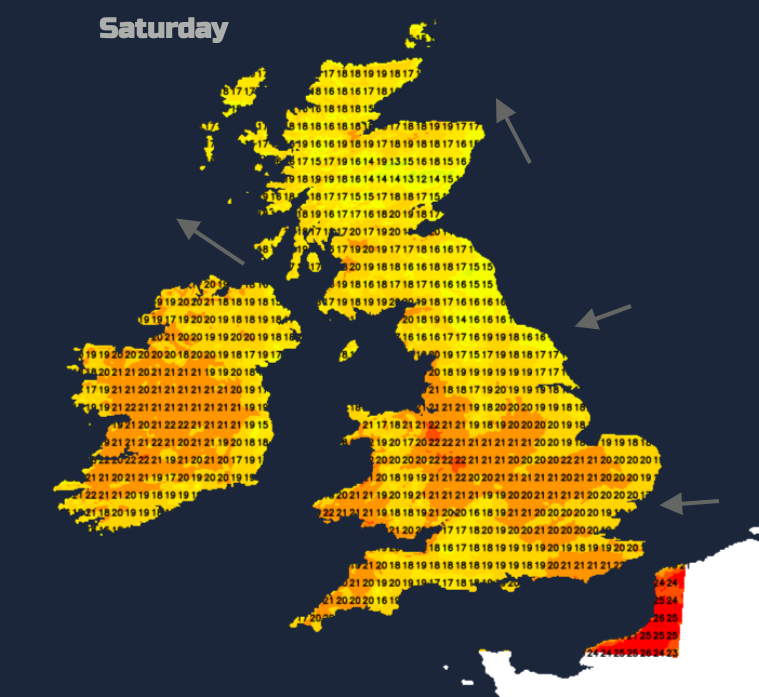
During Saturday, these well scattered clusters might drift westwards over southern Britain during the day with plenty of medium-level cloud. For much of the UK, there will be a lot of fair, dry and bright weather with just pockets of stubborn low cloud. In the sunny or bright areas, it will feel pleasantly warm. The east coast will feel fresher with a breeze off the North Sea. Pembrokeshire will feel warmer, up to 21C.
Overnight temperatures will dip into single figures for northern Britain at the weekend, so a coolness by night.
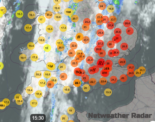
Sunday looks fair and dry again with an easterly flow. A lot will depend on the cloud cover. If this remains thick it will keep the temperatures in the low to mid 20sC with almost a dampness in the air at times. If it thins and breaks any sunshine will make quite a difference and temperatures will leap up, perhaps even to 29C in London. The air will be warm and humid, maybe with just a few showers crossing the Channel by Sunday evening as Northern France could see the risk of thunderstorms again. Frontal rain should arrive from the west over Ireland on Sunday night.
Loading recent activity...