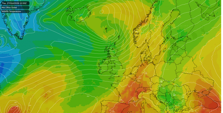
As many head back to work after the Bank Holiday weekend, those in England may be feeling rather grumpy as the fine, warm weather continues. On Monday, Writtle in Essex reached 23.8C (75F) and today London should reach 25C, possibly 26C (79C). Wednesday could be even warmer.
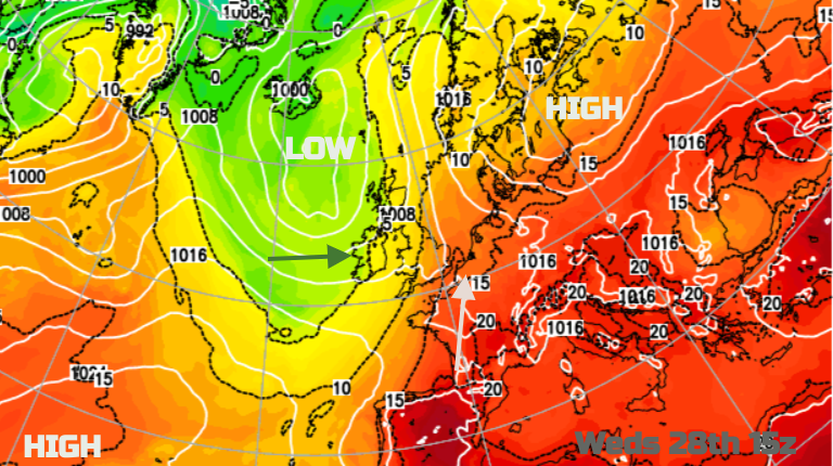
High pressure is over mainland Europe bringing a lot of steady weather but low pressures continue to nip in from the Atlantic over northwestern Europe, particularly the UK. Whilst southeast England began Tuesday with light winds, sunshine and temperatures soon up to 20C, there have been strong, gusty winds and a band of frontal rain over the Irish Sea and feeding up into Scotland. Once more it is western Scotland seeing the most rainfall.
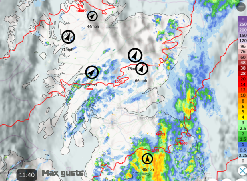
Strong, gusty winds this morning making it feel more like autumn
Met Office has a warning about heavy rain and the risk of flooding for SW Scotland on Tuesday. This region has seen a lot of wet weather recently and in excess of 60mm is mentioned, over the hills.
“some localised but minor impacts from small rivers and surface water across Central Scotland and Dumfries & Galloway.” SEPA
The air does feel fresher behind this cold front but still, temperatures in Northern Ireland and Scotland should reach 19C. The frontal rain continues to pile into the Solway Firth, over Cumbria and western Wales. All these areas keep some cloud and outbreaks of rain with gusty winds from the southwest. For a large portion of England and southeast Wales, it will be a warm, fine day with sunshine.
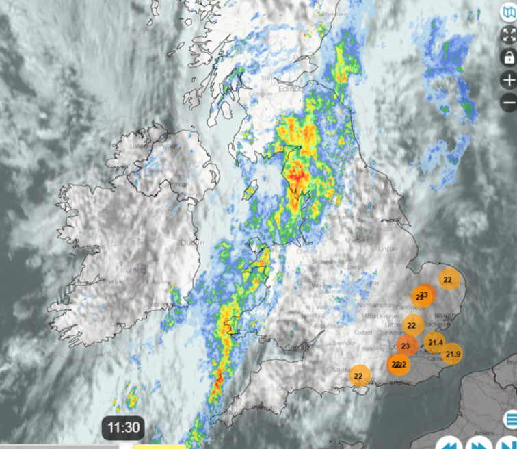
This warm air from the south remains during Tuesday night with temperatures in southeast England staying at 15 to 18C. Showery outbreaks of rain continue along the fading frontal boundary, over northern England, southern Scotland and western Wales. This front has to slow right down as it comes up against the large anticyclone over Europe. It will take until late on Thursday for the cold front to reach Kent and Suffolk, subduing the midweek heat but it could wave back in the south at the weekend as high pressure builds.
The winds will be from the south on Wednesday and it will feel warmer for most. The Moray coast could reach 21C with a bit of Foehn Effect over the mountains in a blustery flow as could the East Lothian coast, with lift over the Lammermuirs. This looks to be the warmest weekday with temperatures into the mid to high 20sC for central, eastern and southeastern England.
If you are off to the seaside at Scarborough or Skegness it should be 24C in the sunshine. Margate and Southend at 25C. On the other side of Britain, there will be showery outbreaks of rain in the morning for northern Wales, Blackpool and Morecambe but then a brighter lunchtime and afternoon with sunshine, up to 21C.
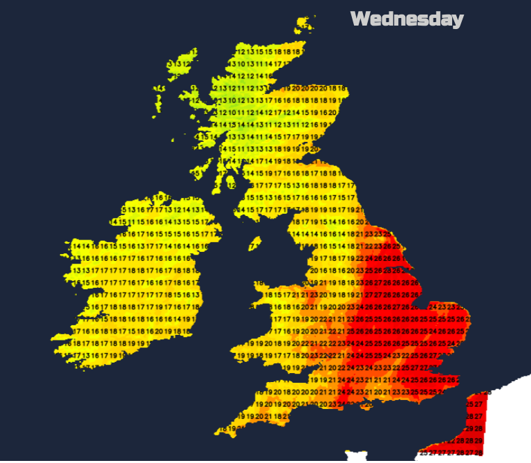
Heavy showers will move from Northern Ireland and western Scotland over more of Scotland in the afternoon with a few of the showers from north Wales reaching northeast England later.
During Wednesday night the winds will veer to a westerly, so feeling cooler by Thursday morning for all but the far southeast.
A feed of blustery, sharp showers will flow into western Scotland and brush the north coast of Northern Ireland. The showers will be scattered but heavy even thundery by Thursday afternoon for central and southern Scotland. For most, it will be another fine day. Plenty of sunshine with light winds in the morning. Suffolk, Essex and Kent may still reach 24 or 25C in the sunshine but for most, it will be 17 to 21C on Thursday. Worth being out of the westerly breeze and in the warm sunshine.
Overall England fares well for the warmth and sunshine in the next few days. There will be a scattering of heavy showers and frontal rain from the west but also warm sunshine mixed in as well. Today is windy and tomorrow will be warmer.
Loading recent activity...