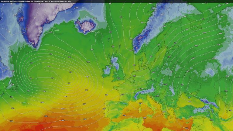



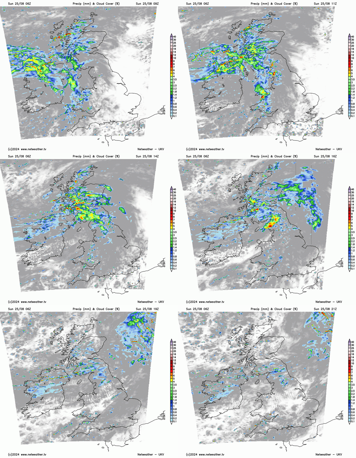
Saturday was a washout and cool day for August across southern England and East Anglia, thanks to a frontal wave moving through, with 20-30mm falling in 24 hours in places, following a rather dry August so far. However, Sunday promises to be a drier day across the southern half of Britain. Cumbria and western Scotland were rather wet too yesterday and unforunately today these areas will see further persistent and heavy rain arriving from the west, with rain spreading across east across Scotland and the northern half of northern England too.
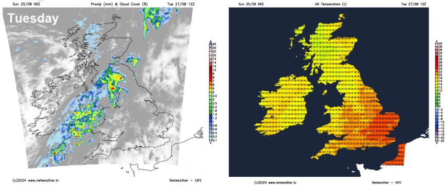
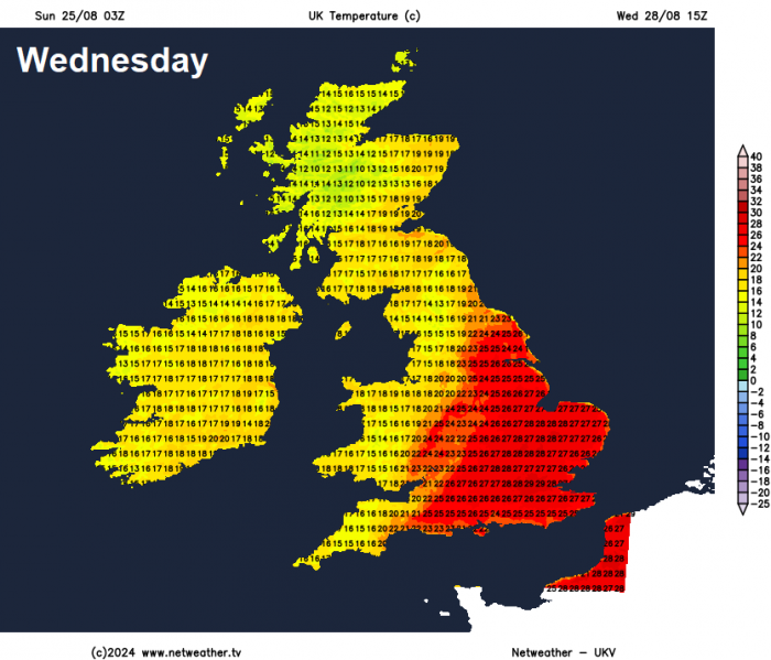
Bank Holiday Monday is looking pretty reasonable too across much of England and Wales, along with Scotland, just a few light showers over western coasts and hills, although it will be breezy, temperatures a degree or two warmer than today. Tuesday sees a frontal system push in from the west and grind to a halt over northern and western areas - bringing a cloudy and wet day, sunnier and warm in the southeast, perhaps reaching 25C here. The front eventually clears east on Wednesday, but not before eastern England see a very warm and sunny day, likely warmest day of the week, with temperatures reaching 28C. Turning cooler and fresher from the west on Thursday and through Friday, with showers possible in the north and west, drier and sunnier in the south and east.
After a cool start, temperatures on the rise towards mid-week, peaking on Wednesday, before cooling down again on Thursday
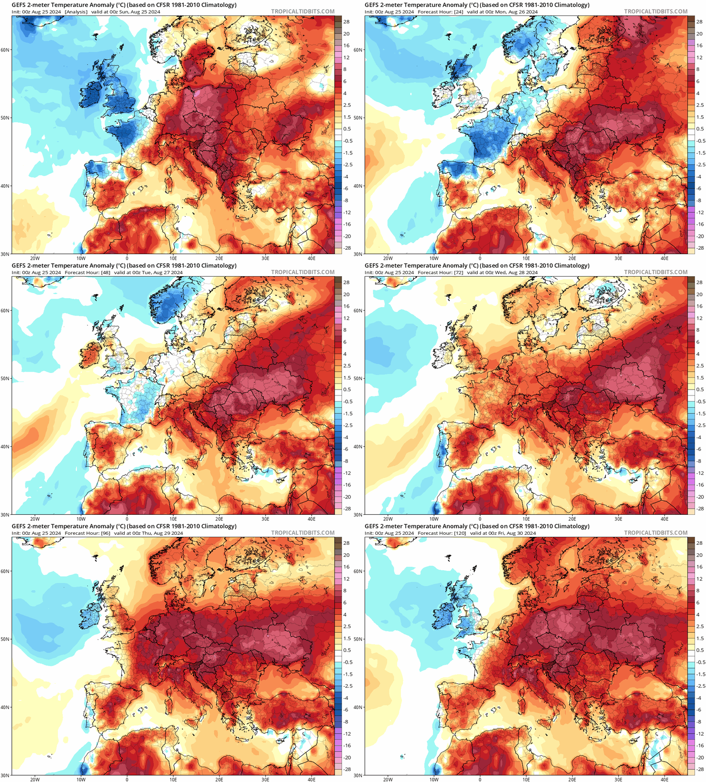
So the week ahead promises rising temperatures until Thursday, before cooler and fresher conditions return. Some rain too, but mostly in the north and west, best of the sunshine in the south and east of England.
In more detail, cloud and outbreaks of rain will continue to spread east from N. Ireland across Scotland, west Wales and NW England through much of Sunday, the rain heavy and persistent across western Scotland and Cumbria - where the ground is already saturated. Much of central, southern and eastern England will have a largely dry and sunny day. It will be a breezy day, especically in the north, warmer than yesterday across the south, temperatures reaching 20C across SE England and East Anglia, mid to high teens elsewhere - all maximum temperatures a little below the average for late August.
For Bank Holiday Monday, high pressure tries to build in from the south, bringing a largely dry day with sunny spells for many, though cloud will thicken at times across the west to bring a few light showers. Cloud with outbreaks of rain along with a strengthening wind will arrive across Ireland and N. Ireland in the evening. Temperatures reaching a warmer 20-23C across England and Wales, high teens across Scotland and N. Ireland.
A frontal system will move in from the west and stall across northern and western areas on Tuesday, bringing a cloudy day with outbreaks of rain, perhaps heavy over hills. Midlands, southern England and East Anglia look to stay fine, dry and warm, best of the sunshine towards the east, temperatures here reaching 23-25C, 18-21C elsewhere.
Cold front across northern England and Wales Wednesday morning moves slowly eastwards across into central parts of England into the afternoon, with a band of rain, perhaps heavy and thundery, along it. Ahead of the front, sunny, very warm or hot across eastern England - with temperatures reaching 25-28C. Cooler and fresher with sunny spells and scattered showers across northern and western areas of the UK.
The cold front with a few showers along it clearing east from eastern England later on Wednesday evening, then Thursday is back into a cooler and fresher westerly flow across all parts, mostly dry with sunny spells across England and Wales, though showers possible across the far west and also across Scotland - where they could turn heavy. A very similar picture on Friday.
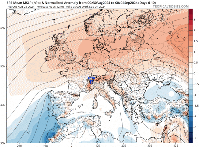
Next Sunday and a new month with prospects of a drier and more settled start to September on the cards for now, with high pressure building in from the southwest and settling near of over the UK into the first 5 days of September at least. uncertainty on where high pressure positions, which will influence how warm it will get and also whether more unsettled conditions could graze parts of the UK around the fringes of the high pressure system. But generally a drier and settled picture looks likely to start next month.
Loading recent activity...