Prepare today for heavy rain and wild gusts forecast for Thursday night and Friday morning as Storm Lilian moves through.
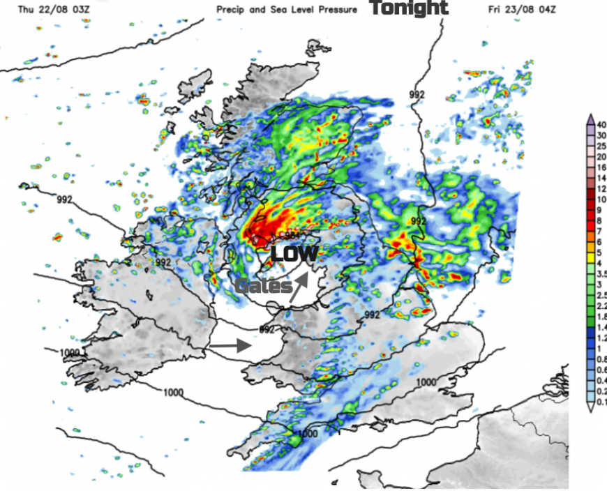
Thursday brings a blustery lull in between two bouts of heavy rain and strong winds, even gales. Through tonight and early on Friday there will be more rain from the Atlantic and a corridor of strong, gusty winds with gales for exposed areas as a small low pressure nips across the UK - now named as Storm Lilian by the Met Office.
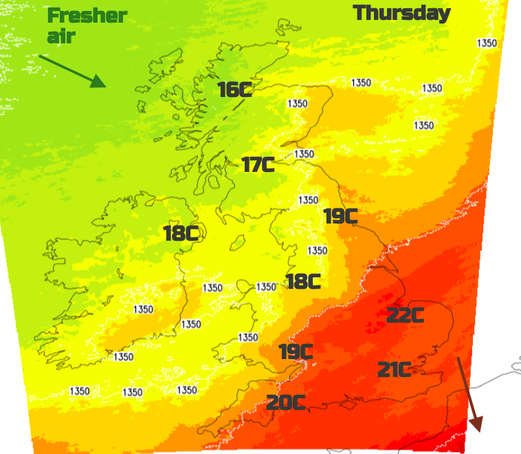
It has already been very wet for western Scotland and other parts of NW UK in the middle of the week. Today there will be sunny spells as a cold front moves southeastwards. Northern Ireland will see scattered shows but much of Britain will become dry as the skies brighten. England and Wales are starting off with cloud and outbreaks of rain but these become more patchy as the whole lot moves towards southeastern Britain. The air changes behind the front, it will feel fresher although in the warm air, temperatures should reach 22C in East Anglia.

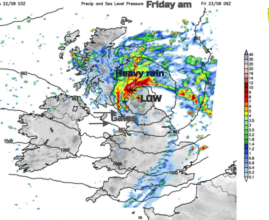
The next low pressure will bring rain over Ireland by this evening and the southwesterly winds will strengthen in the Western Approaches as the low centre arrives. Heavy rain will set in overnight for Wales, Northern Ireland particularly County Down, Cumbria and parts of Scotland with intense rain forecast for southwestern Scotland before dawn. This region has already seen a lot of rain this week so there could be flooding issues

For the Irish Sea conditions will worsen with the Met Office Inshore Waters forecast including
Winds - Southwest 6 to gale 8, veering west 4 or 5 for a time, occasionally severe gale 9 later. Sea state- Rough or very rough becoming moderate for a time.
It will be worth preparing tonight for this incoming wet and very windy weather. The heavy rain does quickly move across southern Scotland, over Edinburgh and Lothian to eastern counties. There will be heavy showers over the far north of England too.

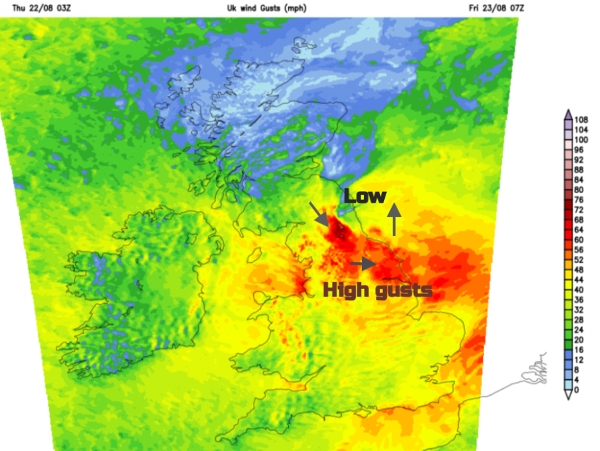
The wild winds will hit northwest Egnland’s coasts and spread over the high ground of northern England as more people begin to travel and start their days. The southerly winds will veer to a westerly.
Northeast England and the Scottish Borders, especially along the A1 look exposed to wild conditions on Friday morning as the low pulls away and the winds strengthen with gusts over 60mph with eastern England down to Norfolk seeing very windy weather to start the day.

The worst of the rain and strong winds will move away over the North Sea by mid-morning on Friday but it will remain windy and gusty for northern and eastern England until the afternoon
Warnings will appear but locally you will know the areas that have issues in strong winds. Preparation and leaving a bit extra time tomorrow should help.
Loading recent activity...