After Monday's oppressive heat and humidity, the rest of this week will be more comfortable. Temperatures will widely be in the high teens to low twenties with a few areas seeing up to 25 or 26C.
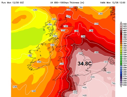
Monday 12th August saw the highest UK temperature of 2024 (so far). Cambridge recorded 34.8C (95F) thanks to a plume of hot, muggy air surging up from France at the start of the week.
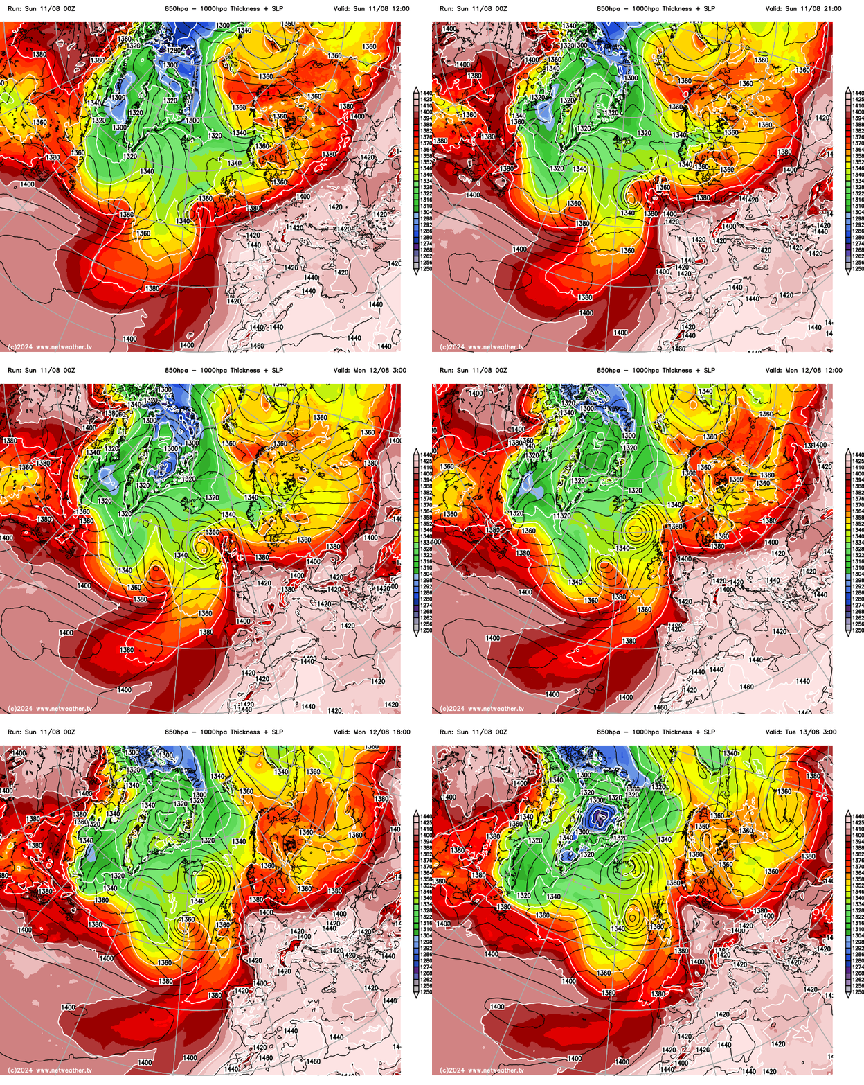
To see UK temperatures leap up like this is incredible. In decades past we would have seen several days of building heat as temperatures crept up a degree (or less) per day. Sunday 11th saw 29.8C in Wisley, Surrey but by Monday, with an air temperature five degrees higher, it was the humidity that was impacting more people.
The heat remains over Greece and the central/eastern Mediterranean with red heat warnings for Italy and the Balkans on Thursday.
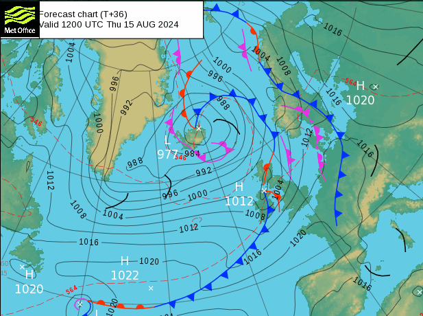
An Atlantic low pressure close to Iceland will change out UK weather. On Wednesday an old front left thicker cloud over parts of England and eastern Wales with temperatures over 23C for eastern England. A cold front from the low will bring blustery showers to NW Scotland on Wednesday night with fresher air. London and the Home Counties will stay calm and warm.
On Thursday the frontal rain will spread southeastwards after reaching Northern Ireland, parts of Scotland but particularly the southwestern quarter, into Cumbria and over the Irish Sea. There will be warm air ahead of this but also a moderate southwesterly wind for England and Wales. East Anglia will see the highest temperatures, in the low to mid-twenties Celsius. The wind will veer to a fresher light westerly for Northern Ireland and Scotland as the showery frontal band reaches Wales and northern England during the afternoon.
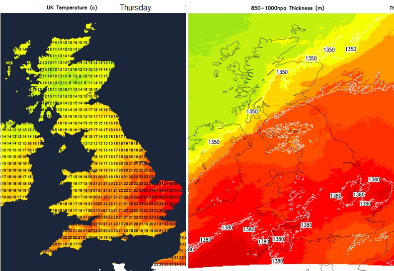
Southeastern England and London will hold onto a fine day with bright spells and feel warm out of the breeze. Gradually the low pressure will manage to steer fresher Atlantic air right across the UK and that stays through the weekend. So it will feel more comfortable by night, the daytime temperatures are back closer to average, and it will still feel warm in any bright sunshine but just a bit cooler in the evenings.
Rain
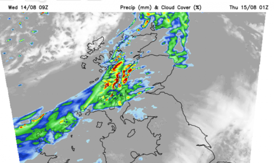
Western Scotland will turn wet and windy tonight. The cold front rain will spread over Northern Ireland, Dumfries & Galloway, and Cumbria and be patchy over more of mainland Scotland with potentially heavier rain north of Aberdeen. By Thursday morning, in a SW wind, SW Scotland, the Isle of Man and Cumbria will be wet and windy.
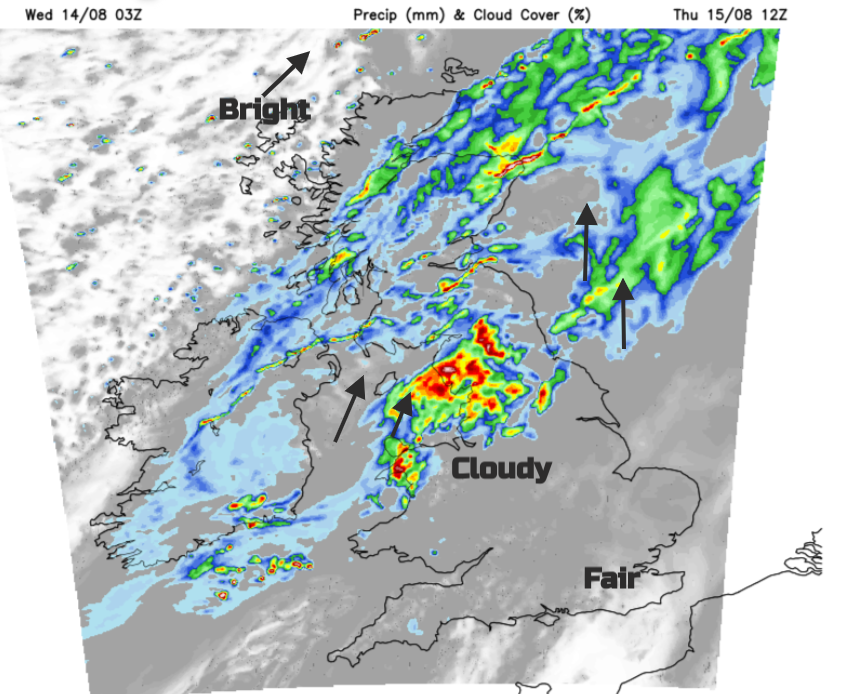
Gradually the far northwest of the UK brightens up as the frontal cloud and rain edges over more of England and into Wales, By Thursday evening there could be some heavier bursts in a line from the Bristol Channel across to The Wash. This risk of rain with embedded heavier bursts heads for Kent during Thursday night.
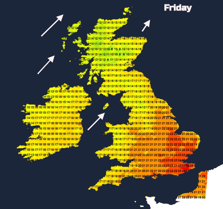
Friday looks bright and sunny for most but it will feel fresher.
Forecast for the next 7 days.
Loading recent activity...