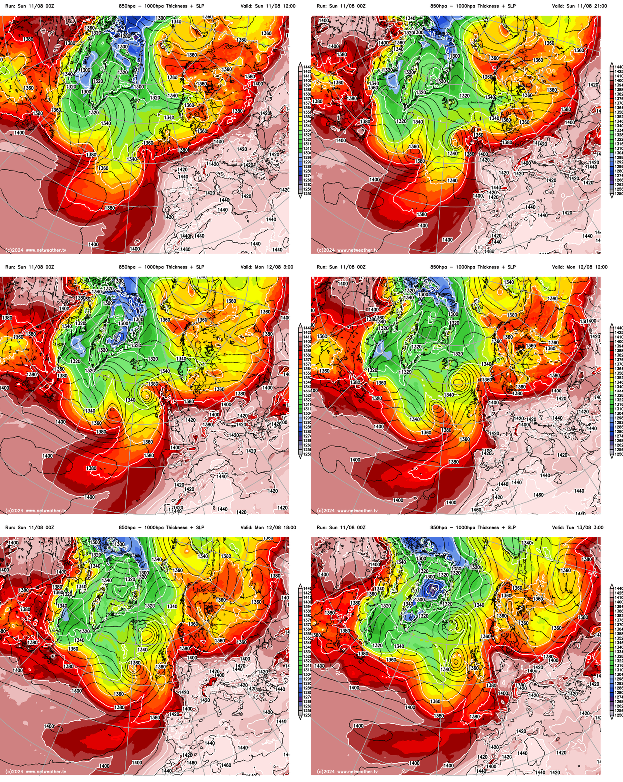
Temperatures on are the rise across England and Wales today and tomorrow, as an amplifying trough in the jet stream and deepening area of low pressure moving north to the west of Ireland pulls in a plume of hot air north from a very hot Spain and France.
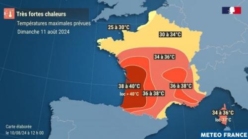
The temperature reached 43.7C at Cordoba in southern Spain and 41.1C at Zaragoza in northeast Spain on Saturday. Today this intense heat along with high humidity will spread north across western France, with temperatures in southwest France forecast to reach 40-41C - in places such as Bordeaux and even along the Atlantic coast further south. This very hot air will reach southern and eastern England briefly tomorrow, allowing temperatures to reach 30-33C across southeast England, East Anglia, the East Midlands and Lincolnshire. A few spots could reach 34 or 35C - making in it the warmest day of the year so far. The humidity will make it feel even more uncomfortable.
Very hot across SW France today, this hot air reaching southern Britain on Monday, allowing temperatures to soar into the low 30s
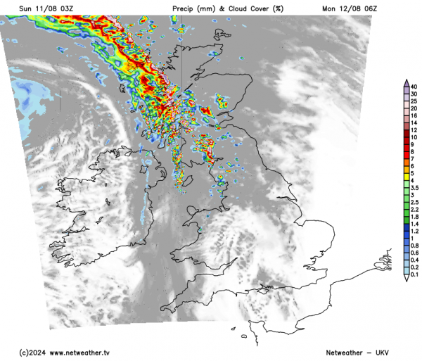
It will be a different story further north and west, as an upper trough and cold front with cooler and fresher air behind moving in from the west engages the plume of hot and humid air triggers thunderstorms - intially across Ireland this evening before developing and moving further northeast across Wales, NW England, N. Ireland and Scotland tonight and Monday morning, followed by cooler and fresher conditions in these areas tomorrow afternoon.
Although it won't be as hot across eastern England on Tuesday, it will still be very warm and humid, with the cooler Atlantic air further west not reaching here until Wednesday. It looks to remain dry across eastern England through to Thursday though, showers possible elsewhere on Tuesday, drier for all Wednesday, as ridge of high pressure builds in. But from Thursday, it looks like most of the UK will be in a more changeable westerly flow, with rain along a cold front spreading southeast across England and Wales on Thursday, followed by showers for some on Friday. Temperatures will still stay around the average for the time of year, so warm where the sun comes out.
In more detail for today, a grey, foggy or foggy start across southern England and south Wales, particularly towards coasts. This is thanks to increasingly humid air arriving from the south, dew points of 17C are being recorded over southern England with air temperature around the same - meaning the air is saturated and forming the fog. Any low cloud, mist and fog should quickly clear this morning to plenty of sunshine across most areas. Turning cloudier across the far west, Ireland and N. Ireland this evening, with showers, perhaps thundery, arriving. Warm or very warm for most today - temperatures reaching 24-27C widely across England and Wales, 18-21C across Scotland and N. Ireland.
A warm and sticky night tonight in the south, as very warm and humid air continues to spread north. Dry for much of England and south Wales, heavy showers or thunderstorms spreading north across Ireland, N. Ireland, north Wales, Irish Sea, Cumbria and western Scotland.
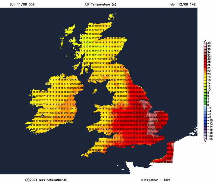
Heavy showers and thunderstorms will clear northeast from Scotland and far north of England on Monday morning, then a mostly dry and sunny day. A weak cold front edging east will introduce cooler and fresher air from the west across Scotland, NW England and Wales. But ahead of the cold front it will be a hot or very hot day in mostly clear skies across much of central, southern and eastern England. Temperatures reaching high twenties to low thirties, perhaps as high as 34-35C across East Anglia and the London area. A good chance this will make it the hottest day of the year so far.
The weak cold front will clear some of the heat and humidity away into Tuesday morning, as it reaches eastern England overnight. But Tuesday will be a very warm and sunny day across central, southern and eastern England. Cooler and turning cloudier further north and west, with showers arriving in the afternoon.
Potential for a few showers across the south on Wednesday morning, but clearing to join most to a dry and sunny day, as a ridge of high pressure builds. Thursday looks more unsettled, with a waving cold front moving slowly southeast across England and Wales, bringing cloud and outbreaks of rain, perhaps heavy in the west, though uncertainty on position through the day. SE England could stay mostly dry and bright or sunny until evening, while Scotland turns sunnier but with a few showers in the west.
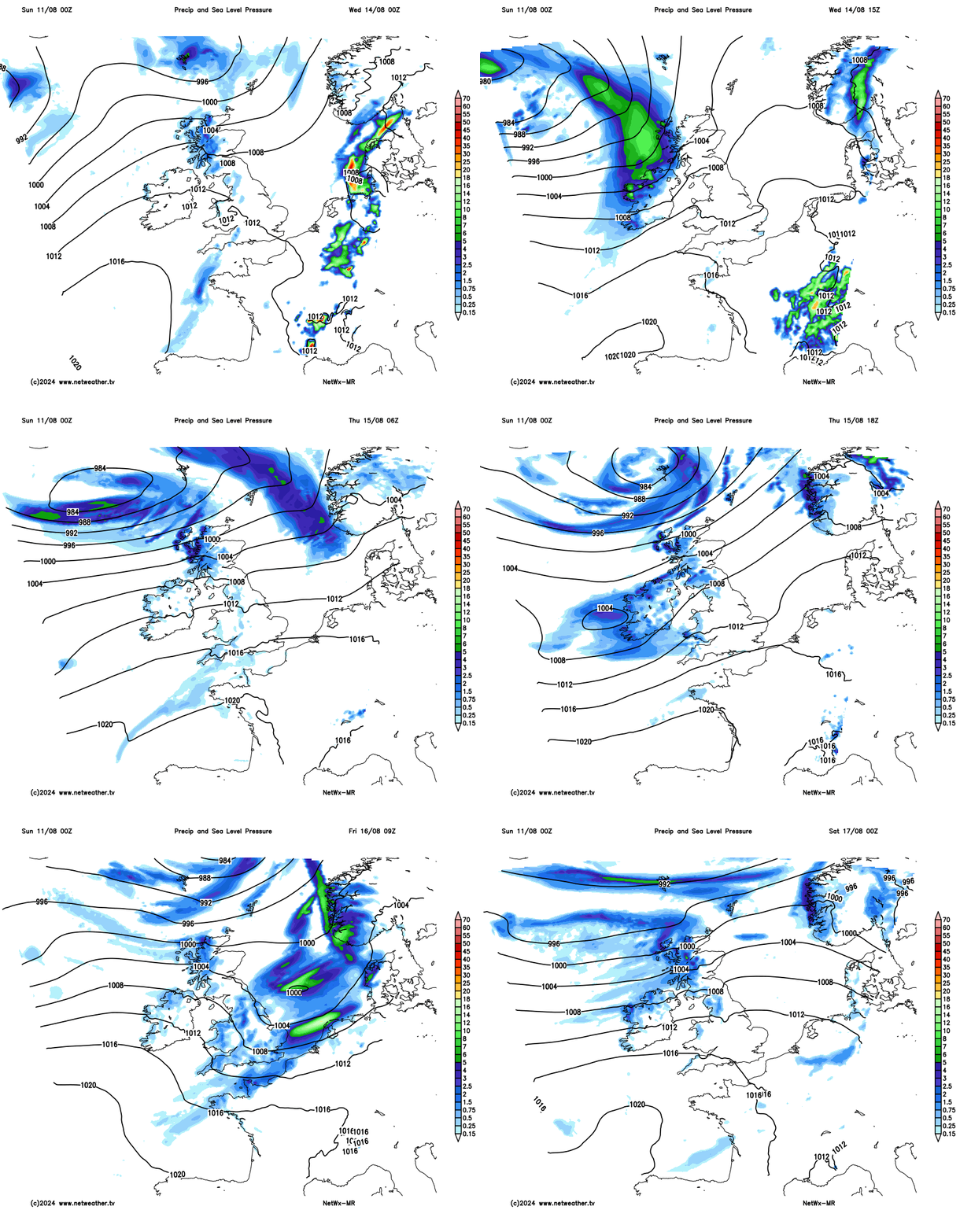
Friday may see cloud and patchy rain in the morning across southern, central and eastern England clearing east to dry and sunnier conditions further north and west. Though with showers in the far northwest. Temperatures Wednesday to Friday around the average for the time of year for England and Wales - reaching 20-24C, perhaps a little cooler than average for Scotland and N. Ireland with mid-to-high teens at best.
Loading recent activity...