After a soggy start to the Olympics in Paris, Britain is set for a welcome change. An anticyclone moving across the country will bring drier weather and warming temperatures. Thunderstorms may develop midweek though.
It was hard not to feel sorry for the organisers, spectators and athletes on Friday evening during the opening ceremony of the Paris Olympics, many of whom got a soaking. The culprit was a slow-moving cold front, with waves along it enhancing the rainfall from time to time, giving a thoroughly wet evening in the French capital. However, towards the English Channel coast it was drier, as it was just to the south, in a clear case of meteorological 'sod's law'. More rain yesterday meant the street skateboarding event had to be postponed until Monday, before the weather finally cleared after dark.
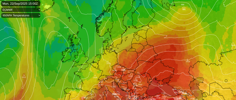
There were also showers across our neck of the woods yesterday, but a rise in pressure both across Britain and northern France overnight will ensure a fine, very warm spell over the next few days. In humid conditions, temperatures into the new working week could reach 30 to 32C again across parts of the East and South. A stifling 34 or 35C is likely in Paris, making life uncomfortable for the athletes, before thunderstorms break the weather down again on either Tuesday or Wednesday.
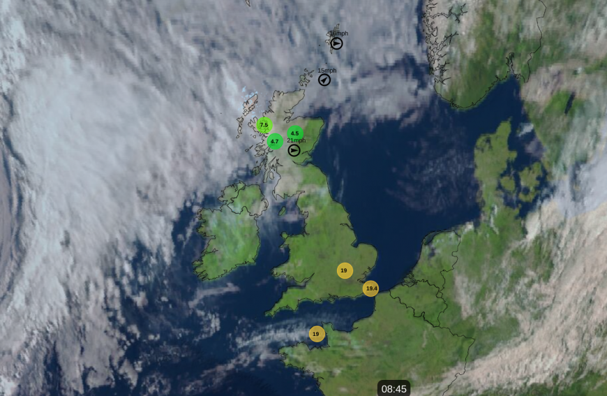
It was nice to see not a drop of rain on the radar across the UK and Ireland this morning, something we haven't seen for quite a while. It was also largely clear, so expect a fine, dry day almost everywhere, with patchy low cloud and mist across the Scottish Border, North West and Wales quickly clearing as an anticyclone makes its way across central and southern parts of Britain.
For most, there'll be lots of sunshine, but some cloud will 'bubble up' through the day before melting away again towards evening. Winds will be light, allowing temperatures to reach a warm 21 to 25C fairly generally and a very warm, locally hot 26 to 27C across parts of East Anglia and the South East.

The North and West of Scotland will also be dry and largely fine. But here and across the far North West and the Northern Isles, a southerly breeze will bring more in the way of mostly medium and high-level cloud. Top temperatures here 16 to 20C.
If you fancy an evening barbecue, conditions should be almost ideal with warmth for a while and well-broken skies in light winds. With largely clear skies after dark, a few mist or fog patches could form in rural areas towards dawn, but these'll be short-lived, soon clearing after sunrise.
Across Northern Ireland, a freshening southerly wind may bring bursts of rain towards Donegal later in the night, this perhaps spreading to the Western Isles by morning. Expect a mild night almost everywhere, with lowest temperatures in the range of 10 to 15C.
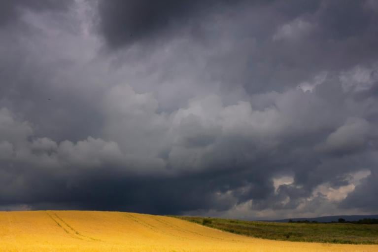
As the heat and humidity build into the new working week, particularly over England and Wales, we'll probably see a few thunderstorms breaking out mostly across the South towards mid-week. Meanwhile, Northern Ireland and Scotland see some rain moving in from the West, with all parts seeing a drop in temperature.
Loading recent activity...