Southern Wales will see a wet middle of the week as the far north of Scotland faces gales by tonight. A mixed picture elsewhere but there is fairly warm air holding on, for now.
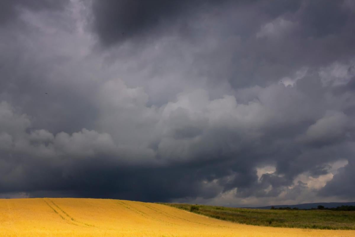
It’s another blustery start with heavy rain in parts of the UK. A new Atlantic low pressure is moving by bringing frontal rainbands and strong winds for some. Although it won’t feel warm in the wind and rain episodes, the air still has residual warmth. By next week, we will be in colder air and there will be a definite nip in the air. This weekend might be the time to look out autumn clothes, even a warmer coat.
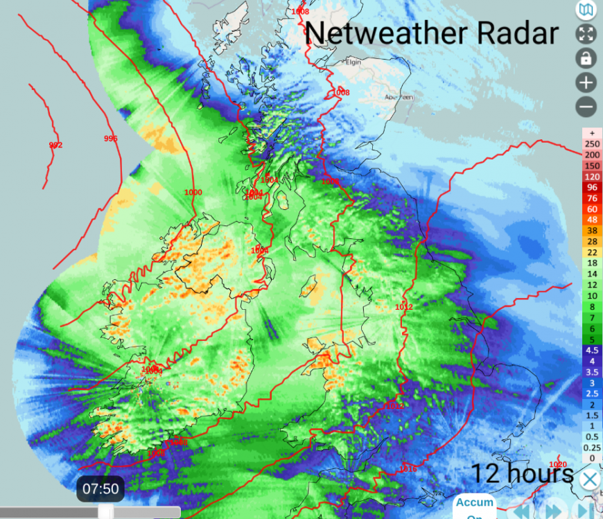
The accumulated rainfall on the Netweather Radar shows where it has been wet over the past 12 hours as the frontal bands moved over Ireland to Britain. The low centre is away to the northwest, offshore and there will be windy conditions around the coasts of Scotland in the SE/E flow, particularly for the Western and Northern Isles today. The warm front and occluded front were across Scotland and eastern Britain by 9am. There has been a yellow rain warning over Ceredigion, Conwy, Gwynedd and NW Powys this morning with windy weather in the SW flow.
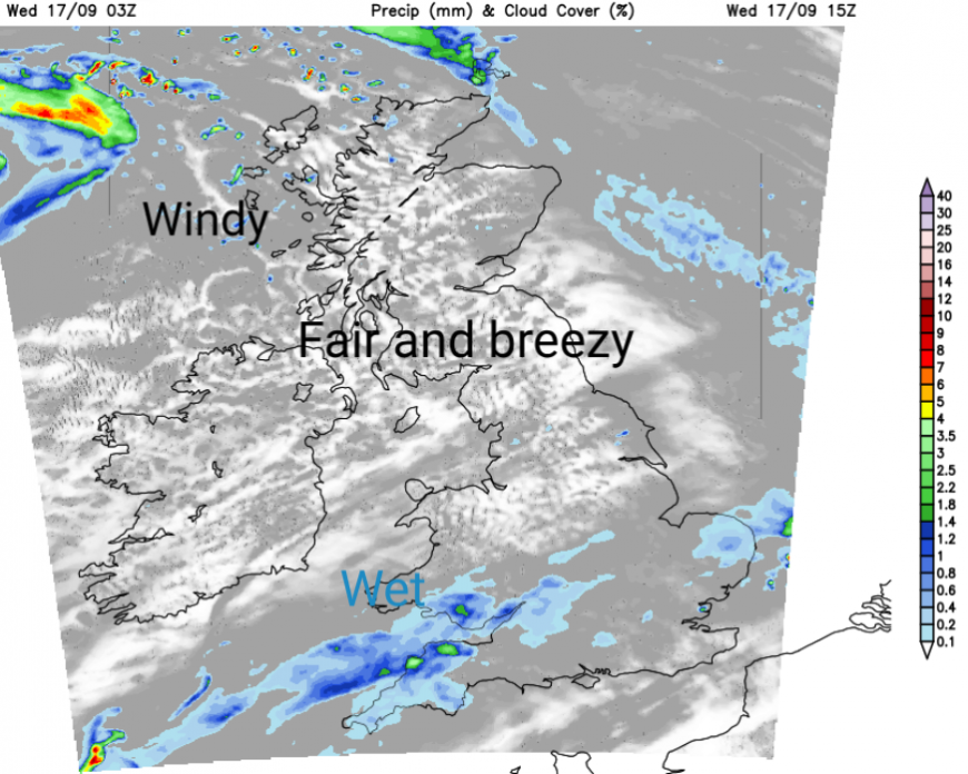
There is also a different yellow rain warning today over the southern counties of Wales, including for Cardiff.
“Heavy rain may lead to some travel delays and flooding in a few places on Wednesday.” MO
This is thanks to the cold front as it trails over central Britain and Wales with little movement. “30-40 mm of rain is expected to fall widely with some places, chiefly on south-west facing hills, receiving 50-70 mm.”
This cold front trails back over the Atlantic as a boundary. Cooler air from the north, with origins nearer the Arctic Circle, although highly modified on its journey over the Atlantic. To the south of the frontal boundary fairly warm air. Temperatures in England could move form the high teens to the low 20sC this week, still above average for the time of year.
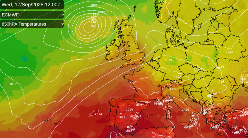
There is still heat over NW Africa and Iberia with yellow heatwave warnings for Portugal after their hottest summer on record. Inland southern Spain also has heat warnings possibly reaching 38 or 39C. The Canary Islands also have yellow heat warnings with up to 34C forecast.
@ExtremeTemps on TwitterX reports: “Exceptional mid September heat in the Mediterranean: Almost 45C at In Salah, ALGERIA 39.8C Amaraleja, PORTUGAL 39.4C El Granado, SPAIN 35.2C Pegomas, FRANCE, which was 0.1C from the September record. "
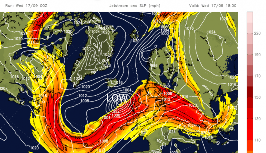
At this time of year, these temperature contrasts help strengthen the jet stream, which then develops Atlantic low pressures and results in wet and windy weather when the lows arrive near the UK.
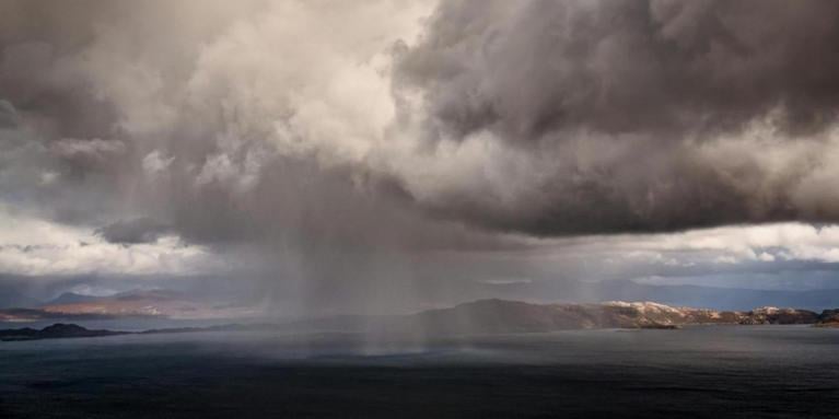
Later today, there will be gales for the far northwest of the UK, with severe gales mentioned for the Western Isles inshore waters with very rough even high seas. There will be a wild night for the northwest of Scotland. Clear skies over much of northern Britain and Northern Ireland with dry weather. The frontal cloud will remain over southern Britain with the rain still continuing in the SW flow over south Wales. There is a low risk of flooding - local surface water flooding impacts and river flooding with travel disruption possible into Thursday morning.
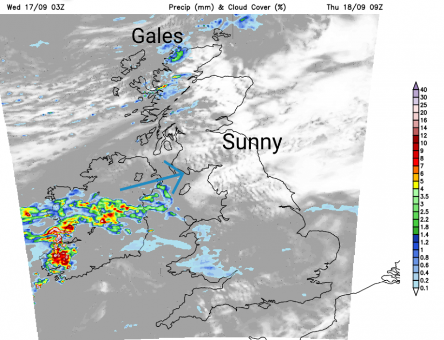
The risk of gales and severe gales in the far north will move with the low centre. A very windy start for Caithness & Sutherland, Moray Firth coasts and Orkney on Thursday with ferry disruption likely. Southern Wales will become drier on Thursday as clusters of heavy showers move from Northern Ireland (Co.Down looks wet) eastwards across the Irish Sea.
Loading recent activity...