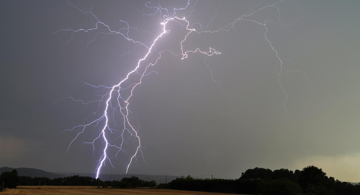
The weather continues in an unsettled mood as we start this week, with outbreaks of heavy and locally thundery rain spreading north and northeast across much of England and Wales over the next 24 hours. Though Scotland and N. Ireland should escape mostly dry, bar some showers developing over eastern Scotland this afternoon.
Rain will be slow to clear the east tomorrow, followed by showers. But for England and Wales is should turn drier for the rest of the week, warmer too towards the south and east of England – where temperatures could reach 26-28C on Thursday and Friday. Scotland and N. Ireland will be cooler and cloudier with rain or showers at times.
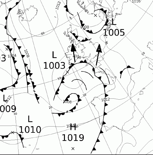
The culprit for today’s spell of wet weather spreading in is an area of low pressure moving in from the southwest pulling in a tongue of warm moist air from France which will be lifted by an occluding frontal boundary associated with the low moving in.
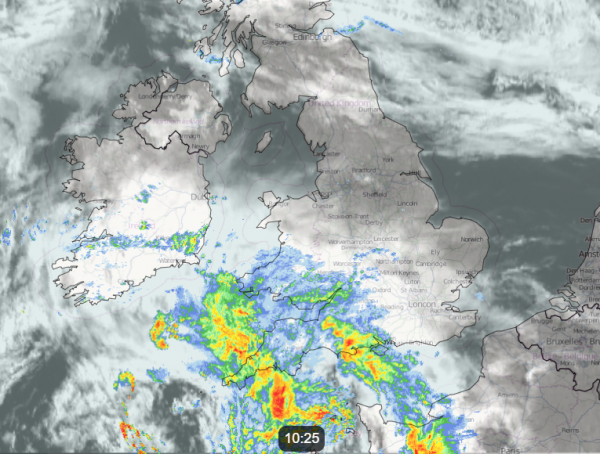
The Met office have issued a yellow warning for rain for large parts of England and Wales for today:
Outbreaks of rain, heavy at times with a risk of thunder, are expected to develop later on Monday afternoon then move northwards through the evening and overnight. 15 to 20 mm rain may fall in less than an hour, with a few places seeing up to 40 mm in 2 hours but perhaps more widely within a longer period overnight. Where this occurs, there is the chance of some flooding and disruption.
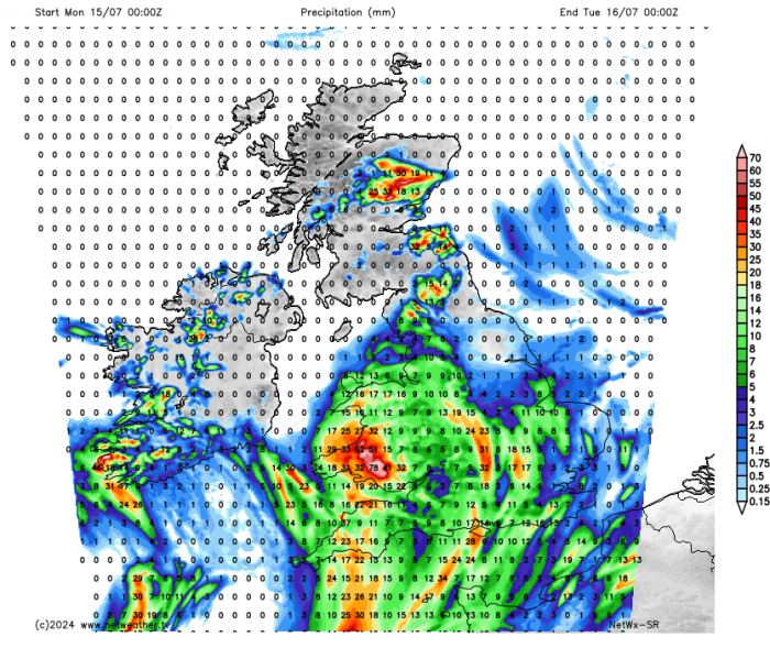
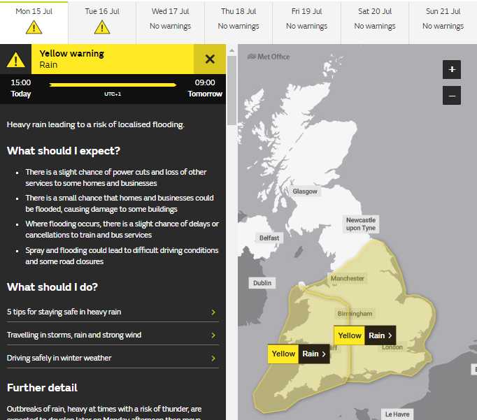
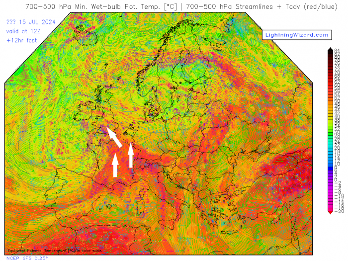
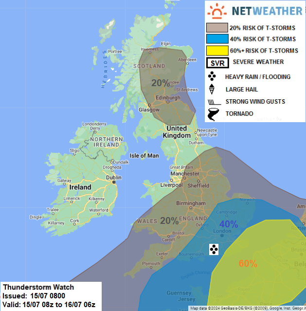
Largest rainfall totals coould be across SW England and Wales. In the east, there is also a risk of thunderstorms developing and pushing northeast early evening across SE England and East Anglia. Behind a band of rain spreading north and northeast this morning and early afternoon, a shortwave trough moving in from the southwest will engage warm and moist plume continuing to advect northwest out of France, creating lift of the plume into cooler air aloft and thus support rapid and strong convection that is likely to manifest in elevated thunderstorms breaking out across northern France, English Channel and moving northeast across SE England and East Anglia through the evening. A Thunderstorm Watch has been issued by Netweather that gives a more detailed insight on this risk of thunderstorms and also risk of isolated storms elsewhere.
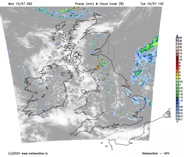
The area of low pressure moving northeast over England tonight, bringing heavy rain and storms ahead of it, will slowly clear out over the North Sea from eastern England Tuesday morning. Heavy rain, perhaps thundery, will wrap around this low and affect central and eastern areas of England tonight and continue to affect eastern England through the morning before clearing out in the afternoon. But showers may develop in its place down the eastern side of Britain and may become thundery locally. Elsewhere, other than a few isolated showers, it should be mostly dry with sunny spells. Temperatures still disappointing for mid-July, reaching 17-20C generally.
The good news is, it’s looking to turn drier for the rest of the week across much of England and Wales, as the jet stream shifts further north to be across northern Scotland later in the week, something that’s not happened very often this summer so far. The jet stream has been mostly south of the UK, hence often cool and recently wet weather.
Wednesday to Friday are looking mostly dry across much of England and Wales, with sunny spells, some showers are possible all three days across west Wales and NW England, but they’ll be hit and miss. It even looks to turn much warmer by Thursday across southern areas, as warmer air is pulled in from the near continent, temperatures may reach 26-28C across SE England and East Anglia.
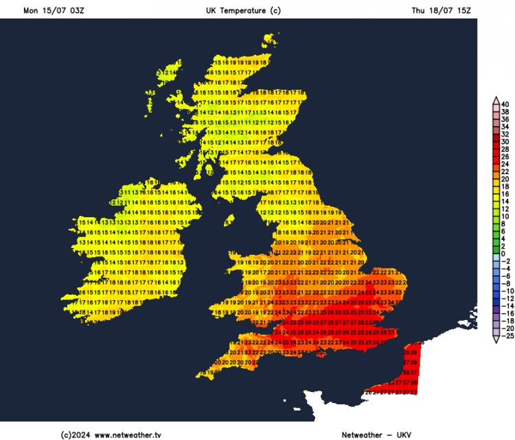
Scotland and N. Ireland, however, will be more changeable nearer the jet stream and frontal systems moving off the Atlantic, with more in the way of cloud, cooler along with spells of rain or showers, more persistent rain looks to affect western Scotland and N. Ireland Wednesday PM and through Thurs.
Loading recent activity...